Category:Geisshof, jungsteinzeitliche-bronzezeitliche Siedlungsstelle (Unterlunkhofen)
Jump to navigation
Jump to search
| Object location | | View all coordinates using: OpenStreetMap |
|---|
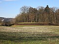
archaeological site in Unterlunkhofen in the canton of Aargau, Switzerland  | |||||
| Upload media | |||||
| Instance of | |||||
|---|---|---|---|---|---|
| Part of | |||||
| Location | Unterlunkhofen, Bremgarten District, Aargau, Switzerland | ||||
| Street address |
| ||||
| Heritage designation | |||||
 | |||||
Media in category "Geisshof, jungsteinzeitliche-bronzezeitliche Siedlungsstelle (Unterlunkhofen)"
This category contains only the following file.
-
 Unterlunkhofen Geisshof.JPG 2,816 × 2,112; 3 MB