Category:Gedgrave
Jump to navigation
Jump to search
English: Gedgrave is a civil parish in the Suffolk Coastal district, in the county of Suffolk, England.
civil parish in East Suffolk, Suffolk, England  | |||||
| Upload media | |||||
| Instance of | |||||
|---|---|---|---|---|---|
| Location |
| ||||
| Population |
| ||||
 | |||||
Subcategories
This category has the following 3 subcategories, out of 3 total.
Media in category "Gedgrave"
The following 140 files are in this category, out of 140 total.
-
 A copse of firs across the field - geograph.org.uk - 4361796.jpg 1,024 × 768; 317 KB
-
 Approaching Ferry Cottage - geograph.org.uk - 4023748.jpg 640 × 427; 124 KB
-
 Bend in the track near Gedgrave Marshes - geograph.org.uk - 5148107.jpg 4,000 × 3,000; 4.75 MB
-
 Boats along the Butley River - geograph.org.uk - 6280124.jpg 800 × 577; 139 KB
-
 Boyton Dock seen across Butley River - geograph.org.uk - 4023735.jpg 427 × 640; 128 KB
-
 Buildings at Ferry Cottage - geograph.org.uk - 4023759.jpg 640 × 427; 145 KB
-
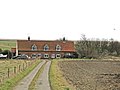
 Buildings at Gedgrave Hall - geograph.org.uk - 4023777.jpg 640 × 427; 139 KB
-
 Butley Ferry - geograph.org.uk - 4023744.jpg 427 × 640; 122 KB
-
 Butley Ferry - geograph.org.uk - 4145373.jpg 640 × 427; 71 KB
-
 Butley River in Suffolk - geograph.org.uk - 6280628.jpg 800 × 507; 67 KB
-
 Butley River looking downstream - geograph.org.uk - 4145313.jpg 640 × 427; 52 KB
-
 Butley River looking upstream - geograph.org.uk - 4145324.jpg 640 × 427; 56 KB
-
 Butley River near Ferry Cottage - geograph.org.uk - 4023754.jpg 640 × 427; 96 KB
-
 Catamaran on the Butley River - geograph.org.uk - 2804779.jpg 4,048 × 3,040; 2.28 MB
-
 Cereal field and Richmond Farm, Orford - geograph.org.uk - 4055504.jpg 1,536 × 1,152; 1.25 MB
-
 Chantry Point - geograph.org.uk - 4022229.jpg 640 × 427; 127 KB
-
 Chantry Point - geograph.org.uk - 875081.jpg 640 × 480; 92 KB
-
 Commercial buildings near Richmond Farm - geograph.org.uk - 4023786.jpg 640 × 427; 121 KB
-
 Cuckold's Point from Chantry Point - geograph.org.uk - 4022246.jpg 640 × 427; 118 KB
-

-
 Drainage ditch on Gedgrave Marshes - geograph.org.uk - 4056076.jpg 1,536 × 1,152; 1.27 MB
-
 Drainage ditch on Gedgrave Marshes - geograph.org.uk - 4056079.jpg 1,536 × 1,152; 1,002 KB
-
 Drainage dyke on Gedgrave marshes - geograph.org.uk - 4361743.jpg 1,024 × 768; 473 KB
-

-

-
 End of the metalled road near Gedgrave Hall - geograph.org.uk - 4361789.jpg 1,024 × 768; 362 KB
-
 Farm buildings along Gedgrave Road - geograph.org.uk - 6280096.jpg 800 × 569; 164 KB
-
 Farm buildings at Gedgrave Hall - geograph.org.uk - 4023614.jpg 640 × 427; 137 KB
-
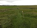
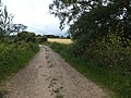
 Farm track and fir trees - geograph.org.uk - 4361737.jpg 1,024 × 768; 601 KB
-
 Farm track and footpath to Gedgrave marshes - geograph.org.uk - 4361739.jpg 1,024 × 768; 463 KB
-
 Farm track and footpath to Gedgrave marshes - geograph.org.uk - 4362058.jpg 1,024 × 768; 398 KB
-
 Farm track and hedgerow - geograph.org.uk - 4361726.jpg 1,024 × 768; 360 KB
-
 Farm track and public footpath - geograph.org.uk - 4362048.jpg 1,024 × 768; 559 KB
-
 Farmland near the Richmond Cottages - geograph.org.uk - 6280085.jpg 800 × 591; 128 KB
-
 Ferry Cottage at the Butley River - geograph.org.uk - 6280833.jpg 800 × 540; 105 KB
-
 Field covered in fleece - geograph.org.uk - 4023780.jpg 640 × 427; 151 KB
-
 Field entrance southwest of Richmond Farm - geograph.org.uk - 3527899.jpg 3,516 × 2,551; 1.88 MB
-
 Flood defences along the Butley River - geograph.org.uk - 6280637.jpg 800 × 504; 107 KB
-
 Flush Bracket OSBM 2677 Richmond Farm - geograph.org.uk - 5061289.jpg 1,920 × 1,994; 557 KB
-
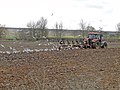 Followers of the plough - geograph.org.uk - 4361802.jpg 1,024 × 768; 392 KB
-
 Footbridge - geograph.org.uk - 4479536.jpg 768 × 1,024; 178 KB
-

-
 Footpath across the marsh at Chantry Point, Orford - geograph.org.uk - 4056255.jpg 1,536 × 1,152; 1.13 MB
-
 Footpath across the marsh at Chantry Point, Orford - geograph.org.uk - 4056259.jpg 1,152 × 1,536; 1.12 MB
-
 Footpath And Footbridge - geograph.org.uk - 4479190.jpg 1,024 × 768; 134 KB
-
 Footpath near Chantry Point - geograph.org.uk - 5148086.jpg 4,000 × 3,000; 4.66 MB
-
 Footpath sign and map of the footpath to the River Ore - geograph.org.uk - 2609134.jpg 2,304 × 3,072; 1.52 MB
-
 Footpath to Butley Ferry - geograph.org.uk - 2608969.jpg 3,072 × 2,304; 1.42 MB
-
 Footpath to the River Ore - geograph.org.uk - 2609132.jpg 3,072 × 2,304; 1.44 MB
-
 Footpath to the Sewage Works ^ River Ore - geograph.org.uk - 2609168.jpg 3,072 × 2,304; 1.63 MB
-
 Forest Track - geograph.org.uk - 4479583.jpg 1,024 × 768; 335 KB
-
 Garage called High Broom - geograph.org.uk - 4361772.jpg 1,024 × 768; 423 KB
-
 Gate And Path - geograph.org.uk - 4479549.jpg 1,024 × 768; 156 KB
-
 Gedgrave - geograph.org.uk - 3389222.jpg 640 × 480; 94 KB
-
 Gedgrave Broom - geograph.org.uk - 1303164.jpg 640 × 480; 48 KB
-
 Gedgrave Broom - geograph.org.uk - 381797.jpg 480 × 640; 61 KB
-
 Gedgrave Hall sign - geograph.org.uk - 2608970.jpg 3,072 × 2,304; 1.32 MB
-
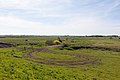
 Gedgrave Marshes - geograph.org.uk - 4056080.jpg 1,536 × 1,152; 990 KB
-
 Gedgrave Marshes looking towards Orford - geograph.org.uk - 4023574.jpg 640 × 427; 129 KB
-
 Gedgrave Marshes near Orford - geograph.org.uk - 6280878.jpg 800 × 577; 115 KB
-
 Gedgrave Pumping Station - geograph.org.uk - 4022295.jpg 640 × 427; 113 KB
-
 Gedgrave Pumping Station - geograph.org.uk - 4022317.jpg 640 × 427; 123 KB
-
 Gedgrave Pumping Station - geograph.org.uk - 4479577.jpg 1,024 × 768; 133 KB
-
 Gedgrave Road - geograph.org.uk - 2609142.jpg 2,304 × 3,072; 1.1 MB
-
 Gedgrave Road - geograph.org.uk - 2609146.jpg 2,304 × 3,072; 1.26 MB
-
 Gedgrave road - geograph.org.uk - 934955.jpg 640 × 480; 94 KB
-
 Gedgrave Road at Richmond Farm - geograph.org.uk - 6280026.jpg 800 × 667; 131 KB
-
 Gedgrave Road by Richmond Farm - geograph.org.uk - 4361806.jpg 1,024 × 768; 388 KB
-
 Gedgrave Road heading towards Orford - geograph.org.uk - 6280860.jpg 800 × 640; 169 KB
-
 Gedgrave Road looking towards the Hall - geograph.org.uk - 4361791.jpg 1,024 × 768; 337 KB
-
 Gedgrave Road northeast of Richmond Farm - geograph.org.uk - 3551659.jpg 3,648 × 2,736; 1.93 MB
-
 Gedgrave Road south of Gedgrave Hall - geograph.org.uk - 3551695.jpg 3,648 × 2,736; 1.48 MB
-
 Gedgrave Road towards Orford - geograph.org.uk - 5825898.jpg 640 × 604; 129 KB
-
 Gedgrave Road, Orford - geograph.org.uk - 4361819.jpg 1,024 × 768; 364 KB
-
 GR postbox near Richmond Cottages - geograph.org.uk - 4361801.jpg 768 × 1,024; 556 KB
-
 Hedge by Gedgrave Road and farm storage area - geograph.org.uk - 4055489.jpg 1,536 × 1,152; 1,020 KB
-
 House in the bracken - geograph.org.uk - 4361776.jpg 1,024 × 768; 505 KB
-
 Huts on Havergate Island - geograph.org.uk - 4023589.jpg 427 × 640; 132 KB
-
 Junction of paths near Richmond Farm Orford - geograph.org.uk - 4055482.jpg 1,536 × 1,152; 1.26 MB
-
-
 Licensed footpath beside Butley River - geograph.org.uk - 4023741.jpg 640 × 427; 122 KB
-
 Looking across Gedgrave Marshes - geograph.org.uk - 4056072.jpg 1,536 × 1,152; 1.15 MB
-

-
 Lower Gull seen from Gedgrave Marshes - geograph.org.uk - 4023624.jpg 640 × 427; 147 KB
-
 Map of the footpath to the River Ore - geograph.org.uk - 2609138.jpg 3,072 × 2,304; 1.33 MB
-
 Marshes beside Butley River - geograph.org.uk - 4022095.jpg 640 × 427; 126 KB
-
 Mud and marsh at the edge of The Gull - geograph.org.uk - 4056081.jpg 1,536 × 1,152; 922 KB
-
 Northern tip of Havergate Island - geograph.org.uk - 4022262.jpg 640 × 427; 111 KB
-
 Obsolete sluice on Gedgrave Marshes - geograph.org.uk - 4022257.jpg 640 × 427; 142 KB
-
 Old pilings by the estuary of the River Ore, Orford - geograph.org.uk - 4056258.jpg 1,536 × 1,152; 1,006 KB
-
 Orford Castle - geograph.org.uk - 6280894.jpg 800 × 537; 103 KB
-
 Orford Castle from Chantry Point - geograph.org.uk - 4022250.jpg 427 × 640; 153 KB
-
 Orford Castle from coastal path - geograph.org.uk - 4022267.jpg 427 × 640; 144 KB
-
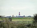 Orford Ness lighthouse from near Gedgrave Hall - geograph.org.uk - 4361750.jpg 1,024 × 768; 254 KB
-
 Orford Quay seen from coastal path - geograph.org.uk - 4022222.jpg 640 × 427; 124 KB
-
 OS Flush Bracket 2677 - geograph.org.uk - 1847064.jpg 1,024 × 768; 287 KB
-
 Outflow of Gedgrave Pumping Station - geograph.org.uk - 4022306.jpg 427 × 640; 112 KB
-

-
 Private track from Ferry Cottage - geograph.org.uk - 4023770.jpg 640 × 427; 128 KB
-
 Reflection in a puddle - geograph.org.uk - 4361748.jpg 768 × 1,024; 435 KB
-
 Richmond Cottages - geograph.org.uk - 4023783.jpg 640 × 427; 141 KB
-
 Richmond Cottages - geograph.org.uk - 4361804.jpg 1,024 × 768; 287 KB
-
 Richmond Cottages near Orford - geograph.org.uk - 6280066.jpg 800 × 535; 126 KB
-
 Richmond Cottages, Orford - geograph.org.uk - 6857354.jpg 4,000 × 3,000; 1.84 MB
-
 River Ore bank at The Gull - geograph.org.uk - 4022269.jpg 640 × 427; 150 KB
-
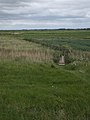
 ROC Orlit B Post Orford - geograph.org.uk - 4928441.jpg 576 × 432; 84 KB
-
 ROC Post Orford - geograph.org.uk - 4928430.jpg 2,410 × 2,410; 4.56 MB
-
 Saltmarsh at Chantry Point - geograph.org.uk - 5148073.jpg 4,000 × 3,000; 4.45 MB
-
 Sea wall at Chantry Point, Orford - geograph.org.uk - 4056257.jpg 1,536 × 1,152; 1.03 MB
-
 Set-aside and maize crop for the pheasants - geograph.org.uk - 4362055.jpg 1,024 × 768; 485 KB
-
 Sheep - geograph.org.uk - 4479561.jpg 1,024 × 768; 158 KB
-
-

-
 Smokehouse at Ferry Cottage - geograph.org.uk - 4023766.jpg 640 × 427; 204 KB
-
 Southern edge of Gedgrave Marshes - geograph.org.uk - 4023600.jpg 640 × 427; 123 KB
-
 Start of licensed footpath - geograph.org.uk - 4022276.jpg 640 × 427; 126 KB
-
 Stonyditch Point, Orford Ness - geograph.org.uk - 1963297.jpg 640 × 427; 87 KB
-
 Storage area in the corner of a field near Orford - geograph.org.uk - 4055486.jpg 1,536 × 1,152; 1,009 KB
-
 The Butley River in Suffolk - geograph.org.uk - 6280126.jpg 800 × 516; 138 KB
-
 The Gull near Orford - geograph.org.uk - 4056252.jpg 1,536 × 1,152; 967 KB
-
 The sea wall at Gedgrave Marshes - geograph.org.uk - 4056253.jpg 1,152 × 1,536; 1.05 MB
-
 The sewage works at Orford on Chantry Marshes - geograph.org.uk - 4056263.jpg 1,536 × 1,152; 1.11 MB
-
 The view from the castle (1) - geograph.org.uk - 5118060.jpg 4,249 × 3,187; 1.59 MB
-
 Track (footpath) from the river to Gedgrave Road - geograph.org.uk - 4055498.jpg 1,536 × 1,152; 1.3 MB
-
 Track (footpath) to River Ore at The Gull - geograph.org.uk - 4055495.jpg 1,152 × 1,536; 1.21 MB
-
 Track across Gedgrave Marshes - geograph.org.uk - 230912.jpg 480 × 640; 70 KB
-
 Track across Gedgrave Marshes - geograph.org.uk - 4056068.jpg 1,536 × 1,152; 1.33 MB
-
 Track across Gedgrave Marshes - geograph.org.uk - 4056074.jpg 1,152 × 1,536; 1.03 MB
-
 Track across the Gedgrave Marshes - geograph.org.uk - 6280108.jpg 800 × 568; 114 KB
-

-

-
 Track near Gedgrave Marshes - geograph.org.uk - 6857361.jpg 4,000 × 3,000; 3.5 MB
-
 Track to Butley Ferry - geograph.org.uk - 4145312.jpg 640 × 420; 73 KB
-
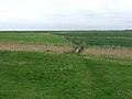
 View across the fields towards Richmond Farm - geograph.org.uk - 5148100.jpg 4,000 × 3,000; 4.7 MB
-
 View down to the River Ore from Orford Castle - geograph.org.uk - 3216468.jpg 1,600 × 1,066; 166 KB
-
 View down to the River Ore from Orford Castle - geograph.org.uk - 3216473.jpg 1,600 × 1,066; 174 KB
-

-
 View of Orford from coastal path - geograph.org.uk - 4022217.jpg 640 × 427; 145 KB
-
 View towards Gedgrave Marshes - geograph.org.uk - 4361774.jpg 1,024 × 768; 295 KB
-
 Where the footpath turns right - geograph.org.uk - 4361771.jpg 1,024 × 768; 283 KB


_-_geograph.org.uk_-_5118060.jpg)
_from_the_river_to_Gedgrave_Road_-_geograph.org.uk_-_4055498.jpg)
_to_River_Ore_at_The_Gull_-_geograph.org.uk_-_4055495.jpg)


