Category:Gayton, Merseyside
Jump to navigation
Jump to search
village in Merseyside, United Kingdom  | |||||
| Upload media | |||||
| Instance of | |||||
|---|---|---|---|---|---|
| Location | Wirral, Merseyside, North West England, England | ||||
 | |||||

Subcategories
This category has the following 12 subcategories, out of 12 total.
!
G
- Gayton Mill, Merseyside (9 F)
- Gayton primary school (3 F)
H
- Heswall Golf Club (14 F)
- Heswall Model Aircraft Club (3 F)
- Heswall Squash Racquets Club (3 F)
R
- Rose Cottage, Gayton (2 F)
T
W
Media in category "Gayton, Merseyside"
The following 37 files are in this category, out of 37 total.
-
 A birders seat by Gayton Sands - geograph.org.uk - 1140392.jpg 640 × 480; 179 KB
-
 A crossing on the Wirral Way - geograph.org.uk - 1140632.jpg 640 × 480; 166 KB
-
 A540 road at the Merseyside-Cheshire boundary.JPG 4,320 × 3,240; 3.7 MB
-
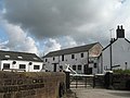
 Backwood Farm Mews - geograph.org.uk - 381136.jpg 640 × 480; 80 KB
-
 Backwood Hall - geograph.org.uk - 381130.jpg 640 × 480; 111 KB
-
 Backwood Hall Farm - geograph.org.uk - 381143.jpg 640 × 480; 67 KB
-
 Benkid77 Telephone Box, Gayton 200709.JPG 1,680 × 2,240; 845 KB
-
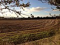 Brownfield (180693499).jpeg 2,048 × 1,536; 1.17 MB
-
 Catkins by the Wirral Way - geograph.org.uk - 1140647.jpg 480 × 640; 194 KB
-
 Chester High Road - geograph.org.uk - 131964.jpg 640 × 480; 61 KB
-
 Chester High Road - geograph.org.uk - 718086.jpg 480 × 640; 79 KB
-
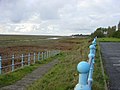
 Coastal footpath, Gayton - geograph.org.uk - 69981.jpg 640 × 480; 159 KB
-
 Dee saltmarsh, Gayton - geograph.org.uk - 69729.jpg 640 × 480; 61 KB
-
 Fibre broadband cabinet, Gayton Road, Heswall.JPG 3,240 × 4,320; 2.88 MB
-
 Footpath and footbridge by Gayton Sands - geograph.org.uk - 1140439.jpg 640 × 480; 144 KB
-
 Footpath and seat by Gayton Sands - geograph.org.uk - 1140389.jpg 640 × 480; 144 KB
-
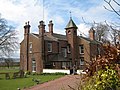
 Gates of Knollwood, Gayton.jpg 4,689 × 3,520; 21.92 MB
-
 Gayton - view along Gayton Farm Road - geograph.org.uk - 271993.jpg 640 × 480; 182 KB
-
 Gayton Conservation Area sign.jpg 3,060 × 5,164; 14.59 MB
-
 Gayton County Primary School - geograph.org.uk - 1500602.jpg 640 × 480; 138 KB
-
 Gayton Park, home of Heswall AFC (1).JPG 4,320 × 3,240; 3.86 MB
-
 Gayton Park, home of Heswall AFC (2).JPG 4,320 × 3,240; 3.74 MB
-
 Gayton Park, home of Heswall AFC (3).JPG 4,320 × 3,240; 4.38 MB
-
 Gayton Play Area, Wirral.JPG 4,320 × 3,240; 3.59 MB
-
 Green space at Gayton, Wirral (1).JPG 3,240 × 4,320; 5.36 MB
-
 Green space at Gayton, Wirral (2).JPG 4,320 × 3,240; 5.17 MB
-
 Green space at Gayton, Wirral (3).JPG 4,320 × 3,240; 5.18 MB
-
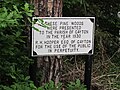 Pine woods plaque, Gayton, Wirral.jpg 4,320 × 3,240; 4.18 MB
-
 Ponies near Gayton Wood - geograph.org.uk - 381153.jpg 640 × 480; 107 KB
-
 Sailing boats on Gayton Channel - geograph.org.uk - 69691.jpg 640 × 480; 58 KB
-
 Saltmarsh on the river Dee - geograph.org.uk - 69708.jpg 640 × 480; 61 KB
-
 Seat with a view at Gayton Sands - geograph.org.uk - 1140394.jpg 640 × 480; 151 KB
-
 Slipway at Gayton Sands - geograph.org.uk - 1140425.jpg 640 × 480; 189 KB
-
 The Wirral Way and a boundary - geograph.org.uk - 1140697.jpg 640 × 480; 212 KB
-
 Trees alongside the Wirral Way - geograph.org.uk - 1140701.jpg 640 × 480; 226 KB
-
 Wirral Way bridleway - geograph.org.uk - 1140595.jpg 640 × 480; 192 KB
-
 Wirral Way bridleway and gates - geograph.org.uk - 1140607.jpg 640 × 480; 166 KB


.jpeg)


.JPG)
.JPG)
.JPG)

.JPG)
.JPG)
.JPG)


