Category:Gayles
Jump to navigation
Jump to search
village and civil parish in North Yorkshire, England .jpg) | |||||
| Upload media | |||||
| Instance of | |||||
|---|---|---|---|---|---|
| Location | Richmondshire, North Yorkshire, Yorkshire and the Humber, England | ||||
| Population |
| ||||
 | |||||
Media in category "Gayles"
The following 84 files are in this category, out of 84 total.
-
 A Barn in Dalton - geograph.org.uk - 4698270.jpg 1,600 × 1,094; 853 KB
-
 Across Rake Gill - geograph.org.uk - 871842.jpg 640 × 427; 97 KB
-
 After Lunch Siesta - geograph.org.uk - 4510110.jpg 640 × 480; 121 KB
-
 An encouraging sign - geograph.org.uk - 2966177.jpg 4,000 × 3,000; 3.86 MB
-
 Approaching Dalton village - geograph.org.uk - 3955672.jpg 640 × 480; 182 KB
-
 Barn below Flats Bank - geograph.org.uk - 4005393.jpg 640 × 480; 143 KB
-
 Bridlebridge over Dalton Beck - geograph.org.uk - 2179630.jpg 3,200 × 2,800; 1.86 MB
-
 Broadclose Plantation by Dalton Beck - geograph.org.uk - 2179697.jpg 3,840 × 2,940; 1.52 MB
-
 Bus shelter at Gayles - geograph.org.uk - 4698254.jpg 1,600 × 1,122; 790 KB
-
 Cattle grid at Rake Gate Bridge - geograph.org.uk - 4004696.jpg 640 × 480; 147 KB
-
 East side of West Street, Gayles - geograph.org.uk - 2179454.jpg 4,160 × 2,925; 1.92 MB
-
 Entry to Feldom Ranges - geograph.org.uk - 4004710.jpg 640 × 480; 123 KB
-
 Feldom Range entrance above Gayles - geograph.org.uk - 2179590.jpg 4,160 × 2,990; 1.28 MB
-
 Field and transmission lines - geograph.org.uk - 3955731.jpg 640 × 480; 97 KB
-
 Field between Kirby Hill and Gayles - geograph.org.uk - 3955993.jpg 640 × 480; 149 KB
-
 Fields on either side of Waitgate Gill - geograph.org.uk - 4004559.jpg 640 × 480; 135 KB
-
 Flats Bank - geograph.org.uk - 2561559.jpg 2,995 × 2,563; 1.44 MB
-
 Folly Plantation - geograph.org.uk - 864078.jpg 640 × 427; 227 KB
-
 Folly Plantation - geograph.org.uk - 866231.jpg 640 × 427; 216 KB
-
 Former Inn, The Bay Horse - geograph.org.uk - 4510186.jpg 640 × 360; 77 KB
-
 Gayles Fields - geograph.org.uk - 5762393.jpg 1,024 × 768; 207 KB
-
 Gayles House.jpg 640 × 479; 107 KB
-
 Gayles Moor - geograph.org.uk - 871797.jpg 640 × 427; 84 KB
-
 Gayles Moor - geograph.org.uk - 871804.jpg 640 × 427; 90 KB
-
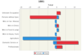 Gayles occupational share.png 416 × 277; 34 KB
-
 Gayles Plantation - geograph.org.uk - 865108.jpg 640 × 427; 207 KB
-
 Gayles Quarry - geograph.org.uk - 4510170.jpg 640 × 480; 142 KB
-
 Gayles Quarry - geograph.org.uk - 4510192.jpg 640 × 360; 101 KB
-
 Gayles, Richmondshire (2008).jpg 3,072 × 2,304; 1.34 MB
-
 Hay crop above Rake Beck - geograph.org.uk - 4607355.jpg 4,320 × 3,240; 3.04 MB
-
 High Waitgate - geograph.org.uk - 871756.jpg 640 × 427; 80 KB
-
 Highland Cattle - geograph.org.uk - 4510165.jpg 640 × 360; 115 KB
-
 Kersey Green Scar - geograph.org.uk - 4004678.jpg 640 × 480; 119 KB
-
 Kersey Green Scar - geograph.org.uk - 5915228.jpg 2,000 × 875; 1.53 MB
-
 Little used telephone box, Gayles - geograph.org.uk - 4698245.jpg 1,217 × 1,600; 680 KB
-
 Low Fields - geograph.org.uk - 2561553.jpg 3,845 × 2,389; 2.1 MB
-
 Low Fields Farm. - geograph.org.uk - 145057.jpg 640 × 479; 97 KB
-
 Near High Waitgate - geograph.org.uk - 871767.jpg 640 × 427; 76 KB
-
 Notices at Rake Gate - geograph.org.uk - 3926061.jpg 1,500 × 1,125; 1.26 MB
-
 Old gateposts on the path to Park Wood - geograph.org.uk - 2179805.jpg 3,240 × 4,320; 1.83 MB
-

-
 Parish Boundary, Feldom Rigg - geograph.org.uk - 865103.jpg 640 × 427; 199 KB
-
 Parish Boundary, Grass Moor - geograph.org.uk - 864022.jpg 640 × 427; 190 KB
-
 Pond Near Stone Man Lane - geograph.org.uk - 864041.jpg 640 × 427; 206 KB
-

-

-
 Quarry House - geograph.org.uk - 2179783.jpg 3,840 × 3,000; 1.67 MB
-
 Rake Gate - geograph.org.uk - 5242697.jpg 640 × 480; 75 KB
-
 Rake Gate Bridge - geograph.org.uk - 2966160.jpg 4,000 × 3,000; 2.99 MB
-
 Rake Gate Bridge - geograph.org.uk - 4004689.jpg 640 × 480; 161 KB
-
 Re-entrant above Dalton - geograph.org.uk - 4510094.jpg 640 × 360; 93 KB
-
 Road heading east out of Gayles - geograph.org.uk - 4698250.jpg 1,600 × 1,065; 737 KB
-
 Road junction to the east of Dalton - geograph.org.uk - 4698262.jpg 1,600 × 1,088; 419 KB
-
 Ruin, Gayles Moor - geograph.org.uk - 864002.jpg 640 × 427; 239 KB
-
 Ruin, Gayles Moor - geograph.org.uk - 866220.jpg 640 × 427; 228 KB
-
 Ruined Moor, Gayles Moor - geograph.org.uk - 863997.jpg 640 × 427; 223 KB
-
 Ruined wall crossing grassy moorland - geograph.org.uk - 5915586.jpg 2,000 × 1,246; 2.03 MB
-
 Ruined Wall, Feldom Rigg - geograph.org.uk - 865124.jpg 640 × 427; 242 KB
-
 Ruined Wall, Near Folly Plantation - geograph.org.uk - 865122.jpg 427 × 640; 225 KB
-
 Sheep grazing near Gayles Fields - geograph.org.uk - 5773386.jpg 1,024 × 776; 153 KB
-
 Shepherd's Hall - geograph.org.uk - 1762802.jpg 2,560 × 1,960; 986 KB
-
 Shepherd's Hall - geograph.org.uk - 4004567.jpg 640 × 480; 117 KB
-
 Slip Inn Bank - geograph.org.uk - 3955729.jpg 640 × 480; 201 KB
-
 Stone Man Lane - geograph.org.uk - 864027.jpg 640 × 427; 230 KB
-
 Stone Man Lane - geograph.org.uk - 865092.jpg 640 × 427; 245 KB
-
 Stone Man Lane - geograph.org.uk - 865128.jpg 427 × 640; 225 KB
-
 Stone Man Lane - geograph.org.uk - 866190.jpg 640 × 427; 223 KB
-
 Stone Man Lane - geograph.org.uk - 866228.jpg 640 × 427; 243 KB
-
 The Grange - geograph.org.uk - 2561544.jpg 3,582 × 2,437; 2.17 MB
-
 The valley of Rake Beck - geograph.org.uk - 4004702.jpg 640 × 480; 156 KB
-
 There's a one-eyed yellow idol ... - geograph.org.uk - 871787.jpg 640 × 427; 64 KB
-
 Towards Gayles Moor - geograph.org.uk - 871734.jpg 640 × 427; 63 KB
-
 Towards Gayles Moor - geograph.org.uk - 871736.jpg 640 × 427; 62 KB
-
 Towards Gayles Moor Wood - geograph.org.uk - 871792.jpg 640 × 427; 80 KB
-
 Towards Gayles Moor Wood - geograph.org.uk - 871795.jpg 640 × 427; 69 KB
-
 Towards Shepherd's Hall - geograph.org.uk - 871747.jpg 640 × 427; 62 KB
-
 Track across Gayles Moor - geograph.org.uk - 871821.jpg 640 × 427; 75 KB
-
 Track Along Feldom Rigg - geograph.org.uk - 866163.jpg 640 × 427; 216 KB
-
 Track to Gayles - geograph.org.uk - 865116.jpg 640 × 427; 205 KB
-
 Track, Gayles Moor - geograph.org.uk - 865083.jpg 640 × 427; 285 KB
-
 View from Kirby Hill - geograph.org.uk - 2257149.jpg 640 × 480; 26 KB
-
 View over a wall, near Gayles - geograph.org.uk - 2379579.jpg 640 × 480; 92 KB
-
 Washbeck Folds - geograph.org.uk - 6682844.jpg 5,472 × 3,648; 6.88 MB
-
 What are you doing here^ - geograph.org.uk - 871739.jpg 640 × 427; 56 KB


