Category:Gateside, North Ayrshire
Jump to navigation
Jump to search
village in North Ayrshire, Scotland, UK  | |||||
| Upload media | |||||
| Instance of | |||||
|---|---|---|---|---|---|
| Location |
| ||||
 | |||||
Subcategories
This category has the following 3 subcategories, out of 3 total.
Media in category "Gateside, North Ayrshire"
The following 60 files are in this category, out of 60 total.
-
 Balgray Bond, whisky barrels, Barrmill, Ayrshire.JPG 2,288 × 1,712; 1.13 MB
-
 Beith Justice or Moot Hill.JPG 2,288 × 1,712; 1.33 MB
-
 Blaelochhead Hillock, Haselet.JPG 4,116 × 2,304; 3.45 MB
-
 Boghall across Loch Brand.jpg 2,288 × 1,712; 1.27 MB
-
 Boghall Burn and old loch dam.JPG 2,288 × 1,712; 1.34 MB
-
 Boghall from near Gateside.JPG 2,288 × 1,712; 1.2 MB
-
 Boghall from near Hill of Beith Castle.JPG 2,288 × 1,712; 1.32 MB
-
 Boghall Loch near Gateside.jpg 600 × 449; 49 KB
-
 Broadstone Farm, Beith.JPG 2,288 × 1,712; 1.25 MB
-
 Broadstone Hall, Beith.JPG 2,288 × 1,712; 1.23 MB
-
 Broadstone kiln sided on.JPG 2,288 × 1,712; 1.24 MB
-
 Broadstone quarry older kiln.JPG 2,288 × 1,712; 1.42 MB
-
 Brownmuir Plantation - geograph.org.uk - 51896.jpg 640 × 479; 150 KB
-
 Cheesepress at Shutterflat.JPG 1,527 × 1,518; 1.21 MB
-
 Cheesepress Re-used.jpg 1,804 × 1,612; 1.89 MB
-
 Crooked Dam on the Powgree, Gateside.JPG 2,288 × 1,712; 1.33 MB
-
 Disciotis venosa at Trearne Quarry.jpg 2,592 × 1,552; 1.77 MB
-
 Dockra House, Broadstone.JPG 2,288 × 1,712; 1.29 MB
-
 Fairy Glen on the Powgree, Gateside.JPG 2,288 × 1,712; 1.32 MB
-
 Gateside from Beith Hill.JPG 2,288 × 1,712; 1.29 MB
-
 Gateside hall.JPG 2,288 × 1,712; 1.23 MB
-
 Gateside mainstreet.JPG 2,288 × 1,712; 1.31 MB
-
 Gateside Primary natural historians.JPG 2,288 × 1,712; 1.34 MB
-
 Gateside Primary school.JPG 2,288 × 1,712; 1.11 MB
-
 Hill of Beith Castle from Grangehill.jpg 2,288 × 1,712; 1.27 MB
-
 Isobel Patrick memorial hall.JPG 2,288 × 1,712; 1.37 MB
-
 Large limekiln, Dockra, Barrmill.JPG 2,288 × 1,712; 1.39 MB
-
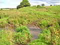
 Loch Brand and drainage ditch.JPG 2,288 × 1,712; 1.3 MB
-
 Loch Brand site - old surface level.JPG 2,288 × 1,712; 1.27 MB
-
 Loch Brand site from Boghall.JPG 2,288 × 1,712; 1.25 MB
-
 Netherhill House.JPG 2,288 × 1,712; 1.19 MB
-
 Netherhill near Gateside.JPG 2,288 × 1,712; 1.2 MB
-
 Netherhill Toll in 1850.jpg 2,288 × 1,712; 1.48 MB
-
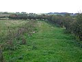 Old lane to Old Hill of Beith.JPG 2,288 × 1,712; 1.18 MB
-
 Old quarry and ford over the Powgree Burn at Spiers.JPG 2,288 × 1,712; 1.31 MB
-
 Ornate manterlpiece gateside.JPG 2,288 × 1,712; 1.23 MB
-
 Pholiota squarrosa at Broadstone on an Ash tree.JPG 2,288 × 1,712; 1.35 MB
-
 Pylon, Shutterflat Farms - geograph.org.uk - 700133.jpg 640 × 480; 55 KB
-
 Road Junction on B777 - geograph.org.uk - 1412377.jpg 640 × 480; 105 KB
-
 Road near Shutterflat Farms - geograph.org.uk - 700136.jpg 480 × 640; 158 KB
-
 Sacraficial gear tooth - detail.JPG 4,608 × 3,456; 3.56 MB
-
 Sacraficial gear tooth.JPG 4,608 × 3,456; 3.62 MB
-
 Scottish Sundial - Gateside.jpg 1,143 × 1,867; 1.38 MB
-
 Scottish Sundial - upper face - Gateside.jpg 2,243 × 1,416; 2.03 MB
-
 Scottish Sundial face- Gateside.jpg 1,824 × 1,022; 1.08 MB
-
 Scottish Sundial faces - Gateside.jpg 1,468 × 2,178; 1.86 MB
-
 The site of the old Boghall Loch.JPG 2,288 × 1,712; 1.16 MB
-
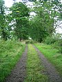 Trearne drive.JPG 1,712 × 2,288; 1.37 MB
-
 Trearne Lodge - coat of arms.JPG 2,739 × 3,594; 4.63 MB
-
 Trearne quarry north.JPG 2,288 × 1,712; 1.21 MB
-
 Trearne quarry south.JPG 2,288 × 1,712; 1.25 MB
-
 Ye Olde Oak - geograph.org.uk - 51907.jpg 640 × 479; 181 KB
-
 Cyclists - geograph.org.uk - 65460.jpg 640 × 479; 86 KB
-
 Dead Tree - geograph.org.uk - 88851.jpg 479 × 640; 116 KB
-
 Gate and field - geograph.org.uk - 1412707.jpg 640 × 480; 56 KB
-
 Gateside - geograph.org.uk - 333515.jpg 640 × 480; 77 KB
-
 Hessilhead - geograph.org.uk - 66823.jpg 640 × 479; 99 KB
-
 Under a Dark Cloud - geograph.org.uk - 65463.jpg 640 × 479; 61 KB
-
 White Gate - geograph.org.uk - 65464.jpg 640 × 479; 111 KB
-
 Winding Road - geograph.org.uk - 65461.jpg 640 × 479; 96 KB


