Category:Gates in Oxfordshire
Jump to navigation
Jump to search
Ceremonial counties of England: Bedfordshire · Berkshire · Buckinghamshire · Cambridgeshire · Cheshire · Cornwall · Cumbria · Derbyshire · Devon · Dorset · Durham · East Riding of Yorkshire · East Sussex · Essex · Gloucestershire · Greater London · Greater Manchester · Hampshire · Herefordshire · Hertfordshire · Kent · Lancashire · Leicestershire · Lincolnshire · Merseyside · Norfolk · North Yorkshire · Northamptonshire · Northumberland · Nottinghamshire · Oxfordshire · Rutland · Shropshire · Somerset · South Yorkshire · Staffordshire · Suffolk · Surrey · Tyne and Wear · Warwickshire · West Midlands · West Sussex · West Yorkshire · Wiltshire · Worcestershire
City-counties: Bristol · City of London
Former historic counties:
Other former counties:
City-counties: Bristol · City of London
Former historic counties:
Other former counties:
Subcategories
This category has the following 10 subcategories, out of 10 total.
+
B
C
- Chastleton House Gateway (11 F)
- Compton Beauchamp House (2 F)
M
O
W
- Water Eaton Manor Gates (5 F)
Media in category "Gates in Oxfordshire"
The following 200 files are in this category, out of 258 total.
(previous page) (next page)-
 "Crash gate" - geograph.org.uk - 345185.jpg 640 × 480; 218 KB
-
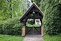 St Mary's Church Pyrton Oxfordshire England lychgate 01.jpg 5,878 × 3,919; 35.69 MB
-
 St Mary's Church Pyrton Oxfordshire England lychgate 03.jpg 4,160 × 6,240; 34.72 MB
-
 St Mary's Church Pyrton Oxfordshire England lychgate 04.jpg 3,874 × 5,812; 30.27 MB
-
 The White House Knightsbridge Lane Pyrton Oxfordshire England.jpg 6,240 × 4,160; 38.44 MB
-
 Gateway to Brightwell Park Brightwell Baldwin Oxfordshire England.jpg 5,908 × 3,939; 32.98 MB
-
 Cuxham Village Hall Oxfordshire England 01.jpg 6,195 × 4,129; 30.75 MB
-
 Cuxham Village Hall Oxfordshire England 02.jpg 5,743 × 3,828; 27.21 MB
-
 A kissing gate on the footpath - geograph.org.uk - 5613990.jpg 2,700 × 2,025; 719 KB
-
-
 Abingdon Cemetery Entrance - geograph.org.uk - 15364.jpg 640 × 480; 108 KB
-
 Abingdon OckStreet 161–167.jpg 1,280 × 850; 589 KB
-
 Abingdon StJohnsHospital.jpg 1,280 × 719; 542 KB
-
 The gate into Albert Park - geograph.org.uk - 1299795.jpg 640 × 427; 105 KB
-
 The courtyard and clock tower of Clock House (geograph 3933468).jpg 1,500 × 976; 179 KB
-

-
 All locked up - geograph.org.uk - 1407030.jpg 640 × 480; 69 KB
-
 Alvescot StoneStile.jpg 961 × 1,280; 852 KB
-
 Level crossing in Ambrosden - geograph.org.uk - 1767686.jpg 640 × 480; 74 KB
-
 Ascott Park gateway and gates.png 1,440 × 665; 548 KB
-
 Aston StJames GatesTransept.jpg 1,024 × 1,280; 892 KB
-
 The Astons Village hall - geograph.org.uk - 1562909.jpg 640 × 427; 91 KB
-
 Back entrance to farm - geograph.org.uk - 591792.jpg 640 × 472; 112 KB
-
 Bampton Church 020.jpg 3,000 × 4,000; 5.04 MB
-
 Lower Cherwell Street looking south - geograph.org.uk - 1474187.jpg 640 × 435; 93 KB
-
 St Hugh's Church, Banbury - geograph.org.uk - 236878.jpg 640 × 480; 57 KB
-
 St. Pauls Church, Neithrop, 2010.jpg 1,704 × 1,180; 154 KB
-
 Footpath and stile - geograph.org.uk - 307316.jpg 640 × 480; 100 KB
-
 Baulking K6 telephone kiosk.jpg 1,024 × 683; 372 KB
-
 Benson church.jpg 640 × 427; 260 KB
-
 Greenmarsh Farm, Bix - geograph.org.uk - 1067357.jpg 640 × 480; 104 KB
-
 Bix and Assendon - Bromsden Farmhouse - 20231021152001.jpg 4,000 × 3,000; 4.29 MB
-
 Bix and Assendon - Bromsden Farmhouse - 20231021152010.jpg 4,000 × 3,000; 4.34 MB
-
 Black Bourton, The Old Inn.jpg 640 × 480; 82 KB
-
-
 Combe Gate Lodge - geograph.org.uk - 1017108.jpg 640 × 426; 87 KB
-
 St Michael's Church in Blewbury-geograph-1664544-by-Steve-Daniels.jpg 1,500 × 1,000; 267 KB
-
 Blewbury GreatTreeFarm barn SSE.jpg 1,280 × 647; 400 KB
-
 Board by the gate - geograph.org.uk - 1617916.jpg 640 × 427; 98 KB
-
 Cottages along the road - geograph.org.uk - 1633504.jpg 640 × 480; 90 KB
-
 Frog Cottage - geograph.org.uk - 1633507.jpg 640 × 480; 118 KB
-
 Gate to Snail Cottage - geograph.org.uk - 1633514.jpg 480 × 640; 100 KB
-
 Botley NorthHinkseyLane 13–15 WSW.jpg 1,280 × 854; 722 KB
-
 Gate in the churchyard wall, Brightwell - geograph.org.uk - 921269.jpg 640 × 480; 112 KB
-
 Glebe Farm (geograph 3444823).jpg 640 × 427; 227 KB
-
 Bucknell ManorFarm.jpg 1,280 × 719; 649 KB
-
 Optare Solo KX56 TXP Burford.jpg 1,280 × 720; 654 KB
-
 Chadlington BaptistChapel North.JPG 1,960 × 2,450; 2.01 MB
-
 Gates to Chastleton House - geograph.org.uk - 1117726.jpg 426 × 640; 95 KB
-
 The tower of Chastleton Church - geograph.org.uk - 901446.jpg 426 × 640; 106 KB
-
 Chastleton Church - geograph.org.uk - 1117723.jpg 426 × 640; 114 KB
-
 Childrey StMaryTheVirgin.JPG 2,974 × 1,950; 2.46 MB
-
 Chinnor 2010.jpg 1,024 × 683; 186 KB
-
 Gateway to Chipping Norton Almshouses - geograph.org.uk - 238605.jpg 480 × 640; 59 KB
-
 Church entrance - geograph.org.uk - 990315.jpg 640 × 426; 108 KB
-
 Church path of St Leonard's Church, Waterstock, Oxfordshire.jpg 429 × 640; 60 KB
-

-
 Combe Lodge Gate - geograph.org.uk - 7152.jpg 640 × 480; 109 KB
-
 ComptonBeauchamp House&Gates.jpg 1,024 × 683; 398 KB
-
 Cornwell Manor - geograph.org.uk - 1552557.jpg 480 × 640; 114 KB
-
 Cornwell Manor - geograph.org.uk - 234133.jpg 640 × 480; 130 KB
-
 Cowley StLuke south.jpg 1,280 × 1,023; 611 KB
-
 Festival preparations at Cropredy (4) - geograph.org.uk - 1433004.jpg 640 × 421; 132 KB
-
 Mill buildings south of Cropredy (1) - geograph.org.uk - 1431427.jpg 640 × 426; 123 KB
-
 Fly tipping by the gate - geograph.org.uk - 1729709.jpg 1,024 × 768; 317 KB
-
 Fundamental Bench Mark 4 - geograph.org.uk - 1729759.jpg 1,024 × 768; 270 KB
-
 Howbury boathouse - geograph.org.uk - 1060693.jpg 640 × 426; 76 KB
-
 Crucifixion over the gate - geograph.org.uk - 1384089.jpg 450 × 600; 59 KB
-
 Entrance to St Paul's Church, Culham, Oxfordshire.jpg 400 × 600; 58 KB
-
 Dilapidated shack - geograph.org.uk - 319643.jpg 640 × 480; 96 KB
-
 Ditchleyfront2.jpg 1,024 × 535; 318 KB
-
 Entrance to The Manor - geograph.org.uk - 832429.jpg 640 × 480; 116 KB
-
 Gateway to The Manor - geograph.org.uk - 832444.jpg 640 × 480; 130 KB
-
 Godfreys Farm - geograph.org.uk - 1639788.jpg 640 × 480; 104 KB
-
 Parsonage Barn near East Hendred - geograph.org.uk - 1308823.jpg 640 × 409; 72 KB
-
 East Hendred War Memorial - geograph.org.uk - 1308798.jpg 428 × 640; 85 KB
-
 Eastern path into Watlington Park - geograph.org.uk - 7718.jpg 640 × 480; 189 KB
-
 EastHendred StAugustine south.jpg 1,280 × 1,280; 1.01 MB
-
 EastHendred WhiteCottage.jpg 961 × 1,280; 635 KB
-
 Elvendon Priory - geograph.org.uk - 37056.jpg 640 × 481; 318 KB
-
 ENG Woodstock Blenheim Palace 001.jpg 2,950 × 3,933; 2.56 MB
-
 ENG Woodstock Blenheim Park 010.jpg 3,933 × 2,950; 3.49 MB
-
 Tithe Barn Enstone Geograph-2824225-by-Michael-Dibb.jpg 4,320 × 3,240; 5 MB
-
 Entrance gateway to the former Lord William's Grammar School, Thame, December 2023.jpg 3,024 × 4,032; 6.6 MB
-
 Entrance to Cornwell Manor - geograph.org.uk - 234120.jpg 640 × 480; 120 KB
-
 Entrance to Long Alley - geograph.org.uk - 2342609.jpg 533 × 800; 116 KB
-
 Entrance to Lucys, Walton Well Road, Oxford.JPG 4,288 × 3,216; 3.03 MB
-
 Entrance to the Bull Croft - geograph.org.uk - 784270.jpg 640 × 427; 97 KB
-
 Exlade Street - geograph.org.uk - 1005605.jpg 640 × 427; 209 KB
-
 Field and Gate - geograph.org.uk - 818373.jpg 640 × 480; 35 KB
-
 Field near Glympton - geograph.org.uk - 1040944.jpg 640 × 464; 53 KB
-
 Field on the other side - geograph.org.uk - 866488.jpg 640 × 426; 39 KB
-
 Fields and Woods - geograph.org.uk - 37077.jpg 640 × 481; 228 KB
-
 Fields looking north - geograph.org.uk - 66779.jpg 640 × 480; 142 KB
-
 Fields past the gate - geograph.org.uk - 1168328.jpg 640 × 426; 58 KB
-
 Fishers Hollow - Field Assarts 03.jpg 2,362 × 1,575; 3.2 MB
-
 Footpath gate - geograph.org.uk - 453421.jpg 640 × 463; 145 KB
-
 Footpath to Lechlade - geograph.org.uk - 1562825.jpg 640 × 427; 72 KB
-
 Footpath to Newington - geograph.org.uk - 1209701.jpg 640 × 480; 111 KB
-
 Footpath to Stokefield Farm - geograph.org.uk - 815372.jpg 640 × 480; 117 KB
-
 Footpath to Winterbrook - geograph.org.uk - 866496.jpg 640 × 426; 70 KB
-
 Freeland WesleyanChapel.JPG 2,910 × 1,940; 833 KB
-
 Garden of Chastleton House - geograph.org.uk - 2551437.jpg 800 × 600; 217 KB
-
 Gate and concrete pillar at Goring Heath, Oxfordshire.jpg 640 × 477; 131 KB
-
 Gate and footpath - geograph.org.uk - 441306.jpg 640 × 480; 118 KB
-
 Gate and RAF hangars - geograph.org.uk - 351110.jpg 640 × 427; 129 KB
-
 Gate and reflection on Otmoor - geograph.org.uk - 180736.jpg 640 × 480; 97 KB
-
 Gate in the fence. - geograph.org.uk - 920671.jpg 640 × 426; 97 KB
-
 Gate in the path - geograph.org.uk - 1451914.jpg 640 × 427; 112 KB
-
 Gate in the path - geograph.org.uk - 1464154.jpg 640 × 427; 88 KB
-
 Gate on Ham Road - geograph.org.uk - 2568455.jpg 1,024 × 768; 320 KB
-
 Gate pillar on Cox's Lane - geograph.org.uk - 595024.jpg 640 × 477; 152 KB
-
 Gate to Bicester Garrison - geograph.org.uk - 464252.jpg 640 × 480; 123 KB
-
 Gate to Blewburton Hill.jpg 1,200 × 900; 578 KB
-
 Gate to North Aston Hall - geograph.org.uk - 799899.jpg 640 × 480; 111 KB
-
 Gate to the brewery - geograph.org.uk - 3160879.jpg 533 × 800; 102 KB
-

-
 Gates of Garsington Manor - geograph.org.uk - 332631.jpg 638 × 640; 343 KB
-
 Gates to the lock - geograph.org.uk - 1428340.jpg 640 × 426; 99 KB
-
 Gateway Approximately 1150 Metres South West of Shotover Park 2.jpg 4,000 × 3,000; 6.98 MB
-
 Gateway to the former Lucy's Eagle Ironworks - geograph.org.uk - 1760232.jpg 1,500 × 964; 157 KB
-
 GreatCoxwell ChapelHouse SW.jpg 1,280 × 1,280; 842 KB
-
 Greys Court, Henley-on-Thames (6228159530).jpg 2,848 × 4,272; 10.94 MB
-
 Greys Court, Henley-on-Thames (6228331224).jpg 4,272 × 2,848; 4.9 MB
-
 Hardwick Church - geograph.org.uk - 1583175.jpg 480 × 640; 124 KB
-
 Holy Trinity Church, Hatford - geograph.org.uk - 113685.jpg 640 × 481; 75 KB
-
 Henley Brewery Malthouse - geograph.org.uk - 5960748.jpg 1,024 × 681; 187 KB
-
 Iffley MillLa 2.jpg 1,280 × 719; 519 KB
-
 Iffley Rectory east.jpg 1,024 × 683; 391 KB
-
 Thatched cottage - geograph.org.uk - 471786.jpg 640 × 480; 77 KB
-
 Jordans Courtyard Gateway, Thame - geograph.org.uk - 247572.jpg 482 × 640; 83 KB
-
 Junction of Thames street - geograph.org.uk - 791905.jpg 640 × 427; 90 KB
-
 Keep clear - geograph.org.uk - 1633520.jpg 640 × 480; 87 KB
-
 Kencot, St. George's Church - geograph.org.uk - 381300.jpg 640 × 432; 145 KB
-
 The war memorial by St Marys Church, Kidlington (geograph 2790480).jpg 1,500 × 2,279; 415 KB
-
 Kidlington ChurchStreet 74–78.jpg 1,280 × 718; 539 KB
-
 Kidlington MillLane 108.jpg 1,280 × 719; 543 KB
-
 Kirtlington (Oxon) St Mary's Church - geograph.org.uk - 69736.jpg 640 × 480; 124 KB
-
 Kirtlington StMary StairEntrance.jpg 720 × 1,280; 330 KB
-
 Lawn - trinity college Oxford.jpg 3,008 × 2,000; 2.79 MB
-
 Le Manoir aux Quatre Saisons - geograph.org.uk - 82877.jpg 640 × 481; 61 KB
-
 Lidstone Court - geograph.org.uk - 1801808.jpg 4,000 × 3,000; 1.83 MB
-
 Lodge at the entrance to Rousham Park-geograph-4522914-by-Mat-Fascione.jpg 1,024 × 829; 348 KB
-
 Behind the gate - geograph.org.uk - 1590860.jpg 640 × 480; 93 KB
-
 Longcross, Castle Mill, Oxford.JPG 4,288 × 3,216; 3.13 MB
-
 Looking North - geograph.org.uk - 38846.jpg 640 × 481; 43 KB
-
 Looking South - geograph.org.uk - 36339.jpg 640 × 481; 58 KB
-
 LowerHeyford KingGeorgesField gates.jpg 1,280 × 719; 577 KB
-
 Manor Farm, Nether Warton - geograph.org.uk - 236946.jpg 640 × 480; 70 KB
-

-
 Old School - geograph.org.uk - 956855.jpg 640 × 426; 89 KB
-
 New Gate - geograph.org.uk - 830679.jpg 640 × 426; 67 KB
-
 Newington Mansion - geograph.org.uk - 82870.jpg 640 × 481; 78 KB
-
 NewingtonHouse gates.jpg 2,500 × 2,000; 1.9 MB
-

-
 North Newington Mill - geograph.org.uk - 236888.jpg 640 × 480; 80 KB
-

-

-
 Nuneham House - geograph.org.uk - 716937.jpg 480 × 640; 140 KB
-
 Old cottages - geograph.org.uk - 782349.jpg 640 × 427; 71 KB
-
 On approach to Ditchley Gate (B4437) - geograph.org.uk - 1472357.jpg 640 × 443; 112 KB
-
 Animal hotel - geograph.org.uk - 1690823.jpg 3,000 × 4,000; 2.39 MB
-
 St Giles' House front gate.JPG 3,000 × 4,000; 3.38 MB
-
 Oxfordshire Way - geograph.org.uk - 1087153.jpg 640 × 480; 82 KB
-
 Oxfordshire Way - geograph.org.uk - 1563136.jpg 640 × 480; 86 KB
-
 Oxfordshire Way - geograph.org.uk - 1598883.jpg 640 × 480; 123 KB
-
 Oxfordshire Way - geograph.org.uk - 321143.jpg 640 × 480; 133 KB
-
 Oxfordshire Way, Blenheim Park - geograph.org.uk - 1015713.jpg 640 × 426; 94 KB
-
 Path by the gate - geograph.org.uk - 2649076.jpg 533 × 800; 201 KB
-
 Pheasant immortalised - geograph.org.uk - 1005698.jpg 640 × 427; 200 KB
-
 Private Property - geograph.org.uk - 1638085.jpg 640 × 480; 136 KB
-
 Quarry Nurseries - geograph.org.uk - 192631.jpg 640 × 480; 59 KB
-
 Quarry Nurseries - geograph.org.uk - 442243.jpg 640 × 397; 83 KB
-
 Railway to Milton Park - geograph.org.uk - 1537426.jpg 640 × 427; 80 KB
-
 Rear of Mapledurham House - geograph.org.uk - 858532.jpg 640 × 427; 115 KB
-
 RotherfieldPeppard LittleGableCottage.jpg 1,280 × 719; 574 KB
-
 Rousham13.jpg 2,448 × 3,264; 3.4 MB
-
 The Old Chapel, Russell's Water - geograph.org.uk - 88660.jpg 640 × 481; 55 KB
-
 Rycote Chapel Gateway - geograph.org.uk - 160584.jpg 640 × 480; 88 KB
-
 SandfordOnThames ManorHouse3.jpg 1,024 × 768; 558 KB
-
 Secretary Kerry Admires the Architecture in Oxford (26923884366).jpg 4,636 × 3,090; 3.06 MB
-
 Sewage treatment works near Tackley - geograph.org.uk - 1772207.jpg 800 × 600; 155 KB
-
 Shutford Cemetery - geograph.org.uk - 409393.jpg 640 × 480; 182 KB
-
 Shutford StMartin porch.jpg 1,025 × 1,280; 982 KB
-
 Sibford Gower, a stile or kissing gate - geograph.org.uk - 801195.jpg 640 × 480; 113 KB
-
 Side gate to the cemetery - geograph.org.uk - 3657400.jpg 800 × 600; 109 KB
-
 St Lawrences Church North Hinksey.jpg 2,857 × 2,113; 1.69 MB
-
 St Mary's Church, Upton - geograph.org.uk - 3970858.jpg 1,600 × 1,200; 669 KB
-
 St Mary, Adwell, churchyard-geograph-3943807.jpg 640 × 480; 98 KB
-
 St Sepulchres Cemetery Oxford 20060715.jpg 1,760 × 1,168; 610 KB
-
 Stanford itV HighSt OrchardHouse.jpg 1,280 × 712; 624 KB
-
 Stanford itV StanfordHouse TuscanDoorway.JPG 1,860 × 2,480; 1.42 MB
-
 The gate to St John The Baptist church - geograph.org.uk - 1709363.jpg 1,500 × 1,114; 158 KB
-

-
 Sydenham OldPostOffice SouthEast.jpg 3,000 × 2,000; 2.09 MB
-
 Thame Park Geograph-3434777-by-Des-Blenkinsopp.jpg 3,888 × 2,592; 3.46 MB
-
 The Brewery gates - geograph.org.uk - 1385776.jpg 450 × 600; 66 KB
-
 The entrance to Rousham House-geograph-3950225-by-Steve-Daniels.jpg 1,500 × 999; 266 KB
-
 The Fox and Hounds, Christmas Common - geograph.org.uk - 3009438.jpg 2,560 × 1,920; 1.13 MB
-
 The old main road at Finmere - geograph.org.uk - 393624.jpg 640 × 446; 126 KB


.jpg)


.jpg)


_-_geograph.org.uk_-_1433004.jpg)
_-_geograph.org.uk_-_1431427.jpg)


.jpg)
.jpg)


.jpg)


_St_Mary%27s_Church_-_geograph.org.uk_-_69736.jpg)


_-_geograph.org.uk_-_1472357.jpg)


.jpg)


