Category:Gates in Leeds
Jump to navigation
Jump to search
Subcategories
This category has the following 9 subcategories, out of 9 total.
B
- Gates in Beeston, Leeds (1 F)
- Gates in Bramley, Leeds (7 F)
- Gates in Burley, Leeds (2 F)
C
- Gates in Cross Gates (2 F)
G
- Gates to 89 Weetwood Lane (5 F)
H
L
W
- Gates in Wetherby (7 F)
Media in category "Gates in Leeds"
The following 140 files are in this category, out of 140 total.
-
 'Lychgate' into Meanwood park, Leeds - geograph.org.uk - 5122863.jpg 2,048 × 1,536; 1.05 MB
-
 198 And 200, Harrogate Road.jpg 3,211 × 2,408; 1.47 MB
-
 204 And 206, Harrogate Road.jpg 2,984 × 2,238; 1.41 MB
-
 210, Harrogate Road.jpg 3,991 × 2,994; 2.16 MB
-
 212, Harrogate Road.jpg 2,592 × 3,456; 1.18 MB
-
 214 And 216, Harrogate Road.jpg 1,578 × 2,103; 632 KB
-
 218 And 218A, Harrogate Road.jpg 3,375 × 2,532; 1.41 MB
-

-
 Anti-terrorism gate, Briggate, Leeds (1st December 2017).jpg 3,872 × 2,176; 3.22 MB
-
 Anti-terrorism gate, Kirkgate, Leeds (1st December 2017).jpg 3,872 × 2,176; 2.94 MB
-
 Arnall Phillips, Silver Royd Hill - geograph.org.uk - 6483343.jpg 1,024 × 768; 142 KB
-
 Autumn colours (4078505161).jpg 1,409 × 1,006; 1.35 MB
-
 Barrier at the edge of Middleton Park - geograph.org.uk - 5099126.jpg 1,024 × 768; 167 KB
-
-
 Black Hills (35086325823).jpg 6,000 × 3,156; 9.76 MB
-
 Black Hills (35086342653).jpg 6,000 × 4,000; 12.89 MB
-
 Black Hills (35726267862).jpg 6,000 × 3,137; 11.14 MB
-
 Black Hills (35854870436).jpg 6,000 × 4,000; 12.74 MB
-

-
 Bramley Gardens, Skeltons Lane, Leeds (26972429038).jpg 6,000 × 4,000; 6.69 MB
-
 Bridge Fold, Kirkstall - geograph.org.uk - 5061029.jpg 768 × 1,024; 92 KB
-
 Burley (34723368310).jpg 5,992 × 3,136; 12.13 MB
-
 Burley Park, electrical substation - geograph.org.uk - 6502918.jpg 1,024 × 768; 370 KB
-
 Burton House - Burton Avenue - geograph.org.uk - 963970.jpg 640 × 483; 284 KB
-
 Canal Road, Rodley, Leeds (35672028500).jpg 3,840 × 2,160; 4.61 MB
-
 Carr Manor - geograph.org.uk - 6669054.jpg 1,024 × 768; 333 KB
-

-
 Church of God Chapeltown 2016.jpg 3,264 × 2,448; 3.44 MB
-
 Churchyard Wall With Railings And Gate Piers To South And Steps To North.jpg 3,252 × 4,336; 3.25 MB
-
 Claytons Waste Traders, Viaduct Road, Leeds - geograph.org.uk - 4920667.jpg 1,024 × 768; 313 KB
-

-
 Cold (2109887733).jpg 2,342 × 3,816; 3.43 MB
-
 Coronation Gateway, Troydale, Pudsey (4983316877).jpg 2,403 × 1,733; 5.54 MB
-
 Cross Park Street - Park Street - geograph.org.uk - 1866338.jpg 640 × 480; 59 KB
-
 Demolition of Eastgate, Leeds (19th April 2014) 002.JPG 4,608 × 3,456; 5.58 MB
-
 Ebor Cottage, Middleton Road, Leeds (34631682706).jpg 4,160 × 3,120; 4.77 MB
-
 Elmete School - main building - geograph.org.uk - 4654823.jpg 1,024 × 768; 214 KB
-
 Enterprise Way - Middleton Road - geograph.org.uk - 3509781.jpg 640 × 480; 85 KB
-
 Entrance to A Plant - geograph.org.uk - 2073131.jpg 1,024 × 768; 175 KB
-
 Entrance to Balks House, Walker's Lane - geograph.org.uk - 6527204.jpg 1,024 × 768; 230 KB
-

-

-

-

-
 Entrance to Goals Leeds - geograph.org.uk - 4963694.jpg 1,024 × 768; 315 KB
-
 Entrance to K D Brothers yard - geograph.org.uk - 4498022.jpg 3,072 × 2,304; 1.88 MB
-
 Entrance to Leeds Caravan Storage - geograph.org.uk - 4963640.jpg 1,024 × 768; 253 KB
-
 Entrance to Leeds Golf Club - geograph.org.uk - 4654808.jpg 1,024 × 768; 319 KB
-
 Entrance to National Grid site off Wyther Lane - geograph.org.uk - 4598821.jpg 1,024 × 768; 167 KB
-
 Entrance to Oakwood Lane allotments - geograph.org.uk - 3233448.jpg 1,024 × 768; 127 KB
-
 Entrance to Swallow Hill College playing fields - geograph.org.uk - 5754896.jpg 1,024 × 768; 139 KB
-
 Entrance to the Leeds Golf Club - geograph.org.uk - 4412529.jpg 1,600 × 1,200; 990 KB
-
 Entrance to the Tower Works site, Armley - geograph.org.uk - 6527394.jpg 1,024 × 768; 256 KB
-
 Exit from Meanwood Park - geograph.org.uk - 6109888.jpg 1,024 × 768; 234 KB
-
 Factory - geograph.org.uk - 99239.jpg 640 × 484; 79 KB
-
 Farfield House, Armley - geograph.org.uk - 6455107.jpg 1,024 × 768; 224 KB
-
 Flower shop and undertakers, Lawnswood cemetery - geograph.org.uk - 6543470.jpg 1,024 × 768; 218 KB
-
 Fly tipping - geograph.org.uk - 99244.jpg 640 × 480; 70 KB
-
 Follow the yellow arrows (2719767929).jpg 1,635 × 2,454; 4.51 MB
-
 Gabriel Court - Hunslet Green Way - geograph.org.uk - 3292557.jpg 640 × 480; 51 KB
-
 Gate at the end of Park Road, Colton - geograph.org.uk - 259451.jpg 640 × 480; 124 KB
-
 Gate in Middleton Park - geograph.org.uk - 6039946.jpg 1,024 × 768; 299 KB
-
 Gate Piers And Wall To Number 48, Ashwood.jpg 3,456 × 4,608; 4 MB
-
 Gate Piers, Gates And Railings To Roundhay Park.jpg 4,608 × 3,456; 5.44 MB
-
 Gate to nowhere (3029971677).jpg 1,688 × 2,560; 5.13 MB
-
 Gate, Moor Road, Headingley (6703039405).jpg 2,091 × 3,137; 5.2 MB
-
 Gate, Pontefract Lane - geograph.org.uk - 2022893.jpg 1,024 × 681; 195 KB
-
 Gate, Roundhay Park (3510284857).jpg 2,560 × 1,920; 4.83 MB
-
 Gate, The Clothworkers' Court, University of Leeds (8392534757).jpg 1,988 × 3,895; 5.68 MB
-
 Gateposts, Temple Newsam Park - geograph.org.uk - 4603471.jpg 1,024 × 682; 180 KB
-
 Gates to Roundhay Park on Wetherby Road (17th May 2018).jpg 5,152 × 3,864; 7.61 MB
-
 Gateway And Flanking Walls To Former Railway Foundry.jpg 3,700 × 2,081; 1.04 MB
-

-
 Gateway To Chapel Allerton Old Graveyard.jpg 3,031 × 2,273; 2.15 MB
-
 Gotts Park, Armley, Leeds - geograph.org.uk - 5136981.jpg 1,280 × 853; 733 KB
-
 HarehillsLaneBaptistChurch1.jpg 2,448 × 3,264; 1.43 MB
-
 HarehillsLaneBaptistChurch2.jpg 2,750 × 2,341; 1.46 MB
-
 Headingley Stadium Entrance.jpg 3,264 × 2,448; 1.17 MB
-
 Horses in field off Smalewell Road - geograph.org.uk - 473076.jpg 640 × 444; 69 KB
-
 Houghly Ghyll, Bramley, Leeds (35272328553).jpg 5,312 × 2,988; 12.58 MB
-
 Houghly Ghyll, Bramley, Leeds (35947093981).jpg 3,840 × 2,160; 5.14 MB
-
 Hunslet cemetery - new cemetery entrance - geograph.org.uk - 6759953.jpg 1,024 × 769; 180 KB
-
 Hunslet cemetery - original entrance - geograph.org.uk - 6759906.jpg 1,024 × 768; 200 KB
-
 Hunslet Road end and Tetley's brewery entrance (24th June 2010).jpg 3,648 × 2,736; 1.91 MB
-
 Hyde Park, Leeds (37301812786).jpg 6,000 × 4,000; 12.15 MB
-
 K2 from Great George Street.jpg 2,736 × 3,648; 1.97 MB
-
 Kepler Terrace, Leeds (35705260441).jpg 3,840 × 2,160; 3.18 MB
-
 Kidacre Street, Hunslet, Leeds (36919350083).jpg 6,000 × 4,000; 13.48 MB
-
 Kidacre Street, Hunslet, Leeds (37589548221).jpg 6,000 × 4,000; 12.13 MB
-
 Kirkstall Forge. Leeds (33712711404).jpg 1,280 × 853; 611 KB
-
 Kirkstall Forge. Leeds (34425019721).jpg 1,280 × 852; 693 KB
-
 Kirkstall Forge. Leeds (34514205906).jpg 1,280 × 720; 569 KB
-
 Leeds (34404204255).jpg 1,280 × 720; 628 KB
-
 Leeds (34404617425).jpg 1,280 × 853; 647 KB
-

-
 Leeds Minster (35795446516).jpg 5,312 × 2,988; 7.79 MB
-
 Sinai Synagogue Roundhay LS8 2AN.jpg 1,783 × 1,337; 500 KB
-

-
 Makeshift gate (4069996458).jpg 2,560 × 1,920; 5.63 MB
-

-
 Montville, Uppermoor - geograph.org.uk - 358615.jpg 636 × 472; 216 KB
-

-
 New Farnley (34162943522).jpg 6,000 × 4,000; 13.31 MB
-
 New Farnley (34189630821).jpg 6,000 × 4,000; 14.72 MB
-
 New Farnley (34190038921).jpg 6,000 × 4,000; 14.34 MB
-
 New Farnley (34279785686).jpg 6,000 × 4,000; 14.07 MB
-
 New Farnley (34279834096).jpg 6,000 × 4,000; 13.63 MB
-
 New Farnley (34280298666).jpg 6,000 × 4,000; 13.14 MB
-
 No entry, off Knowsthorpe Road - geograph.org.uk - 2073105.jpg 1,024 × 768; 128 KB
-

-

-
 Old gateway, Wood Lane - geograph.org.uk - 279837.jpg 640 × 480; 123 KB
-
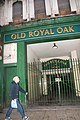 Old Royal Oak Pub, New York Street - geograph.org.uk - 2733186.jpg 2,592 × 3,872; 3.51 MB
-
 Pedestrianised end of Merrion Street, Leeds (31st January 2018).jpg 5,152 × 3,864; 8.42 MB
-
 Pottery Fields gas depot, Kidacre Street, Leeds (10th August 2018).jpg 5,152 × 3,864; 7.56 MB
-
 Remains of the Vesper Gate - geograph.org.uk - 268077.jpg 640 × 480; 73 KB
-
 Roadside gate, Lower Mickletown - geograph.org.uk - 1592355.jpg 640 × 480; 93 KB
-
 Roundhay (37536466352).jpg 6,000 × 4,000; 11.74 MB
-
 Side gate, St. Oswald's Church, Collingham (14th July 2017).jpg 2,176 × 3,872; 4.25 MB
-

-

-
 St John the Evangelist's Church, Leeds (25th September 2010) 005.jpg 2,736 × 3,648; 2.05 MB
-
 St John the Evangelist's Church, Leeds 2023 (2).jpg 4,471 × 3,354; 3.8 MB
-
 St Mary in the Wood Church, Morley, Leeds (36735573463).jpg 6,000 × 4,000; 14.06 MB
-
 St. Luke's Church, Clifford, West Yorkshire (15th July 2017) 005.jpg 3,872 × 2,176; 3.03 MB
-
 Stone Head and Railings.jpg 1,195 × 2,121; 2.12 MB
-
 Swinnow Moor House - 128 Swinnow Road - geograph.org.uk - 450815.jpg 640 × 325; 68 KB
-
 Tetley Hall 02.jpg 4,608 × 3,456; 5.45 MB
-
 Tetley Hall 03.jpg 4,608 × 3,456; 5.64 MB
-
 Tetley's brewery entrance from Hunslet Road, Leeds (24th June 2010).jpg 3,648 × 2,736; 1.99 MB
-
 Thornbury Avenue, Leeds (35642954021).jpg 5,312 × 2,988; 7.41 MB
-
 To the Park - geograph.org.uk - 830953.jpg 640 × 480; 62 KB
-
 Turnley House.jpg 1,867 × 1,400; 457 KB
-
 University of Leeds (4th May 2010) 064.jpg 3,872 × 2,592; 3.81 MB
-
 Wall, Gate Piers And Gates To Carr Manor House 14 June 2022.jpg 3,341 × 1,969; 1.78 MB
-
 Wall, Gate Piers And Gates To Carr Manor House.jpg 4,395 × 3,296; 3.84 MB
-
 Water Lane, Leeds (37001178471).jpg 6,000 × 4,000; 10.95 MB
-
 Water Lane, Leeds (37143418125).jpg 6,000 × 4,000; 12.25 MB
-

-
 Webton Court.jpg 4,107 × 3,080; 2.93 MB


.jpg)
.jpg)

.jpg)


.jpg)
.jpg)
.jpg)
.jpg)

.jpg)

.jpg)


.jpg)


.jpg)
.jpg)

_002.JPG)
.jpg)


.jpg)


.jpg)
.jpg)

.jpg)
.jpg)

.jpg)


.jpg)
.jpg)


.jpg)
.jpg)

.jpg)
.jpg)
.jpg)
.jpg)
.jpg)
.jpg)
.jpg)
.jpg)

.jpg)


.jpg)


.jpg)
.jpg)
.jpg)
.jpg)
.jpg)
.jpg)


.jpg)
.jpg)


.jpg)
.jpg)


_005.jpg)
.jpg)
.jpg)
_005.jpg)


.jpg)
.jpg)


_064.jpg)


.jpg)
.jpg)

