Category:Garvald, East Lothian
Jump to navigation
Jump to search
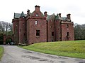
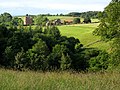
English: Garvald, is a village south of Haddington in East Lothian, Scotland. The combined parish of Garvald and Bara, borders Whittingehame to the East, Morham to the North, Yester to the West, and Lauder to the South. It is mainly an agricultural parish. The red freestone once constantly mined in this parish was well-known throughout the whole country.
village in East Lothian, Scotland, UK .jpg) | |||||
| Upload media | |||||
| Instance of | |||||
|---|---|---|---|---|---|
| Part of |
| ||||
| Location |
| ||||
| Elevation above sea level |
| ||||
| official website | |||||
 | |||||
Subcategories
This category has the following 2 subcategories, out of 2 total.
S
- Sancta Maria Abbey, Nunraw (6 F)
W
- Whittingehame Church (2 F)
Media in category "Garvald, East Lothian"
The following 82 files are in this category, out of 82 total.
-
 Blaikie Heugh - geograph.org.uk - 425408.jpg 640 × 480; 102 KB
-
 Blaikie Heugh - geograph.org.uk - 425643.jpg 640 × 480; 79 KB
-
 Cemetery at Nunraw Abbey - geograph.org.uk - 942414.jpg 640 × 480; 134 KB
-
 Cloudberries near garvald.jpg 1,944 × 2,592; 1.47 MB
-
 Drifting, B6370 - geograph.org.uk - 136463.jpg 640 × 480; 69 KB
-
 Evidence of change - geograph.org.uk - 136008.jpg 640 × 480; 104 KB
-
 Garvald (geograph 3946012).jpg 640 × 480; 232 KB
-
 Getting ready for the new crop - geograph.org.uk - 1223425.jpg 640 × 480; 62 KB
-
 Moorcock Hall - geograph.org.uk - 1094162.jpg 640 × 426; 77 KB
-
 Nunraw - geograph.org.uk - 142510.jpg 640 × 480; 83 KB
-
 Nunraw Abbey - geograph.org.uk - 942398.jpg 480 × 640; 58 KB
-
 Papple Farm and Steadings - geograph.org.uk - 425453.jpg 640 × 433; 76 KB
-
 Papple Steading and Doocot - geograph.org.uk - 329243.jpg 480 × 640; 67 KB
-
 Road at Chesters Farm - geograph.org.uk - 1223427.jpg 592 × 640; 61 KB
-
 Stoneypath Tower and cottages - geograph.org.uk - 699278.jpg 640 × 480; 135 KB
-
 Sundial, Whittingehame Tower - geograph.org.uk - 425383.jpg 480 × 640; 160 KB
-
 The Garvald Inn (geograph 2530167).jpg 2,592 × 1,944; 2.26 MB
-
 The main street in Garvald (geograph 2530158).jpg 2,592 × 1,944; 2.64 MB
-
 Wild gooseberries n g.jpg 1,944 × 2,592; 1.44 MB
-
 Across the Donolly Burn. - geograph.org.uk - 143887.jpg 640 × 480; 54 KB
-
 Ascending the Lammermuirs - geograph.org.uk - 167561.jpg 640 × 480; 51 KB
-
 Balfour Monument - geograph.org.uk - 425397.jpg 640 × 480; 86 KB
-
 Balfour Monument - geograph.org.uk - 425401.jpg 480 × 640; 77 KB
-
 Balfour Monument - geograph.org.uk - 425440.jpg 640 × 480; 99 KB
-
 Baro Wood. - geograph.org.uk - 136114.jpg 640 × 480; 104 KB
-
 Below Newmains Hill - geograph.org.uk - 159952.jpg 640 × 480; 151 KB
-
 Berwick Law - geograph.org.uk - 474762.jpg 640 × 475; 32 KB
-
 Broomy Brae - geograph.org.uk - 164002.jpg 640 × 480; 58 KB
-

-
 Country road - geograph.org.uk - 619591.jpg 640 × 480; 97 KB
-
 Cut timber. - geograph.org.uk - 136002.jpg 640 × 480; 140 KB
-
 Donolly Burn. - geograph.org.uk - 143882.jpg 640 × 480; 64 KB
-
 East Lothian in September - geograph.org.uk - 578927.jpg 640 × 480; 82 KB
-
 Effect of a gate. - geograph.org.uk - 136468.jpg 640 × 480; 74 KB
-
 Farm track - geograph.org.uk - 136109.jpg 640 × 480; 62 KB
-
 Farmland beneath Newlands Hill. - geograph.org.uk - 163975.jpg 640 × 480; 70 KB
-
 Faseny Cottage - geograph.org.uk - 326163.jpg 640 × 480; 113 KB
-
 Faseny Water - geograph.org.uk - 326147.jpg 640 × 326; 57 KB
-
 Fen Strip - geograph.org.uk - 167542.jpg 640 × 480; 81 KB
-
 Footbridge on the Papana Water - geograph.org.uk - 337021.jpg 640 × 480; 153 KB
-
 Garvald panorama from Law Knowes - geograph.org.uk - 328954.jpg 640 × 155; 55 KB
-
 Garvald, East Lothian - geograph.org.uk - 35510.jpg 640 × 480; 103 KB
-
 Green lane, Sled Hill - geograph.org.uk - 226347.jpg 640 × 480; 148 KB
-
 Grouse Butt No. 10, Little Collar Law - geograph.org.uk - 121043.jpg 640 × 480; 324 KB
-
 Grouse Butt No. 3, Meikle Says Law - geograph.org.uk - 121005.jpg 640 × 480; 276 KB
-
 Hairy Burn - geograph.org.uk - 226470.jpg 640 × 480; 104 KB
-
 Hare Cleugh Heatwave - geograph.org.uk - 205606.jpg 640 × 480; 75 KB
-
 Herring Road - geograph.org.uk - 206519.jpg 640 × 480; 92 KB
-
 In the grounds of Nunraw Abbey - geograph.org.uk - 619596.jpg 640 × 480; 96 KB
-
 Insulator - geograph.org.uk - 238626.jpg 640 × 480; 59 KB
-
 Jonscleuch - geograph.org.uk - 167910.jpg 640 × 480; 83 KB
-
 Killpallet Heights - geograph.org.uk - 238612.jpg 640 × 480; 70 KB
-
 Landrover track, Dun Side - geograph.org.uk - 121024.jpg 640 × 480; 241 KB
-
 Lane, Whittingehame - geograph.org.uk - 136005.jpg 640 × 480; 88 KB
-
 Lawhead Plantation. - geograph.org.uk - 136013.jpg 640 × 480; 79 KB
-
 Lone beech, Garvald Mains - geograph.org.uk - 226362.jpg 640 × 480; 76 KB
-
 Loth Stone, Traprain - geograph.org.uk - 425423.jpg 480 × 640; 130 KB
-
 Loth Stone, Traprain - geograph.org.uk - 425424.jpg 640 × 480; 148 KB
-
 Near Baro. - geograph.org.uk - 136112.jpg 640 × 480; 114 KB
-
 Newlands Hill - geograph.org.uk - 151174.jpg 500 × 375; 87 KB
-
 On Dodd Law - geograph.org.uk - 163989.jpg 640 × 480; 81 KB
-
 Roadside oaks. - geograph.org.uk - 136011.jpg 640 × 480; 70 KB
-
 Round bales near Stoneypath. - geograph.org.uk - 143877.jpg 623 × 479; 61 KB
-
 Rowans, Faseny Cottage - geograph.org.uk - 327182.jpg 640 × 482; 101 KB
-
 Sheepfold, Kingside Hill - geograph.org.uk - 277363.jpg 640 × 464; 107 KB
-
 Sounding Burn - geograph.org.uk - 226349.jpg 640 × 480; 118 KB
-
 SSEB road, Hare Cleuch - geograph.org.uk - 238646.jpg 640 × 480; 105 KB
-
 SSEB road, Killpallet Heights - geograph.org.uk - 238622.jpg 480 × 640; 62 KB
-
 SSEB road, Killpallet Heights - geograph.org.uk - 238633.jpg 640 × 480; 66 KB
-
 Star Wood - geograph.org.uk - 205724.jpg 640 × 480; 81 KB
-
 The Road from Garvald Kirk - geograph.org.uk - 472432.jpg 640 × 480; 91 KB
-
 The Road to Garvald Mains Farm - geograph.org.uk - 472442.jpg 640 × 480; 76 KB
-
 Torness pylons - geograph.org.uk - 167894.jpg 640 × 480; 75 KB
-
 Track off Meikle Says Law - geograph.org.uk - 180593.jpg 640 × 480; 132 KB
-
 View from the grounds of Nunraw Abbey - geograph.org.uk - 695562.jpg 640 × 426; 71 KB
-
 View of Traprain and Berwick Law - geograph.org.uk - 424836.jpg 640 × 480; 76 KB
-
 War memorial, Whittingehame - geograph.org.uk - 424900.jpg 640 × 480; 160 KB
-
 White Castle Fort, Garvald - geograph.org.uk - 277366.jpg 640 × 480; 62 KB
-
 Whiteadder Valley at Johnscleugh - geograph.org.uk - 375570.jpg 640 × 480; 115 KB
-
 Whittingehame Water - geograph.org.uk - 425640.jpg 640 × 480; 161 KB
-
 Woodland edge, Whittingehame - geograph.org.uk - 136001.jpg 640 × 480; 119 KB
-
 Y-junction, Landrover track - geograph.org.uk - 121021.jpg 640 × 480; 276 KB


.jpg)


.jpg)


