Category:Gartow (Wusterhausen)
Jump to navigation
Jump to search
| Object location | | View all coordinates using: OpenStreetMap |
|---|
human settlement in Germany _Dorfstrasse.jpg) | |||||
| Upload media | |||||
| Instance of |
| ||||
|---|---|---|---|---|---|
| Location | Wusterhausen/Dosse, Ostprignitz-Ruppin District, Brandenburg, Germany | ||||
| Elevation above sea level |
| ||||
 | |||||
English: The village Gartow is part of Wusterhausen/Dosse municipality, Ostprignitz-Ruppin district, Brandenburg state, Germany
Deutsch: Das Dorf Gartow gehört zur Gemeinde Wusterhausen/Dosse, Landkreis Ostprignitz-Ruppin, Land Brandenburg, Deutschland.
Français : Le village de Gartow fait partie de la commune de Wusterhausen/Dosse, arrondissement Prignitz-de-l'Est-Ruppin, état fédéral de Brandebourg, Allemagne
Subcategories
This category has only the following subcategory.
D
Media in category "Gartow (Wusterhausen)"
The following 5 files are in this category, out of 5 total.
-
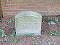 Dorfkirche Gartow (Wusterhausen) Epitaph Maria von Quast.jpg 4,000 × 3,000; 4.28 MB
-
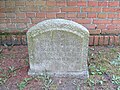 Dorfkirche Gartow (Wusterhausen) Epitaph Otto von Quast.jpg 4,000 × 3,000; 4.5 MB
-
 Gartow (Wusterhausen) Dorfstrasse.jpg 4,000 × 3,000; 3.7 MB
-
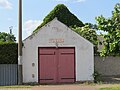 Gartow (Wusterhausen) Feuerwehrhaus.jpg 4,000 × 3,000; 3.12 MB
-
 Gartow Urmesstischblatt 3141-1825.png 973 × 737; 1.34 MB
_Epitaph_Maria_von_Quast.jpg)
_Epitaph_Otto_von_Quast.jpg)
_Feuerwehrhaus.jpg)
