Category:Gartnerboligen (Frederiksdal)
Jump to navigation
Jump to search
| Object location | | View all coordinates using: OpenStreetMap |
|---|
Media in category "Gartnerboligen (Frederiksdal)"
The following 5 files are in this category, out of 5 total.
-
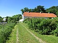
 Frederiksdal - gartnerboligen 01.jpg 5,184 × 3,888; 6.44 MB
-
 Frederiksdal - gartnerboligen 03.jpg 3,909 × 2,932; 3.26 MB
-
 Frederiksdal gartnerboligen 02.jpg 3,057 × 4,076; 2.61 MB
-
 Frederiksdal gartnerboligen 04.jpg 5,184 × 3,888; 8.92 MB
-
 Frederiksdal gartnerboligen 05.jpg 5,184 × 3,888; 7.17 MB


