Category:Garthamlock
Jump to navigation
Jump to search
district in Glasgow City, Scotland, UK  | |||||
| Upload media | |||||
| Instance of | |||||
|---|---|---|---|---|---|
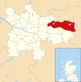
| Location | Glasgow City, Scotland | ||||
 | |||||
Subcategories
This category has the following 2 subcategories, out of 2 total.
A
G
- Glasgow Fort (27 F)
Media in category "Garthamlock"
The following 9 files are in this category, out of 9 total.
-
 Bend in Tillycairn Road - geograph.org.uk - 1262025.jpg 640 × 480; 114 KB
-
 Craigend and Garthamlock Water Towers - geograph.org.uk - 83929.jpg 640 × 480; 99 KB
-
 Cranhill from the air (geograph 5716380).jpg 640 × 480; 239 KB
-
 Glasgow wards 2017 no21 North East.png 2,000 × 2,040; 503 KB
-
 New housing development in Garthamlock - geograph.org.uk - 1262015.jpg 640 × 480; 106 KB
-
 Tillycairn Road housing - geograph.org.uk - 1262018.jpg 640 × 480; 113 KB
-
 Water towers, Garthamlock (geograph 4455374).jpg 3,504 × 2,336; 5.15 MB
-
 Homes in Garthamlock - geograph.org.uk - 453348.jpg 640 × 480; 75 KB
-
 Water Towers - geograph.org.uk - 453333.jpg 640 × 480; 67 KB

.jpg)


.jpg)

