Category:Gartenpavillon, Landsitz Sandhof (Worblaufenstrasse 157a, Worblaufen)
Jump to navigation
Jump to search
| Object location | | View all coordinates using: OpenStreetMap |
|---|
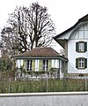
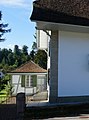
pavilion attached to residential building and part of a building ensemble in Worblaufen in the canton of Bern, Switzerland  | |||||
| Upload media | |||||
| Instance of | |||||
|---|---|---|---|---|---|
| Part of | |||||
| Location | Worblaufen, Ittigen, Bern-Mittelland administrative district, Bernese Mittelland administrative region, Bern, Switzerland | ||||
| Street address |
| ||||
| Heritage designation |
| ||||
| Inception |
| ||||
 | |||||
Media in category "Gartenpavillon, Landsitz Sandhof (Worblaufenstrasse 157a, Worblaufen)"
The following 3 files are in this category, out of 3 total.
-
 Gartenpavillon Worblaufenstr 157a.jpg 1,320 × 1,587; 2.5 MB
-
 Gartenpavillon, Ittigen Sandhof DSC00904 (cropped).JPG 1,689 × 2,269; 2.57 MB
-
 Ittigen Sandhof DSC00904.JPG 4,372 × 2,601; 6.85 MB
.JPG)
