Category:Gartalm
Jump to navigation
Jump to search
| Object location | | View all coordinates using: OpenStreetMap |
|---|
 | |||||
| Upload media | |||||
| Instance of | |||||
|---|---|---|---|---|---|
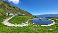
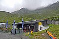
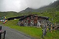
| Location | Fügenberg, Schwaz District, Tyrol, Austria | ||||
| Mountain range | |||||
 | |||||
Media in category "Gartalm"
The following 11 files are in this category, out of 11 total.
-
 Gartalm 2022 01.jpg 2,200 × 1,239; 668 KB
-
 Gartalm 2022 02.jpg 2,200 × 1,239; 596 KB
-
 Gartalm 2022 03.jpg 2,200 × 1,239; 506 KB
-
 Gedenkstein Bär BrunoGartalm.jpg 3,024 × 4,032; 7.76 MB
-
 T-Fügenberg-Gartalm-1.jpg 3,648 × 2,432; 1.65 MB
-
 T-Fügenberg-Gartalm-2.jpg 3,120 × 2,080; 1.72 MB
-
 T-Fügenberg-Gartalm-3.jpg 3,648 × 2,432; 1.79 MB
-
 T-Fügenberg-Gartalm-4.jpg 3,260 × 2,445; 1.6 MB
-
 T-Fügenberg-Gartalm-5.jpg 3,179 × 2,119; 1.64 MB
-
 T-Fügenberg-Gartalm-6.jpg 3,648 × 2,432; 1.8 MB
-
 T-Fügenberg-Kuhmesser.jpg 3,648 × 2,736; 1.96 MB


