Category:Garsdale Head
Jump to navigation
Jump to search
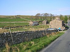
English: Garsdale Head is a hamlet in Cumbria, but is part of the Yorkshire Dales National Park. It lies at the top of the valley of Garsdale, on and near the A684 road between Sedbergh and Hawes. Its main attraction is Garsdale railway station on the Settle-Carlisle Railway and the former Wensleydale Railway. The alternative name was Hawes Junction until the branch line to Hawes was closed in 1964, and this name remains in common use.
hamlet in Cumbria, England, UK | |||||
| Upload media | |||||
| Instance of | |||||
|---|---|---|---|---|---|
| Location | Garsdale, Westmorland and Furness, Cumbria, North West England, England | ||||
 | |||||
Subcategories
This category has the following 2 subcategories, out of 2 total.
G
M
- The Moorcock Inn, Hawes (21 F)
Media in category "Garsdale Head"
The following 45 files are in this category, out of 45 total.
-
20093,20061 & 47444 , Lunds Viaduct.jpg 2,000 × 1,361; 689 KB
-
Alberta crossing the A684 at Garsdale Head - geograph.org.uk - 6584090.jpg 1,024 × 768; 160 KB
-
Bridge 115, Garsdale Head - geograph.org.uk - 76809.jpg 640 × 480; 68 KB
-
Bridge to Yore House - geograph.org.uk - 188110.jpg 640 × 480; 123 KB
-
Clough River - geograph.org.uk - 554368.jpg 640 × 480; 117 KB
-
Dandry Mire house at Garsdale Head - geograph.org.uk - 1901760.jpg 640 × 480; 100 KB
-
Dandrymire Viaduct - geograph.org.uk - 156513.jpg 640 × 492; 67 KB
-
Dandrymire Viaduct - geograph.org.uk - 163948.jpg 640 × 363; 95 KB
-
Dandrymire Viaduct - geograph.org.uk - 613342.jpg 640 × 438; 115 KB
-
Garsdale Head - geograph.org.uk - 2120528.jpg 640 × 480; 72 KB
-
Garsdale Head - view from High Scale - geograph.org.uk - 628668.jpg 640 × 480; 58 KB
-
Garsdale Head, Coal Road - geograph.org.uk - 1898983.jpg 1,024 × 768; 254 KB
-
Garsdale Head, Coal Road gateway - geograph.org.uk - 1913114.jpg 640 × 480; 69 KB
-
Garsdale Head, Millennium Monument - geograph.org.uk - 1914650.jpg 768 × 1,024; 144 KB
-
Garsdale Head, stream - geograph.org.uk - 1909984.jpg 768 × 1,024; 232 KB
-
Garsdale Head.jpg 640 × 480; 133 KB
-
Garsdale Low Moor at Garsdale Head - geograph.org.uk - 3372546.jpg 1,024 × 768; 140 KB
-
Heather on Garsdale Common - geograph.org.uk - 600296.jpg 640 × 637; 99 KB
-
Midland Cottages, Garsdale Head - geograph.org.uk - 2344107.jpg 1,024 × 768; 121 KB
-
Moorcock Inn road junction - geograph.org.uk - 539666.jpg 640 × 480; 96 KB
-
Moorcock Inn, Garsdale Head, Yorkshire, England - 1900-05.jpg 1,023 × 633; 446 KB
-
Railway above Garsdale - geograph.org.uk - 606477.jpg 640 × 425; 73 KB
-
Railway bridge over the A684 road.jpg 1,024 × 763; 631 KB
-
Swallowed up by the forest - geograph.org.uk - 699724.jpg 640 × 480; 122 KB
-
The Moorcock - geograph.org.uk - 163952.jpg 640 × 480; 83 KB
-
The Moorcock - geograph.org.uk - 381184.jpg 640 × 480; 163 KB
-
The view from Dandrymire Viaduct - geograph.org.uk - 5492476.jpg 800 × 600; 69 KB
-
View from the Dandrymire Viaduct - geograph.org.uk - 5492532.jpg 800 × 560; 78 KB
-
Wall Corner - geograph.org.uk - 287609.jpg 640 × 480; 96 KB
-
Wall on Baugh Fell - geograph.org.uk - 416476.jpg 640 × 467; 164 KB
-
Waterfalls on Clough River - geograph.org.uk - 435748.jpg 640 × 480; 99 KB
-
East Mud Becks - geograph.org.uk - 191918.jpg 640 × 480; 165 KB
-
East Mud Becks - geograph.org.uk - 437354.jpg 640 × 480; 97 KB
-
Garsdale Common - geograph.org.uk - 287547.jpg 640 × 480; 82 KB
-
Garsdale Head - geograph.org.uk - 191167.jpg 640 × 480; 114 KB
-
Garsdale Millennium Cairn - geograph.org.uk - 441709.jpg 640 × 427; 96 KB
-
Garth Gill House - geograph.org.uk - 255493.jpg 640 × 480; 105 KB
-
Gate - geograph.org.uk - 437361.jpg 640 × 480; 102 KB
-
Grisedale Road - geograph.org.uk - 254349.jpg 640 × 480; 83 KB
-
Hawes Junction Methodist Chapel - geograph.org.uk - 348666.jpg 640 × 445; 80 KB
-
Knudmaning - geograph.org.uk - 417088.jpg 640 × 480; 131 KB
-
On Garsdale Common - geograph.org.uk - 287553.jpg 640 × 480; 100 KB
-
Railway Bridge - geograph.org.uk - 437358.jpg 640 × 480; 127 KB
-
Shaw Paddock - geograph.org.uk - 343233.jpg 640 × 479; 111 KB
-
The Road to Knudmaning - geograph.org.uk - 435749.jpg 640 × 480; 100 KB


