Category:Garndiffaith
Jump to navigation
Jump to search
village in Wales  | |||||
| Upload media | |||||
| Instance of | |||||
|---|---|---|---|---|---|
| Location | Torfaen, Wales | ||||
 | |||||

English: Garndiffaith is a village located in Torfaen, south east Wales. It is a small rural area situated between Talywain and Varteg, three miles north of the town of Pontypool and 3.5 miles south of the town of Blaenavon (a World Heritage Site). The village is now part of the Abersychan suburb of Pontypool which also includes Cwmavon, Pentwyn, Talywain, Varteg, and Victoria Village.
Media in category "Garndiffaith"
The following 16 files are in this category, out of 16 total.
-

-
 Bethel Court, Garndiffaith - geograph.org.uk - 1905671.jpg 640 × 480; 73 KB
-
 Birchill Cottage, Garndiffaith - geograph.org.uk - 1857429.jpg 640 × 480; 66 KB
-
 Co-operative Terrace, Garndiffaith - geograph.org.uk - 1857021.jpg 640 × 480; 70 KB
-
 Disused railway bridge - geograph.org.uk - 558132.jpg 640 × 482; 104 KB
-
 Disused railway bridge - geograph.org.uk - 558137.jpg 640 × 482; 124 KB
-
 Eastern arches of Garndiffaith Viaduct - geograph.org.uk - 2137511.jpg 640 × 480; 133 KB
-
 Footpath down to the works - geograph.org.uk - 469455.jpg 640 × 480; 123 KB
-
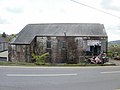 Garn Motorcycles, Garndiffaith - geograph.org.uk - 1857456.jpg 640 × 480; 60 KB
-
 Garndiffaith Viaduct arches - geograph.org.uk - 2137504.jpg 480 × 640; 93 KB
-
 Garndiffaith Viaduct crosses Viaduct Road (geograph 2137517).jpg 640 × 496; 96 KB
-
 Garndiffaith Viaduct from the north - geograph.org.uk - 2137473.jpg 640 × 562; 91 KB
-
 Hanbury Arms, Garndiffaith - geograph.org.uk - 1905660.jpg 640 × 480; 70 KB
-

-
 Junction with phonebox - geograph.org.uk - 558131.jpg 640 × 482; 96 KB
-
 Lovely wildflower meadow - geograph.org.uk - 469457.jpg 640 × 480; 96 KB


.jpg)


