Category:Garlinge
Jump to navigation
Jump to search
English: Garlinge is a village in the suburbs of Margate in Kent, United Kingdom, situated 2 km southwest of the centre of the town. It is in the Thanet local government district. There is a small selection of shops in the village, such as a bakery, newsagents, barbers and also a petrol station. There are also two car workshops.
village in the United Kingdom  | |||||
| Upload media | |||||
| Instance of |
| ||||
|---|---|---|---|---|---|
| Location | Thanet, Kent, South East England, England | ||||
 | |||||
Subcategories
This category has the following 2 subcategories, out of 2 total.
J
O
- Oasts in Garlinge (1 F)
Media in category "Garlinge"
The following 24 files are in this category, out of 24 total.
-
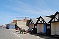
 Beach Huts, Westbrook Bay - geograph.org.uk - 1473078.jpg 640 × 430; 131 KB
-
 Beach Huts, Westbrook Bay - geograph.org.uk - 1473102.jpg 640 × 430; 117 KB
-
 Cafe on the promenade at Westbrook Bay - geograph.org.uk - 1473098.jpg 640 × 430; 115 KB
-
 Dent De Lion Castle (The Remains Of ) - geograph.org.uk - 331972.jpg 640 × 480; 98 KB
-
 Garlinge newsagents - geograph.org.uk - 743977.jpg 640 × 480; 148 KB
-
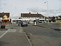
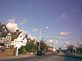
 High Street, Garlinge - geograph.org.uk - 743940.jpg 640 × 480; 166 KB
-
 Hussar Hotel, Garlinge - geograph.org.uk - 743987.jpg 640 × 480; 182 KB
-
-
 Looking E along Birds Avenue, Garlinge - geograph.org.uk - 743577.jpg 640 × 480; 146 KB
-
 Looking N along High Street, Garlinge - geograph.org.uk - 743570.jpg 640 × 480; 144 KB
-
 Shottendane Road, Margate - geograph.org.uk - 341091.jpg 480 × 640; 55 KB
-

-
 View along High Street towards Garlinge - geograph.org.uk - 743509.jpg 640 × 480; 190 KB
-
 View along High Street, Garlinge - geograph.org.uk - 743532.jpg 640 × 480; 249 KB
-
-
 Bridleway to Garlinge - geograph.org.uk - 742835.jpg 640 × 480; 163 KB
-

-
 Closes Cottages on Minster Road - geograph.org.uk - 742818.jpg 640 × 480; 143 KB
-
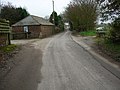 Entrance To Spratling Court Farm - geograph.org.uk - 341074.jpg 640 × 480; 123 KB
-
 Farm and Horses - geograph.org.uk - 332049.jpg 640 × 480; 75 KB
-
 Flete Road, Near Manston - geograph.org.uk - 341078.jpg 480 × 640; 77 KB
-

-
 The Road To Woodchurch - geograph.org.uk - 341098.jpg 480 × 640; 65 KB
-
 Water Tower - geograph.org.uk - 332052.jpg 640 × 480; 87 KB


_-_geograph.org.uk_-_331972.jpg)


