Category:Garlieston
Jump to navigation
Jump to search
English: Garlieston, Dumfries and galloway, Scotland
village in Dumfries and Galloway, Scotland, UK  | |||||
| Upload media | |||||
| Instance of | |||||
|---|---|---|---|---|---|
| Location |
| ||||
 | |||||
Subcategories
This category has the following 3 subcategories, out of 3 total.
B
G
- Garlieston Harbour (20 F)
- Garlieston railway station (2 F)
Media in category "Garlieston"
The following 200 files are in this category, out of 217 total.
(previous page) (next page)-
 A 'Beetle' At Garlieston Bay - Image ^1 - geograph.org.uk - 3507584.jpg 4,592 × 3,448; 4.38 MB
-
 A 'Beetle' At Garlieston Bay - Image ^2 - geograph.org.uk - 3507611.jpg 4,592 × 3,448; 4.31 MB
-
 A 'Beetle' At Garlieston Bay - Image ^3 - geograph.org.uk - 3507633.jpg 4,592 × 3,448; 3.48 MB
-
 A 'Beetle' At Garlieston Bay - Image ^4 - geograph.org.uk - 3507666.jpg 3,448 × 4,592; 2.74 MB
-
 A beetle Pontoon - geograph.org.uk - 235206.jpg 640 × 480; 134 KB
-
 A heron strikes in Garlieston Bay - geograph.org.uk - 5831317.jpg 2,831 × 3,554; 1.25 MB
-
 A new house - geograph.org.uk - 500555.jpg 640 × 480; 128 KB
-
 A path in Galloway House Gardens - geograph.org.uk - 1563928.jpg 640 × 480; 131 KB
-

-
 Anchor by the Breakwater - geograph.org.uk - 5561453.jpg 3,694 × 2,463; 1.96 MB
-
 Anchors Away - geograph.org.uk - 2992495.jpg 640 × 470; 78 KB
-
 Beetle across the Bay - geograph.org.uk - 2995424.jpg 640 × 472; 99 KB
-
 Before the Bay - geograph.org.uk - 5562260.jpg 4,272 × 2,848; 2.6 MB
-
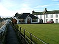
 Bowling green, Garlieston - geograph.org.uk - 1563963.jpg 640 × 480; 65 KB
-
 Breakwater at Garlieston - geograph.org.uk - 4857472.jpg 1,920 × 1,280; 1.39 MB
-
 Breakwater at Garlieston - geograph.org.uk - 4857480.jpg 1,920 × 1,280; 1.35 MB
-
 Breakwater at Garlieston Bay - geograph.org.uk - 2992530.jpg 480 × 640; 86 KB
-
 Breakwater Near Garlieston Harbour - geograph.org.uk - 3579387.jpg 4,592 × 3,448; 4.48 MB
-
 Breakwater, Garlieston Bay. - geograph.org.uk - 1558599.jpg 640 × 402; 50 KB
-
 Bridge Over Mill Burn - geograph.org.uk - 739378.jpg 638 × 480; 88 KB
-
 Burn to Bay - geograph.org.uk - 3017725.jpg 640 × 480; 58 KB
-
 Carswell Village - geograph.org.uk - 604065.jpg 640 × 480; 158 KB
-
 Coastal footpath - geograph.org.uk - 1563887.jpg 640 × 480; 117 KB
-
 Coastal Path - geograph.org.uk - 2992591.jpg 640 × 470; 85 KB
-
 Coastal path south of Garlieston - geograph.org.uk - 1282266.jpg 640 × 428; 100 KB
-
 Coastal path south of Garlieston - geograph.org.uk - 1282280.jpg 640 × 428; 123 KB
-
 Coastal Path to Garlieston - geograph.org.uk - 4857479.jpg 1,920 × 1,280; 2.13 MB
-
 Colourful cottages. - geograph.org.uk - 1068534.jpg 640 × 427; 50 KB
-
 Cormorant on Garlieston Beach - geograph.org.uk - 2376985.jpg 640 × 480; 143 KB
-
 Cow parsley on the shore at Garlieston - geograph.org.uk - 5825589.jpg 5,067 × 3,694; 2.29 MB
-
 Culderry, Garlieston - geograph.org.uk - 2832107.jpg 640 × 480; 71 KB
-
 Death Row - geograph.org.uk - 840702.jpg 480 × 640; 149 KB
-
 Disused Whithorn Railway Line - geograph.org.uk - 601877.jpg 640 × 480; 144 KB
-
 Dumbie Breakwater - geograph.org.uk - 5561461.jpg 2,518 × 1,679; 968 KB
-
 Dumbie Point - geograph.org.uk - 3017764.jpg 640 × 482; 62 KB
-
 Dumbie Point - geograph.org.uk - 5694079.jpg 2,919 × 1,890; 483 KB
-
 End of the Pier at Garlieston - geograph.org.uk - 3915274.jpg 1,920 × 1,280; 1.39 MB
-
 Entering Garlieston Harbour - geograph.org.uk - 2998141.jpg 640 × 480; 67 KB
-
 Erratic boulder - geograph.org.uk - 3161872.jpg 640 × 480; 88 KB
-
 Farmland and Woodland - geograph.org.uk - 4857483.jpg 1,920 × 1,280; 2.48 MB
-
 Footpath to Cruggleton Castle from Garlieston - geograph.org.uk - 3232022.jpg 4,000 × 3,000; 5.65 MB
-
 Forteviot Hall - geograph.org.uk - 739357.jpg 640 × 480; 62 KB
-
 Garlieston - geograph.org.uk - 1281127.jpg 640 × 428; 49 KB
-
 Garlieston - geograph.org.uk - 89019.jpg 640 × 427; 64 KB
-
 Garlieston at Low Tide - geograph.org.uk - 3422211.jpg 640 × 480; 88 KB
-
 Garlieston Bay - geograph.org.uk - 1281069.jpg 640 × 428; 51 KB
-
 Garlieston Bay - geograph.org.uk - 1558569.jpg 640 × 480; 60 KB
-
 Garlieston Bay - geograph.org.uk - 2207925.jpg 640 × 480; 85 KB
-
 Garlieston Bay - geograph.org.uk - 2207930.jpg 640 × 480; 74 KB
-
 Garlieston Bay - geograph.org.uk - 2207936.jpg 640 × 480; 81 KB
-
 Garlieston Bay - geograph.org.uk - 2207941.jpg 640 × 480; 85 KB
-
 Garlieston Bay - geograph.org.uk - 2209712.jpg 640 × 290; 39 KB
-
 Garlieston Bay - geograph.org.uk - 2209715.jpg 640 × 480; 74 KB
-
 Garlieston Bay - geograph.org.uk - 2209717.jpg 640 × 480; 71 KB
-
 Garlieston Bay - geograph.org.uk - 2214553.jpg 640 × 480; 64 KB
-
 Garlieston Bay - geograph.org.uk - 2214564.jpg 640 × 480; 82 KB
-
 Garlieston Bay - geograph.org.uk - 2343081.jpg 640 × 480; 51 KB
-
 Garlieston Bay - geograph.org.uk - 2355513.jpg 640 × 480; 55 KB
-
 Garlieston Bay - geograph.org.uk - 2355520.jpg 640 × 463; 48 KB
-
 Garlieston Bay - geograph.org.uk - 2355530.jpg 640 × 381; 38 KB
-
 Garlieston Bay - geograph.org.uk - 2355638.jpg 640 × 461; 56 KB
-
 Garlieston Bay - geograph.org.uk - 2355650.jpg 640 × 466; 57 KB
-
 Garlieston Bay - geograph.org.uk - 2359835.jpg 640 × 480; 52 KB
-
 Garlieston Bay - geograph.org.uk - 2359867.jpg 640 × 459; 54 KB
-
 Garlieston Bay - geograph.org.uk - 2389664.jpg 640 × 434; 51 KB
-
 Garlieston Bay - geograph.org.uk - 2562512.jpg 640 × 480; 64 KB
-
 Garlieston Bay - geograph.org.uk - 2562523.jpg 640 × 480; 83 KB
-
 Garlieston Bay - geograph.org.uk - 2562526.jpg 640 × 480; 79 KB
-
 Garlieston Bay - geograph.org.uk - 2562548.jpg 640 × 480; 55 KB
-
 Garlieston Bay - geograph.org.uk - 2605292.jpg 640 × 470; 73 KB
-
 Garlieston Bay - geograph.org.uk - 2764295.jpg 2,592 × 1,944; 685 KB
-
 Garlieston Bay - geograph.org.uk - 2764299.jpg 2,592 × 1,944; 633 KB
-
 Garlieston Bay - geograph.org.uk - 2832212.jpg 640 × 480; 72 KB
-
 Garlieston Bay - geograph.org.uk - 2876704.jpg 640 × 480; 70 KB
-
 Garlieston Bay - geograph.org.uk - 2876711.jpg 640 × 480; 75 KB
-
 Garlieston Bay - geograph.org.uk - 2876917.jpg 640 × 472; 82 KB
-
 Garlieston Bay - geograph.org.uk - 2979117.jpg 2,048 × 1,536; 1.34 MB
-
 Garlieston Bay - geograph.org.uk - 316792.jpg 640 × 480; 67 KB
-
 Garlieston Bay - geograph.org.uk - 3422254.jpg 640 × 480; 87 KB
-
 Garlieston Bay - geograph.org.uk - 3915268.jpg 1,920 × 1,280; 913 KB
-
 Garlieston Bay - geograph.org.uk - 4857461.jpg 1,920 × 1,280; 1.32 MB
-
 Garlieston Bay - geograph.org.uk - 4857470.jpg 1,920 × 1,280; 1.64 MB
-
 Garlieston Bay - geograph.org.uk - 4857482.jpg 1,920 × 1,280; 1.47 MB
-
 Garlieston Bay - geograph.org.uk - 5693958.jpg 2,976 × 1,984; 1.88 MB
-
 Garlieston Bay - geograph.org.uk - 5694015.jpg 2,976 × 1,984; 2.99 MB
-
 Garlieston Bay - geograph.org.uk - 5694016.jpg 2,976 × 1,984; 2.83 MB
-
 Garlieston Bay - geograph.org.uk - 5694042.jpg 2,976 × 1,984; 2.69 MB
-
 Garlieston Bay - geograph.org.uk - 5694043.jpg 2,976 × 1,984; 2.8 MB
-
 Garlieston Bay - geograph.org.uk - 5694059.jpg 2,976 × 1,984; 2.32 MB
-
 Garlieston Bay - geograph.org.uk - 5694061.jpg 2,976 × 1,984; 2.18 MB
-
 Garlieston Bay - geograph.org.uk - 5694069.jpg 2,877 × 1,984; 684 KB
-
 Garlieston Bay - geograph.org.uk - 5694070.jpg 2,976 × 1,984; 2.37 MB
-
 Garlieston Bay - geograph.org.uk - 5694078.jpg 2,907 × 1,905; 531 KB
-
 Garlieston Bay - geograph.org.uk - 604291.jpg 640 × 480; 99 KB
-
 Garlieston Bay - geograph.org.uk - 736496.jpg 640 × 427; 111 KB
-
 Garlieston Bay - geograph.org.uk - 843615.jpg 640 × 480; 87 KB
-
 Garlieston Bay - geograph.org.uk - 867323.jpg 640 × 395; 60 KB
-
 Garlieston Bay 25th December 2010 - geograph.org.uk - 2209722.jpg 640 × 465; 51 KB
-
 Garlieston Bay 25th December 2010 - geograph.org.uk - 2209723.jpg 640 × 471; 68 KB
-
 Garlieston Bay at Low Tide - geograph.org.uk - 2832122.jpg 640 × 470; 62 KB
-
 Garlieston Beach - geograph.org.uk - 2389889.jpg 640 × 497; 60 KB
-
 Garlieston Beach - geograph.org.uk - 2508652.jpg 640 × 480; 70 KB
-
 Garlieston Beach - geograph.org.uk - 2605272.jpg 640 × 474; 108 KB
-
 Garlieston Beach - geograph.org.uk - 2654041.jpg 640 × 480; 130 KB
-
 Garlieston Beach - geograph.org.uk - 2684413.jpg 640 × 472; 81 KB
-
 Garlieston Beach - geograph.org.uk - 2741028.jpg 2,529 × 1,899; 541 KB
-
 Garlieston Beach at NX 48000 47000 - geograph.org.uk - 2826841.jpg 480 × 640; 59 KB
-
 Garlieston Beach at NX 48000 47000 - geograph.org.uk - 2826847.jpg 640 × 480; 49 KB
-
 Garlieston Beach at NX 48000 47000 - geograph.org.uk - 2826850.jpg 640 × 480; 44 KB
-
 Garlieston Beach at NX 48000 47000 - geograph.org.uk - 2826852.jpg 640 × 480; 49 KB
-
 Garlieston Bowling Club - geograph.org.uk - 739386.jpg 638 × 480; 69 KB
-
 Garlieston Caravan Site - geograph.org.uk - 392959.jpg 640 × 480; 71 KB
-
 Garlieston from the bay - geograph.org.uk - 2980409.jpg 1,798 × 763; 256 KB
-
 Garlieston Harbour - geograph.org.uk - 1954081.jpg 3,648 × 2,736; 4.73 MB
-
 Garlieston Harbour - geograph.org.uk - 2343065.jpg 640 × 480; 78 KB
-
 Garlieston Harbour - geograph.org.uk - 2355502.jpg 640 × 480; 65 KB
-
 Garlieston Harbour - geograph.org.uk - 2355505.jpg 640 × 480; 62 KB
-
 Garlieston Harbour - geograph.org.uk - 2355646.jpg 640 × 480; 83 KB
-
 Garlieston Harbour - geograph.org.uk - 2359843.jpg 640 × 480; 89 KB
-
 Garlieston Harbour - geograph.org.uk - 2389676.jpg 640 × 422; 55 KB
-
 Garlieston Harbour - geograph.org.uk - 5694077.jpg 2,976 × 1,984; 2.39 MB
-
 Garlieston Harbour over the bay - geograph.org.uk - 2980394.jpg 1,024 × 768; 231 KB
-
 Garlieston Main Street.jpg 640 × 480; 88 KB
-
 Garlieston Pier - geograph.org.uk - 3017709.jpg 640 × 500; 87 KB
-
 Garlieston Pier - geograph.org.uk - 3017804.jpg 640 × 480; 65 KB
-
 Garlieston Pier - geograph.org.uk - 3915277.jpg 1,920 × 1,280; 1.24 MB
-
 Garlieston Pier - geograph.org.uk - 3915283.jpg 1,920 × 1,280; 1,013 KB
-
 Garlieston Pier - geograph.org.uk - 5694081.jpg 2,976 × 1,984; 2.3 MB
-
 Garlieston Road - geograph.org.uk - 867366.jpg 640 × 374; 65 KB
-
 Garlieston Village Hall - geograph.org.uk - 739367.jpg 638 × 480; 65 KB
-
 Garlieston village.JPG 2,288 × 1,712; 1.2 MB
-
 Garlieston, Galloway.JPG 2,288 × 1,712; 1.3 MB
-
 Garlieston-Scotland (Locator LG).png 400 × 280; 88 KB
-
 Heading towards Dumbie Point - geograph.org.uk - 2975638.jpg 1,024 × 683; 82 KB
-
 High Tide - geograph.org.uk - 5400147.jpg 4,552 × 3,414; 2.28 MB
-
 High tide with rocks - geograph.org.uk - 3161856.jpg 640 × 480; 99 KB
-
 Horse Jumps - geograph.org.uk - 2654029.jpg 640 × 480; 57 KB
-
 House along the path - geograph.org.uk - 2975645.jpg 1,024 × 683; 176 KB
-
 Inflatable boat in Garlieston Bay - at high tide - geograph.org.uk - 5831323.jpg 4,785 × 3,576; 4.19 MB
-
 Innerwell Port - geograph.org.uk - 601870.jpg 640 × 480; 61 KB
-
 Kilfillan Burn - geograph.org.uk - 5562262.jpg 4,272 × 2,848; 4.78 MB
-
 Late Summer Garden House - geograph.org.uk - 1304960.jpg 640 × 480; 134 KB
-
 Loft Access, Harbour Building - geograph.org.uk - 736488.jpg 480 × 640; 112 KB
-
 Looking at South Crescent - geograph.org.uk - 2980399.jpg 1,024 × 768; 212 KB
-
 Low Tide - geograph.org.uk - 5817050.jpg 4,608 × 3,456; 4.35 MB
-
 Low tide at Garlieston - geograph.org.uk - 2764291.jpg 2,592 × 1,944; 691 KB
-
 Low Tide at Garlieston - geograph.org.uk - 3017116.jpg 640 × 480; 57 KB
-
 Low Tide at Garlieston - geograph.org.uk - 3789409.jpg 640 × 480; 86 KB
-
 Low Tide at Garlieston Bay - geograph.org.uk - 737206.jpg 640 × 384; 80 KB
-
 Low Tide at Garlieston Breakwater - geograph.org.uk - 843569.jpg 640 × 480; 133 KB
-
 Low tide in Garlieston Bay, looking north east - geograph.org.uk - 1833485.jpg 3,611 × 2,243; 3.07 MB
-
 Man's Best Friend - geograph.org.uk - 2878279.jpg 480 × 640; 97 KB
-
 Mapa Bhaile Ghèarr Lios DG.jpg 2,004 × 1,363; 599 KB
-
 Mill Burn - geograph.org.uk - 739382.jpg 638 × 480; 109 KB
-
 Mobile Bank, Garlieston - geograph.org.uk - 5694053.jpg 2,976 × 1,984; 2.54 MB
-
 MV Balmoral - geograph.org.uk - 2998118.jpg 550 × 640; 63 KB
-
 No Path - geograph.org.uk - 739722.jpg 638 × 480; 128 KB
-
 North Crescent, Garlieston - geograph.org.uk - 1281046.jpg 640 × 428; 56 KB
-
 Old Railway Bridge - geograph.org.uk - 600203.jpg 640 × 480; 94 KB
-
 One man and his dog - geograph.org.uk - 2376970.jpg 640 × 480; 98 KB
-
 Panorama of Garlieston - geograph.org.uk - 2980411.jpg 2,736 × 744; 538 KB
-
 Path to Cruggleton Bay - geograph.org.uk - 2992543.jpg 640 × 480; 82 KB
-
 Pier at Garlieston - geograph.org.uk - 5040197.jpg 1,024 × 682; 166 KB
-

-
 Post Office, Garlieston - geograph.org.uk - 316778.jpg 480 × 640; 68 KB
-
 Primroses - geograph.org.uk - 604309.jpg 640 × 480; 108 KB
-

-

-
 Riding Lesson on Garlieston Beach - geograph.org.uk - 2984909.jpg 640 × 480; 93 KB
-
 Riding Out on Garlieston Beach - geograph.org.uk - 2984919.jpg 492 × 640; 92 KB
-
 Rocky fore shore - geograph.org.uk - 2980387.jpg 1,024 × 768; 193 KB
-
 Sailing in to Garlieston - geograph.org.uk - 2998129.jpg 640 × 480; 61 KB
-
 Scotland to England - geograph.org.uk - 2832258.jpg 480 × 640; 70 KB
-
 Sea Horses - geograph.org.uk - 2654020.jpg 640 × 480; 57 KB
-
 Sea Lavender - geograph.org.uk - 3161910.jpg 640 × 480; 101 KB
-
 Seafront cottages, Garlieston - geograph.org.uk - 604345.jpg 640 × 480; 69 KB
-
 Seat at Garlieston Bay - geograph.org.uk - 4857473.jpg 1,920 × 1,280; 1.31 MB
-
 Seating on the Pier at Garlieston - geograph.org.uk - 3915280.jpg 1,920 × 1,280; 1.22 MB
-
 Shot past the Bows - geograph.org.uk - 2998175.jpg 640 × 473; 93 KB
-
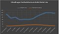 Sileadh agus Teothachd ann am Baile Geàrr Lios.jpg 573 × 335; 35 KB
-
 Small Breakwater - geograph.org.uk - 2992594.jpg 640 × 475; 91 KB
-
 Small Creek, Near Dumbie Point - geograph.org.uk - 736446.jpg 480 × 600; 80 KB
-
 South and North Crescent - geograph.org.uk - 2980402.jpg 1,024 × 768; 183 KB
-
 South Crescent - geograph.org.uk - 739304.jpg 640 × 427; 68 KB
-
 South Crescent, Garlieston - geograph.org.uk - 1281011.jpg 640 × 428; 67 KB
-
 South Street - geograph.org.uk - 737185.jpg 640 × 480; 67 KB
-
 Stone Breakwater - geograph.org.uk - 5561484.jpg 2,802 × 1,869; 744 KB
-
 Sunny Day at Garlieston - geograph.org.uk - 3789411.jpg 640 × 480; 102 KB
-
 Sunrise in Garlieston - geograph.org.uk - 4287737.jpg 640 × 426; 29 KB
-
 The beach at Garlieston - geograph.org.uk - 4503959.jpg 640 × 480; 404 KB
-
 The Harbour Inn, Garlieston - geograph.org.uk - 1281109.jpg 640 × 428; 67 KB
-
 The Pier at Garlieston - geograph.org.uk - 4857471.jpg 1,920 × 1,280; 1.76 MB
-
 The Pier at Garlieston - geograph.org.uk - 4857474.jpg 1,920 × 1,280; 1.46 MB
-
 The tip of an old anchor at Garlieston - geograph.org.uk - 5825703.jpg 5,184 × 3,689; 3.91 MB
-
 Throw the ball Dad - geograph.org.uk - 3422267.jpg 640 × 480; 80 KB
-
 Tied at the Pier - geograph.org.uk - 3017121.jpg 640 × 480; 80 KB
-
 Towards North Crescent - geograph.org.uk - 2973674.jpg 1,024 × 683; 63 KB
-
 Towards the Harbour - geograph.org.uk - 2980382.jpg 1,024 × 768; 150 KB
-
 Track by the side of Garlieston Bay - geograph.org.uk - 1558581.jpg 640 × 450; 82 KB
-
 Track Through Shore Wood Belts - geograph.org.uk - 739741.jpg 640 × 427; 117 KB


.png)


