Category:Gare du Val d'Europe
Jump to navigation
Jump to search
| Object location | | View all coordinates using: OpenStreetMap |
|---|
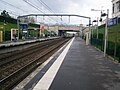
railway station in Serris, France  _-_2024-07-20_-_1.jpg) | |||||
| Upload media | |||||
| Instance of |
| ||||
|---|---|---|---|---|---|
| Location | Serris, Seine-et-Marne, Île-de-France, Metropolitan France, France | ||||
| Transport network | |||||
| Owned by | |||||
| Operator | |||||
| Inception |
| ||||
| Date of official opening |
| ||||
| Adjacent station | |||||
 | |||||
Subcategories
This category has only the following subcategory.
E
Media in category "Gare du Val d'Europe"
The following 17 files are in this category, out of 17 total.
-
 Gare Val Europe - Montévrain (FR77) - 2024-07-20 - 1.jpg 4,032 × 3,024; 3.36 MB
-
 Gare Val Europe - Montévrain (FR77) - 2024-07-20 - 2.jpg 4,032 × 3,024; 4.07 MB
-
 Gare Val Europe - Montévrain (FR77) - 2024-07-20 - 3.jpg 4,032 × 3,024; 3.85 MB
-
 Gare Val Europe - Montévrain (FR77) - 2024-07-20 - 4.jpg 4,032 × 3,024; 3.91 MB
-
 RER A - Gare ValdEurope 10.JPG 2,304 × 1,728; 868 KB
-
 RER A - Gare ValdEurope 11.JPG 2,304 × 1,728; 792 KB
-
 RER A - Gare ValdEurope 12.JPG 2,304 × 1,728; 791 KB
-
 RER A - Gare ValdEurope 13.JPG 2,304 × 1,728; 819 KB
-
 RER A - Gare ValdEurope 2.JPG 576 × 432; 168 KB
-
 RER A - Gare ValdEurope 3.JPG 576 × 432; 131 KB
-
 RER A - Gare ValdEurope 4.JPG 2,304 × 1,728; 829 KB
-
 RER A - Gare ValdEurope 5.JPG 2,304 × 1,728; 834 KB
-
 RER A - Gare ValdEurope 6.JPG 2,304 × 1,728; 834 KB
-
 RER A - Gare ValdEurope 7.JPG 2,304 × 1,728; 762 KB
-
 RER A - Gare ValdEurope 8.JPG 2,304 × 1,728; 848 KB
-
 RER A - Gare ValdEurope 9.JPG 2,304 × 1,728; 815 KB
-
 RER A - Gare ValdEurope.JPG 576 × 432; 128 KB
_-_2024-07-20_-_1.jpg)
_-_2024-07-20_-_2.jpg)
_-_2024-07-20_-_3.jpg)
_-_2024-07-20_-_4.jpg)


