Category:Gare de Reignac
Jump to navigation
Jump to search
| Object location | | View all coordinates using: OpenStreetMap |
|---|
railway station in Reignac-sur-Indre, France  | |||||
| Upload media | |||||
| Instance of | |||||
|---|---|---|---|---|---|
| Location | Reignac-sur-Indre, Indre-et-Loire, Centre-Val de Loire, Metropolitan France, France | ||||
| Transport network | |||||
| Owned by | |||||
| Operator | |||||
| Elevation above sea level |
| ||||
| Connecting line | |||||
| Adjacent station | |||||
 | |||||
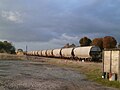
Français : La gare de Reignac est une gare ferroviaire française de la ligne de Joué-lès-Tours à Châteauroux, située sur le territoire de la commune de Reignac-sur-Indre, dans le département d'Indre-et-Loire, en région Centre-Val de Loire.
Media in category "Gare de Reignac"
The following 3 files are in this category, out of 3 total.
-
 Céréales Reignac.jpg 1,920 × 1,440; 680 KB
-
 Gare de Reignac-sur-Indre.jpg 4,160 × 3,120; 3.61 MB
-
 Gare Reignac.jpg 1,920 × 1,440; 677 KB

