Category:Gare de Pontanevaux
Jump to navigation
Jump to search
| Object location | | View all coordinates using: OpenStreetMap |
|---|
railway station in La Chapelle-de-Guinchay, France _-_2024-05-08_-_7.jpg) _-_2024-05-08_-_1.jpg) | |||||
| Upload media | |||||
| Instance of | |||||
|---|---|---|---|---|---|
| Location | La Chapelle-de-Guinchay, Saône-et-Loire, Bourgogne-Franche-Comté, Metropolitan France, France | ||||
| Transport network | |||||
| Architect | |||||
| Owned by | |||||
| Operator | |||||
| Date of official opening |
| ||||
| Elevation above sea level |
| ||||
| Connecting line | |||||
| Adjacent station | |||||
 | |||||
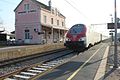
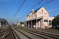
Français : La gare de Pontanevaux est une gare ferroviaire française de la ligne de Paris-Lyon à Marseille-Saint-Charles située à Pontanevaux sur le territoire de la commune de La Chapelle-de-Guinchay dans le département de Saône-et-Loire en région Bourgogne.
Media in category "Gare de Pontanevaux"
The following 61 files are in this category, out of 61 total.
-
 Borne OùRA Gare Pontanevaux Chapelle Guinchay 1.jpg 3,456 × 5,184; 6.58 MB
-
 Borne OùRA Gare Pontanevaux Chapelle Guinchay 2.jpg 3,456 × 5,184; 4.55 MB
-
 Gare Pontanevaux Chapelle - La Chapelle-de-Guinchay (FR71) - 2024-05-08 - 1.jpg 4,032 × 2,196; 2.94 MB
-
 Gare Pontanevaux Chapelle - La Chapelle-de-Guinchay (FR71) - 2024-05-08 - 10.jpg 4,032 × 3,024; 4.51 MB
-
 Gare Pontanevaux Chapelle - La Chapelle-de-Guinchay (FR71) - 2024-05-08 - 2.jpg 4,032 × 3,024; 2.59 MB
-
 Gare Pontanevaux Chapelle - La Chapelle-de-Guinchay (FR71) - 2024-05-08 - 3.jpg 4,032 × 3,024; 4.76 MB
-
 Gare Pontanevaux Chapelle - La Chapelle-de-Guinchay (FR71) - 2024-05-08 - 4.jpg 4,032 × 3,024; 4.79 MB
-
 Gare Pontanevaux Chapelle - La Chapelle-de-Guinchay (FR71) - 2024-05-08 - 5.jpg 4,032 × 3,024; 4.39 MB
-
 Gare Pontanevaux Chapelle - La Chapelle-de-Guinchay (FR71) - 2024-05-08 - 6.jpg 4,032 × 3,024; 4.19 MB
-
 Gare Pontanevaux Chapelle - La Chapelle-de-Guinchay (FR71) - 2024-05-08 - 7.jpg 5,346 × 4,121; 17.25 MB
-
 Gare Pontanevaux Chapelle - La Chapelle-de-Guinchay (FR71) - 2024-05-08 - 8.jpg 5,933 × 2,582; 12.54 MB
-
 Gare Pontanevaux Chapelle - La Chapelle-de-Guinchay (FR71) - 2024-05-08 - 9.jpg 4,032 × 3,024; 4.65 MB
-
 Gare Pontanevaux Chapelle Guinchay 01.jpg 5,184 × 3,456; 5.75 MB
-
 Gare Pontanevaux Chapelle Guinchay 02.jpg 5,184 × 3,456; 7.57 MB
-
 Gare Pontanevaux Chapelle Guinchay 03.jpg 5,184 × 3,456; 7.57 MB
-
 Gare Pontanevaux Chapelle Guinchay 04.jpg 5,184 × 3,456; 7.12 MB
-
 Gare Pontanevaux Chapelle Guinchay 05.jpg 5,184 × 3,456; 5.82 MB
-
 Gare Pontanevaux Chapelle Guinchay 06.jpg 5,184 × 3,456; 6.51 MB
-
 Gare Pontanevaux Chapelle Guinchay 07.jpg 5,184 × 3,456; 6.19 MB
-
 Gare Pontanevaux Chapelle Guinchay 08.jpg 5,184 × 3,456; 6.59 MB
-
 Gare Pontanevaux Chapelle Guinchay 09.jpg 5,184 × 3,456; 5.69 MB
-
 Gare Pontanevaux Chapelle Guinchay 10.jpg 5,184 × 3,456; 6.49 MB
-
 Gare Pontanevaux Chapelle Guinchay 11.jpg 5,184 × 3,456; 6.94 MB
-
 Gare Pontanevaux Chapelle Guinchay 12.jpg 5,184 × 3,456; 8.69 MB
-
 Gare Pontanevaux Chapelle Guinchay 13.jpg 5,184 × 3,456; 6.9 MB
-
 Gare Pontanevaux Chapelle Guinchay 14.jpg 5,184 × 3,456; 5.24 MB
-
 Gare Pontanevaux Chapelle Guinchay 15.jpg 5,184 × 3,456; 6.64 MB
-
 Gare Pontanevaux Chapelle Guinchay 16.jpg 3,456 × 5,184; 5.72 MB
-
 Gare Pontanevaux Chapelle Guinchay 17.jpg 5,184 × 3,456; 8.48 MB
-
 Gare Pontanevaux Chapelle Guinchay 18.jpg 5,184 × 3,456; 6.36 MB
-
 Gare Pontanevaux Chapelle Guinchay 19.jpg 5,184 × 3,456; 4.95 MB
-
 Gare Pontanevaux Chapelle Guinchay 20.jpg 5,184 × 3,456; 5.16 MB
-
 Gare Pontanevaux Chapelle Guinchay 21.jpg 5,184 × 3,456; 5.24 MB
-
 Gare Pontanevaux Chapelle Guinchay 22.jpg 5,184 × 3,456; 5.32 MB
-
 Gare Pontanevaux Chapelle Guinchay 23.jpg 5,184 × 3,456; 5.16 MB
-
 Gare Pontanevaux Chapelle Guinchay 24.jpg 5,184 × 3,456; 5.36 MB
-
 Gare Pontanevaux Chapelle Guinchay 25.jpg 5,184 × 3,456; 6.31 MB
-
 Gare Pontanevaux Chapelle Guinchay 26.jpg 5,184 × 3,456; 5.45 MB
-
 Gare Pontanevaux Chapelle Guinchay 27.jpg 5,184 × 3,456; 9.97 MB
-
 Gare-Pontanevaux-1900.jpg 926 × 600; 416 KB
-
 Indication altitude Gare Pontanevaux Chapelle Guinchay 1.jpg 5,184 × 3,456; 6.5 MB
-
 Indication altitude Gare Pontanevaux Chapelle Guinchay 2.jpg 5,184 × 3,456; 7.84 MB
-
 Panneau Gare Pontanevaux Chapelle - La Chapelle-de-Guinchay (FR71) - 2024-05-08 - 1.jpg 3,640 × 1,204; 1.19 MB
-
 Panneau Gare Pontanevaux Chapelle - La Chapelle-de-Guinchay (FR71) - 2024-05-08 - 4.jpg 4,032 × 3,024; 2.77 MB
-
 Panneau Gare Pontanevaux Chapelle Guinchay 1.jpg 5,184 × 3,456; 4.39 MB
-
 Panneau Gare Pontanevaux Chapelle Guinchay 2.jpg 5,184 × 3,456; 8.43 MB
-
 Panneau Gare Pontanevaux Chapelle Guinchay 3.jpg 5,184 × 3,456; 5.62 MB
-
 Passage souterrain Gare Pontanevaux Chapelle Guinchay 1.jpg 5,184 × 3,456; 5.39 MB
-
 Passage souterrain Gare Pontanevaux Chapelle Guinchay 2.jpg 5,184 × 3,456; 4.98 MB
-
 Passage souterrain Gare Pontanevaux Chapelle Guinchay 3.jpg 5,184 × 3,456; 8.94 MB
-
 Passage souterrain Gare Pontanevaux Chapelle Guinchay 4.jpg 5,184 × 3,456; 5.27 MB
-
 Passage souterrain Gare Pontanevaux Chapelle Guinchay 5.jpg 5,184 × 3,456; 6.56 MB
-
 Passage souterrain Gare Pontanevaux Chapelle Guinchay 6.jpg 5,184 × 3,456; 6.59 MB
-
 Passage souterrain Gare Pontanevaux Chapelle Guinchay 7.jpg 5,184 × 3,456; 8.36 MB
-
 Repère nivellement Gare Pontanevaux Chapelle Guinchay 1.jpg 5,184 × 3,456; 6.18 MB
-
 Repère nivellement Gare Pontanevaux Chapelle Guinchay 2.jpg 5,184 × 3,456; 5.54 MB
-
 TER Gare Pontanevaux Chapelle Guinchay 1.jpg 5,184 × 3,456; 5.48 MB
-
 TER Gare Pontanevaux Chapelle Guinchay 2.jpg 5,184 × 3,456; 4.73 MB
-
 TER Gare Pontanevaux Chapelle Guinchay 3.jpg 5,184 × 3,456; 5.36 MB
-
 Voie ferrée Gare Pontanevaux Chapelle Guinchay 1.jpg 5,184 × 3,456; 8.72 MB
-
 Voie ferrée Gare Pontanevaux Chapelle Guinchay 2.jpg 5,184 × 3,456; 11.29 MB


_-_2024-05-08_-_1.jpg)
_-_2024-05-08_-_10.jpg)
_-_2024-05-08_-_2.jpg)
_-_2024-05-08_-_3.jpg)
_-_2024-05-08_-_4.jpg)
_-_2024-05-08_-_5.jpg)
_-_2024-05-08_-_6.jpg)
_-_2024-05-08_-_8.jpg)
_-_2024-05-08_-_9.jpg)


_-_2024-05-08_-_4.jpg)


