Category:Gare de Luc (Lozère)
Jump to navigation
Jump to search
| Object location | | View all coordinates using: OpenStreetMap |
|---|
railway station in Luc, France  | |||||
| Upload media | |||||
| Instance of | |||||
|---|---|---|---|---|---|
| Location | Luc, Lozère, Occitania, Metropolitan France, France | ||||
| Transport network | |||||
| Owned by | |||||
| Operator | |||||
| Elevation above sea level |
| ||||
| Connecting line | |||||
| Adjacent station | |||||
 | |||||
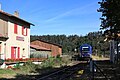
Français : La gare de Luc (Lozère) est une gare ferroviaire de la ligne de Saint-Germain-des-Fossés à Nîmes-Courbessac, située sur le territoire de la commune de Luc, dans le département de la Lozère en région Languedoc-Roussillon. Officiellement, elle est appelée « Luc (Lozère) » sur les documents officiels1 et certains documents commerciaux.
Media in category "Gare de Luc (Lozère)"
The following 3 files are in this category, out of 3 total.
-
 Deux ATER en gare de Luc par Cramos.jpg 1,200 × 800; 284 KB
-
 Gare de Luc par Cramos.jpg 1,200 × 800; 280 KB
-
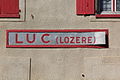 Plaque nominative de la gare de Luc en Lozère par Cramos.jpg 800 × 533; 181 KB

