Category:Gare de Lain - Thury
Jump to navigation
Jump to search
| Object location | | View all coordinates using: OpenStreetMap |
|---|
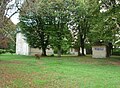
railway station in Lain, France  | |||||
| Upload media | |||||
| Pronunciation audio | |||||
|---|---|---|---|---|---|
| Instance of | |||||
| Location | Lain, canton of Courson-les-Carrières | ||||
| Date of official opening |
| ||||
| Date of official closure |
| ||||
| Elevation above sea level |
| ||||
| Connecting line | |||||
 | |||||
Media in category "Gare de Lain - Thury"
The following 2 files are in this category, out of 2 total.
-
 Gare de Lain Thury.JPG 1,097 × 802; 406 KB
-
 Horaires 1929 ligne Triguères Surgy.JPG 963 × 1,268; 958 KB
