
Category:Gare de La Chapelle-Aulnay
| Object location | | View all coordinates using: OpenStreetMap |
|---|
railway station in La Chapelle-sur-Erdre, France  _-_2022-09-17_-_1.jpg) | |||||
| Upload media | |||||
| Instance of | |||||
|---|---|---|---|---|---|
| Location | La Chapelle-sur-Erdre, Loire-Atlantique, Pays de la Loire, Metropolitan France, France | ||||
| Transport network | |||||
| Owned by | |||||
| Operator | |||||
| Date of official opening |
| ||||
| Connecting line | |||||
| Adjacent station | |||||
 | |||||
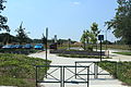
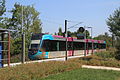
Français : La gare de La Chapelle-Aulnay est l'une des quatre gares ferroviaires de la ligne de Nantes à Châteaubriant situées sur le territoire de la commune de La Chapelle-sur-Erdre, dans le département de la Loire-Atlantique, en région Pays de la Loire.
Media in category "Gare de La Chapelle-Aulnay"
The following 19 files are in this category, out of 19 total.
-
 Gare Chapelle Aulnay - La Chapelle-sur-Erdre (FR44) - 2022-09-17 - 1.jpg 4,032 × 3,024; 4.96 MB
-
 Gare Chapelle Aulnay - La Chapelle-sur-Erdre (FR44) - 2022-09-17 - 2.jpg 4,032 × 3,024; 5.84 MB
-
 Gare Chapelle Aulnay - La Chapelle-sur-Erdre (FR44) - 2022-09-17 - 3.jpg 4,032 × 3,024; 4.66 MB
-
 Gare-La-Chapelle-Aulnay-2014 01.JPG 4,592 × 3,056; 5.91 MB
-
 Gare-La-Chapelle-Aulnay-2014 02.JPG 4,592 × 3,056; 5.84 MB
-
 Gare-La-Chapelle-Aulnay-2014 03.JPG 4,592 × 3,056; 5.69 MB
-
 Gare-La-Chapelle-Aulnay-2014 04.JPG 4,592 × 3,056; 5.03 MB
-
 Gare-La-Chapelle-Aulnay-2014 05.JPG 4,592 × 3,056; 4.81 MB
-
 Gare-La-Chapelle-Aulnay-2014 06.JPG 4,592 × 3,056; 5.28 MB
-
 Gare-La-Chapelle-Aulnay-2014 07.JPG 4,592 × 3,056; 5.44 MB
-
 Panneau Gare Chapelle Aulnay - La Chapelle-sur-Erdre (FR44) - 2022-09-17 - 1.jpg 3,538 × 893; 592 KB
-
 Panneau Gare Chapelle Aulnay - La Chapelle-sur-Erdre (FR44) - 2022-09-17 - 2.jpg 4,032 × 3,024; 5.12 MB
-

-

-
 Second parking de la Chapelle-Aulnay par Cramos.jpg 3,000 × 2,000; 2.07 MB
-
 Totem Gare Chapelle Aulnay - La Chapelle-sur-Erdre (FR44) - 2022-09-17 - 1.jpg 3,024 × 4,032; 3.51 MB
-
 Tram-train arrivant à la Chapelle-Aulnay par Cramos.jpg 3,000 × 2,000; 2.34 MB
-
 Tram-train et parking vide à La Chapelle-Aulnay par Cramos.jpg 3,000 × 2,000; 1.89 MB
-
 Tramtrain arrêt La Chapelle Sur Erdre-centre.jpg 2,816 × 1,880; 2.23 MB
_-_2022-09-17_-_1.jpg)
_-_2022-09-17_-_2.jpg)
_-_2022-09-17_-_3.jpg)


_-_2022-09-17_-_2.jpg)
_-_2022-09-17_-_1.jpg)
_-_2022-09-17_-_2.jpg)

_-_2022-09-17_-_1.jpg)

