Category:Gare de Hermes - Berthecourt
Jump to navigation
Jump to search
| Object location | | View all coordinates using: OpenStreetMap |
|---|
railway station in Hermes, France  | |||||
| Upload media | |||||
| Instance of | |||||
|---|---|---|---|---|---|
| Location | Hermes, canton of Noailles | ||||
| Transport network | |||||
| Owned by | |||||
| Operator | |||||
| Elevation above sea level |
| ||||
| Connecting line | |||||
| Adjacent station | |||||
 | |||||
Media in category "Gare de Hermes - Berthecourt"
The following 9 files are in this category, out of 9 total.
-
 Chaix 1914 - Hermes à Beaumont.JPG 2,356 × 539; 392 KB
-
 Hermes (60), gare d'Hermes - Berthecourt 1.jpg 3,648 × 2,736; 1.1 MB
-
 Hermes (60), gare d'Hermes - Berthecourt 2.jpg 3,648 × 2,736; 1.13 MB
-
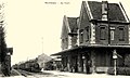 Hermes Carte postale gare 10.jpg 1,024 × 615; 349 KB
-
 Hermes gare 1.JPG 3,648 × 2,736; 1.83 MB
-
 Hermes gare 2.JPG 3,648 × 2,736; 1.66 MB
-
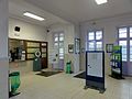
 Hermes int gare.JPG 3,175 × 2,273; 2.27 MB
-
 Hermes quai 1.JPG 3,648 × 2,736; 1.84 MB
-
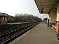 Hermes quai 2.JPG 3,648 × 2,736; 1.49 MB
,_gare_d%27Hermes_-_Berthecourt_1.jpg)
,_gare_d%27Hermes_-_Berthecourt_2.jpg)


