Category:Gare de Chailly - Boissy-le-Châtel
Jump to navigation
Jump to search
| Object location | | View all coordinates using: OpenStreetMap |
|---|
railway station in Chailly-en-Brie, France  | |||||
| Upload media | |||||
| Instance of | |||||
|---|---|---|---|---|---|
| Location | Chailly-en-Brie, Seine-et-Marne, Île-de-France, Metropolitan France, France | ||||
| Transport network | |||||
| Owned by | |||||
| Date of official opening |
| ||||
| Date of official closure |
| ||||
| Connecting line | |||||
 | |||||
Media in category "Gare de Chailly - Boissy-le-Châtel"
The following 4 files are in this category, out of 4 total.
-
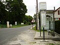 Arrêt bus de Chailly - Boissy-le-Châtel.jpg 2,560 × 1,920; 1.26 MB
-
 Gare de Chailly - Boissy.JPG 4,224 × 2,376; 4.63 MB
-
 Gare-ancienne Chailly-Boissy.jpg 834 × 484; 126 KB
-
 Quai de l'ex-gare de Chailly - Boissy-le-Châtel.jpg 2,560 × 1,920; 1.27 MB


