Category:Gare d'Yvetot
Jump to navigation
Jump to search
| Object location | | View all coordinates using: OpenStreetMap |
|---|
railway station in Yvetot, France  | |||||
| Upload media | |||||
| Instance of | |||||
|---|---|---|---|---|---|
| Location | Yvetot, Seine-Maritime, Normandy, Metropolitan France, France | ||||
| Transport network | |||||
| Architect | |||||
| Owned by | |||||
| Operator | |||||
| Date of official opening |
| ||||
| Elevation above sea level |
| ||||
| Connecting line | |||||
| Adjacent station | |||||
 | |||||
Français : La gare d'Yvetot est une gare ferroviaire française de la ligne de Paris-Saint-Lazare au Havre, située sur le territoire de la commune d'Yvetot, dans le département de la Seine-Maritime en région Haute-Normandie.
Media in category "Gare d'Yvetot"
The following 10 files are in this category, out of 10 total.
-
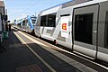 Autorails X 73500 en gare dYvetot.jpg 4,272 × 2,848; 3.91 MB
-
 Façade de la gare d'Yvetot.jpg 3,233 × 2,155; 1.63 MB
-
 Gare d'Yvetot, arrivée d'un Intercités Paris - Le Havre.jpg 4,272 × 2,848; 5.33 MB
-
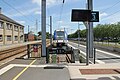 Gare d'Yvetot, le quai terminus.jpg 4,272 × 2,848; 5.31 MB
-
 Gare yvetot.jpg 2,304 × 1,728; 1.67 MB
-
 Gare-Yvetot-1900.jpg 995 × 630; 433 KB
-
 Gareyvetotbv.jpg 620 × 333; 33 KB
-
 L'entrée de la gare d'Yvetot, direction Le Havre.jpg 4,272 × 2,848; 4.29 MB
-
 La place de la gare d'Yvetot.jpg 4,272 × 2,848; 5.78 MB
-
 Yvetot, la gare.jpg 4,272 × 2,848; 7.4 MB


