Category:Ganghwa
Jump to navigation
Jump to search
Districts of Incheon: Bupyeong · Dong · Gyeyang · Jung · Michuhol · Namdong · Seo · Yeonsu
Counties of Incheon: Ganghwa · Ongjin
Counties of Incheon: Ganghwa · Ongjin
administrative division of South Korea   | |||||
| Upload media | |||||
| Instance of | |||||
|---|---|---|---|---|---|
| Location | Incheon, ROK | ||||
| Area |
| ||||
| official website | |||||
 | |||||
Subcategories
This category has the following 15 subcategories, out of 15 total.
B
- Buses in Ganghwa County (5 F)
C
D
- Daeryong (village) (8 F)
- Dongsan (village) (4 F)
G
I
- Insa (village) (8 F)
M
- Maps of Ganghwa (14 F)
N
- Nanjeong (village) (2 F)
O
S
- Soknorang sweet potatoes (4 F)
U
- Udo (Incheon) (68 F)
Media in category "Ganghwa"
The following 47 files are in this category, out of 47 total.
-
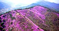 Azalea photo4.jpg 1,100 × 589; 724 KB
-
 DMZ - panoramio - AwOiSoAk KaOsIoWa (5).jpg 3,648 × 2,432; 1.94 MB
-
 Ganghwa Panorama.jpg 2,053 × 643; 532 KB
-
 Ganghwa-gun office.JPG 2,816 × 2,112; 1.53 MB
-
 Gyeonggi-Incheon Border sign in ROK National Route 48 Ganghwadaegyo BR(Westward Dir) 1.jpg 4,608 × 3,456; 5.65 MB
-
 Gyeonggi-Incheon Border sign in ROK National Route 48 Ganghwadaegyo BR(Westward Dir) 2.jpg 4,608 × 3,456; 5.67 MB
-
 Gyeonggi-Incheon Border sign in ROK National Route 48 Ganghwadaegyo BR(Westward Dir) 3.jpg 4,608 × 3,456; 5.59 MB
-
 Incheon-Gyeonggi Border sign in ROK National Route 48 Ganghwadaegyo BR(Eastward Dir).jpg 4,608 × 3,456; 5.67 MB
-
 Inchon islands 2.svg 912 × 653; 393 KB
-
 ROK National Route 48 Ganghwadaegyo BR(Eastward Dir).jpg 4,608 × 3,456; 5.61 MB
-
 ROK National Route 48 Ganghwadaegyo BR(Westward Dir) 1.jpg 4,608 × 3,456; 5.66 MB
-
 ROK National Route 48 Ganghwadaegyo BR(Westward Dir) 2.jpg 4,608 × 3,456; 5.61 MB
-
 ROK National Route 48 Ganghwadaegyo BR-Almigol Crossrd(Westward Dir).jpg 4,608 × 3,456; 5.62 MB
-
 ROK National Route 48 Yongjeong IC Construction Zone(Eastward Dir).jpg 4,608 × 3,456; 5.57 MB
-
 Route 48 Ganghwa, Incheon-Gimpo, Gyeonggi-do border 2.JPG 3,264 × 2,448; 1.31 MB
-
 Route 48 Gimpo, Gyeonggi-do-Ganghwa, Incheon border.JPG 3,264 × 2,448; 2.28 MB
-
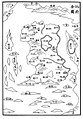 The Complete Map of Sim-bu (Ganghwa-bu).jpg 1,600 × 2,300; 759 KB
-
 The Map of the Walled City of the Sim-bu Government.jpg 1,600 × 2,300; 574 KB
-
 강화 갯벌.jpg 2,040 × 2,952; 1.73 MB
-
 강화 고대섭 가옥.jpg 1,200 × 801; 822 KB
-
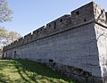
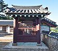
 강화 석수문 아치 홍예.jpg 1,200 × 753; 842 KB
-
 강화군 외포리 관광안내소 - panoramio.jpg 1,536 × 1,024; 957 KB
-
 강화여자중학교 전경.png 787 × 255; 483 KB
-
 김상용 순절비 정면.jpg 1,200 × 943; 1.27 MB
-
 대한성공회 강화성당 내부 천정.jpg 4,000 × 2,670; 6.02 MB
-
 대한성공회 강화성당 배면.jpg 4,000 × 2,670; 6.95 MB
-
 대한성공회 강화성당 사제관.jpg 4,000 × 2,373; 8.9 MB
-
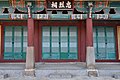
 대한성공회 강화성당 천주성전 편액.jpg 4,000 × 2,670; 5.82 MB
-
 대한성공회 강화성당 측면.jpg 4,000 × 2,729; 7.72 MB
-
 대한성공회 강화성당.jpg 4,000 × 2,670; 7.24 MB
-
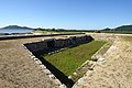
 망양 돈대.jpg 1,114 × 867; 536 KB
-
 망월돈대.jpg 4,000 × 2,670; 9.2 MB
-
 솔정리고씨가옥 영섭재 안채 외부.jpg 1,440 × 810; 293 KB
-
 양헌수 승전비.jpg 750 × 510; 499 KB
-
 충렬사 (강화군) 01.jpg 1,200 × 1,059; 877 KB
-
 충렬사 (강화군) 02.jpg 801 × 1,200; 672 KB
-
 충렬사 (강화군) 03.jpg 1,200 × 801; 776 KB
-
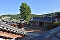 충렬사 (강화군) 04.jpg 1,200 × 801; 633 KB
-
 충렬사 (강화군) 05.jpg 1,200 × 682; 571 KB
-
 충렬사 (강화군) 06.jpg 1,200 × 801; 577 KB
-
 충렬사 (강화군) 07.jpg 1,200 × 554; 508 KB
-
 충렬사 (강화군) 08.jpg 1,200 × 801; 585 KB
-
 충렬사 (강화군) 09.jpg 1,200 × 611; 621 KB
-
 충렬사 (강화군) 10.jpg 1,200 × 627; 615 KB
-
 충렬사 (강화군) 11.jpg 1,200 × 703; 510 KB
-
 충렬사 (강화군) 12.jpg 1,200 × 801; 592 KB
-
 충렬사 (강화군) 13.jpg 1,200 × 801; 795 KB

.jpg)

_1.jpg)
_2.jpg)
_3.jpg)
.jpg)

.jpg)
_1.jpg)
_2.jpg)
.jpg)
.jpg)


.jpg)


_01.jpg)
_02.jpg)
_03.jpg)
_04.jpg)
_05.jpg)
_06.jpg)
_07.jpg)
_08.jpg)
_09.jpg)
_10.jpg)
_11.jpg)
_12.jpg)
_13.jpg)