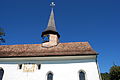
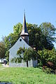
Category:Galluskapelle Oberstammheim
Jump to navigation
Jump to search
| Object location | | View all coordinates using: OpenStreetMap |
|---|
  | |||||
| Upload media | |||||
| Instance of | |||||
|---|---|---|---|---|---|
| Part of | |||||
| Location |
| ||||
| Street address |
| ||||
| Heritage designation | |||||
 | |||||
Subcategories
This category has only the following subcategory.
Media in category "Galluskapelle Oberstammheim"
The following 34 files are in this category, out of 34 total.
-
 2011-09-10-Vinlando (Foto Dietrich Michael Weidmann) 310.JPG 3,872 × 2,592; 4.11 MB
-
 2011-09-10-Vinlando (Foto Dietrich Michael Weidmann) 311.JPG 3,872 × 2,592; 3.5 MB
-
 2011-09-10-Vinlando (Foto Dietrich Michael Weidmann) 314.JPG 2,592 × 3,872; 3.47 MB
-
 2011-09-10-Vinlando (Foto Dietrich Michael Weidmann) 315.JPG 2,592 × 3,872; 4.43 MB
-
 2011-09-10-Vinlando (Foto Dietrich Michael Weidmann) 316.JPG 2,592 × 3,872; 3.48 MB
-
 2011-09-10-Vinlando (Foto Dietrich Michael Weidmann) 317.JPG 2,592 × 3,872; 3.78 MB
-
 2011-09-10-Vinlando (Foto Dietrich Michael Weidmann) 318.JPG 3,872 × 2,592; 3.79 MB
-
 2011-09-10-Vinlando (Foto Dietrich Michael Weidmann) 319.JPG 2,592 × 3,872; 4.02 MB
-
 2011-09-10-Vinlando (Foto Dietrich Michael Weidmann) 320.JPG 3,872 × 2,592; 4.23 MB
-
 2011-09-10-Vinlando (Foto Dietrich Michael Weidmann) 322.JPG 2,592 × 3,872; 4.58 MB
-
 2011-09-10-Vinlando (Foto Dietrich Michael Weidmann) 323.JPG 2,592 × 3,872; 4.72 MB
-
 2011-09-10-Vinlando (Foto Dietrich Michael Weidmann) 324.JPG 2,592 × 3,872; 4.64 MB
-
 2011-09-10-Vinlando (Foto Dietrich Michael Weidmann) 364.JPG 3,872 × 2,592; 3.22 MB
-
 2011-09-10-Vinlando (Foto Dietrich Michael Weidmann) 365.JPG 3,872 × 2,592; 4.13 MB
-
 2011-09-10-Vinlando (Foto Dietrich Michael Weidmann) 377.JPG 3,872 × 2,592; 3.46 MB
-
 2011-09-10-Vinlando (Foto Dietrich Michael Weidmann) 378.JPG 3,872 × 2,592; 3.33 MB
-
 Galluskapelle in Oberstammheim.jpg 4,200 × 2,800; 5.51 MB
-
 Oberstammheim - Reformierte Galluskapelle, Chilenbückli 2011-09-16 13-32-02.JPG 4,288 × 2,848; 6.49 MB
-
 Oberstammheim - Reformierte Galluskapelle, Chilenbückli 2011-09-16 13-32-10.JPG 2,848 × 4,288; 6.34 MB
-
 Oberstammheim - Reformierte Galluskapelle, Chilenbückli 2011-09-16 13-34-28.jpg 4,000 × 2,667; 4.48 MB
-
 Oberstammheim - Reformierte Galluskapelle, Chilenbückli 2011-09-16 13-35-22.jpg 2,667 × 4,000; 3.73 MB
-
 Oberstammheim - Reformierte Galluskapelle, Chilenbückli 2011-09-16 13-46-06.jpg 4,000 × 2,667; 3.4 MB
-
 Oberstammheim - Reformierte Galluskapelle, Chilenbückli 2011-09-16 13-46-12 ShiftN.jpg 2,665 × 4,000; 3.09 MB
-
 Oberstammheim - Reformierte Galluskapelle, Chilenbückli 2011-09-16 13-47-00 ShiftN.jpg 2,666 × 4,000; 3.54 MB
-
 Oberstammheim - Reformierte Galluskapelle, Chilenbückli 2011-09-16 13-47-34.jpg 4,288 × 2,848; 2.37 MB
-
 Oberstammheim - Reformierte Galluskapelle, Chilenbückli 2011-09-16 13-49-14.jpg 2,607 × 3,910; 2.75 MB
-
 Oberstammheim - Reformierte Galluskapelle, Chilenbückli 2011-09-16 13-49-30.JPG 4,288 × 2,848; 6.72 MB
-
 Oberstammheim - Reformierte Galluskapelle, Chilenbückli 2011-09-16 13-50-16.jpg 4,067 × 2,702; 3.39 MB
-
 Oberstammheim - Reformierte Galluskapelle, Chilenbückli 2011-09-16 13-50-30.JPG 2,848 × 4,288; 3.11 MB
-
 Oberstammheim - Reformierte Galluskapelle, Chilenbückli 2011-09-16 13-51-54 ShiftN.jpg 4,000 × 2,627; 2.7 MB
-
 Oberstammheim - Reformierte Galluskapelle, Chilenbückli 2011-09-16 13-52-06 ShiftN2.jpg 2,613 × 4,000; 3.11 MB
-
 Oberstammheim Galluskapelle.jpg 4,000 × 3,000; 4.72 MB
-
 Oberstammheim ZH Galluskapelle.jpg 4,000 × 3,000; 4.79 MB
-
 Reformierte Galluskapelle, Chilenbückli in Oberstammheim 2011-09-16 13-45-56 ShiftN.jpg 2,714 × 3,619; 2.99 MB
_310.JPG)
_311.JPG)
_314.JPG)
_315.JPG)
_316.JPG)
_317.JPG)
_318.JPG)
_319.JPG)
_320.JPG)
_322.JPG)
_323.JPG)
_324.JPG)
_364.JPG)
_365.JPG)
_377.JPG)
_378.JPG)


