Category:Galician-language SVG maps
Jump to navigation
Jump to search
Subcategories
This category has only the following subcategory.
Media in category "Galician-language SVG maps"
The following 19 files are in this category, out of 19 total.
-
 Agalega Islands map-gl.png 3,333 × 4,054; 3.01 MB
-
 DialectosBasco.png 686 × 484; 77 KB
-
 Euro2008 venues gl.png 730 × 320; 67 KB
-
 Great Rift Valley map-gl.svg 1,403 × 1,808; 1.05 MB
-
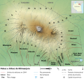
 Kilimanjaro and Arusha National Parks map-gl.svg 2,242 × 1,621; 1.6 MB
-
 Map of USA with state names gl.svg 959 × 593; 332 KB
-
 Map SNP1 gl.svg 2,883 × 1,548; 308 KB
-
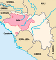 MapaFutaXalon.png 1,351 × 1,455; 240 KB
-
 Mount Kilimanjaro and Mount Meru map-gl.svg 2,242 × 1,888; 1.68 MB
-
 Mount Kilimanjaro Climbing Routes and Huts photomap-gl.svg 1,561 × 1,083; 1.35 MB
-
 Mount Kilimanjaro Ethnic Groups map-gl.svg 2,050 × 1,907; 790 KB
-
 Mount Kilimanjaro Geology map-gl.svg 2,670 × 1,721; 1.03 MB
-
 Mount Kilimanjaro Summit photomap-gl.svg 806 × 669; 415 KB
-
 Mount Kilimanjaro Vegetation photomap-gl.svg 2,333 × 2,000; 3.36 MB
-
 Plano Troia-Hissarlik.svg 731 × 659; 154 KB
-
 Provincias de España galego.svg 644 × 458; 1.36 MB
-
 Regions and Prefectures of Japan (gl).svg 2,480 × 3,175; 98 KB
-
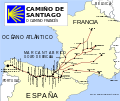 Rutas do Camiño de Santiago francés.svg 1,010 × 850; 121 KB
-
 Tanzania map-gl.svg 2,064 × 2,075; 3.23 MB


.svg)

