Category:Gailey
Jump to navigation
Jump to search
English: Gailey is a small village in Staffordshire, England. It is at the junction of the A5 and A449 roads, and is on the boundary of the parishes of Brewood and Coven (formerly Brewood) and Penkridge, in South Staffordshire. (→Gailey, Staffordshire)
Polski: Gailey – wieś w Anglii, w hrabstwie Staffordshire, w dystrykcie South Staffordshire. Leży 13 km na południe od miasta Stafford i 190 km na północny zachód od Londynu. (→Gailey (Staffordshire))

village in the United Kingdom  | |||||
| Upload media | |||||
| Instance of | |||||
|---|---|---|---|---|---|
| Location | South Staffordshire, Staffordshire, West Midlands, England | ||||
 | |||||
Subcategories
This category has the following 2 subcategories, out of 2 total.
G
- Gailey railway station (2 F)
- Gailey Top Lock (20 F)
Media in category "Gailey"
The following 42 files are in this category, out of 42 total.
-
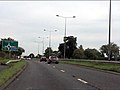 A449 approaching Gailey roundabout - geograph.org.uk - 2056760.jpg 640 × 480; 54 KB
-
 About to turn right at Gailey Island - geograph.org.uk - 857169.jpg 640 × 480; 60 KB
-
 Another lock on the Staffs and Worcs - geograph.org.uk - 1335360.jpg 640 × 425; 74 KB
-

-
 Approaching Gailey Wharf, Staffordshire - geograph.org.uk - 1558348.jpg 640 × 471; 144 KB
-
 Croft Farm, Croft Lane, Gailey - geograph.org.uk - 884719.jpg 640 × 480; 98 KB
-
 From Layby on the A5 Towards Gailey - geograph.org.uk - 2475477.jpg 640 × 428; 81 KB
-

-
 Gailey Wharf - geograph.org.uk - 290754.jpg 640 × 448; 63 KB
-
 Holiday makers on the Staffs and Worcs - geograph.org.uk - 1334929.jpg 640 × 425; 105 KB
-
 On the move again - geograph.org.uk - 1335355.jpg 640 × 425; 125 KB
-
 Peering through the fence - geograph.org.uk - 1334923.jpg 426 × 640; 63 KB
-
 Former Church on Watling Street - geograph.org.uk - 92422.jpg 640 × 480; 208 KB
-
 River Penk - geograph.org.uk - 234924.jpg 640 × 480; 80 KB
-
 Road signs at the Gailey roundabout - geograph.org.uk - 2440686.jpg 3,872 × 2,592; 5.38 MB
-
 Rodbaston College - geograph.org.uk - 278062.jpg 640 × 480; 76 KB
-
 Rodbaston College - geograph.org.uk - 278066.jpg 640 × 480; 86 KB
-
 Spread Eagle at Gailey - geograph.org.uk - 424732.jpg 640 × 480; 133 KB
-

-

-

-

-

-
-
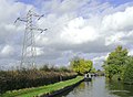
 Staffs and Worcs Canal - geograph.org.uk - 640649.jpg 640 × 461; 79 KB
-
 Staffs and Worcs Canal - geograph.org.uk - 641375.jpg 640 × 480; 299 KB
-
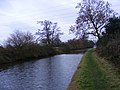 Staffs and Worcs Canal Towpath - geograph.org.uk - 1079151.jpg 640 × 480; 91 KB
-

-

-

-

-
 Wharf Cottage - geograph.org.uk - 1311780.jpg 640 × 320; 52 KB
-
 Approaching Otherton Lane Bridge - geograph.org.uk - 164993.jpg 640 × 427; 108 KB
-
 Dobbies Garden Centre, Gailey - geograph.org.uk - 301210.jpg 640 × 456; 62 KB
-
 Hazelcroft Farm - geograph.org.uk - 287591.jpg 640 × 480; 88 KB
-
 Mere Lane Farm - geograph.org.uk - 92425.jpg 640 × 480; 130 KB
-
 Not so Peaceful Stretch^ - geograph.org.uk - 164992.jpg 640 × 427; 132 KB
-
 Railway Bridge (Disused) - geograph.org.uk - 164994.jpg 640 × 427; 104 KB
-
 The old line at Penkridge - geograph.org.uk - 87428.jpg 640 × 480; 125 KB
-
 View of Rowley Hill - geograph.org.uk - 234926.jpg 640 × 480; 80 KB
-
 View Towards Kinvaston Hall Farm - geograph.org.uk - 238470.jpg 640 × 480; 81 KB
-
 Water Eaton - geograph.org.uk - 234928.jpg 640 × 480; 94 KB


_-_geograph.org.uk_-_164994.jpg)


