Category:Gables in England
Jump to navigation
Jump to search

Subcategories
This category has the following 20 subcategories, out of 20 total.
B
- Gables in Berkshire (5 F)
D
E
G
H
- Gables in Herefordshire (17 F)
K
- Gables in Kent (12 F)
L
M
N
O
S
- Gables in Surrey (11 F)
W
- Gables in Warwickshire (62 F)
- Gables in West Sussex (14 F)
- Gables in West Yorkshire (46 F)
- Gables in Worcestershire (7 F)
Media in category "Gables in England"
The following 200 files are in this category, out of 436 total.
(previous page) (next page)-

-
 1999 abandoned cottage, Sandhall, Skelton, Kilpin, East Yorkshire, England 1.jpg 4,512 × 2,977; 9.01 MB
-
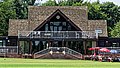
 Radlett Cricket Club pavilion, Hertfordshire 1.jpg 4,578 × 2,575; 9.21 MB
-
 Radlett Cricket Club pavilion, Hertfordshire 2.jpg 4,570 × 2,571; 10.44 MB
-
 Radlett Cricket Club pavilion, Hertfordshire 3.jpg 4,135 × 1,654; 5.87 MB
-
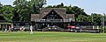
 Hertford Cricket Club Hertfordshire England cricket field old building 01.jpg 4,478 × 3,358; 14.18 MB
-
 Hertford Cricket Club Hertfordshire England cricket field old building gabled house 01.jpg 4,613 × 2,595; 17.33 MB
-
 Ifield CC v Crawley Eagles CC at Charlwood, Surrey, England 001.jpg 4,613 × 2,595; 13.26 MB
-
 Ifield CC v Crawley Eagles CC at Charlwood, Surrey, England 002.jpg 4,613 × 2,595; 13.34 MB
-
 41 Florence Road, Brighton (December 2013) (Decorative Gable).JPG 2,600 × 3,000; 1.65 MB
-
 Christ Church - geograph.org.uk - 1157074.jpg 640 × 480; 94 KB
-
 Christ Church, Accrington - geograph.org.uk - 717511.jpg 640 × 480; 194 KB
-
 Ackleton Church - geograph.org.uk - 1750609.jpg 800 × 600; 95 KB
-
 Sundial on Aldeburgh Moot Hall - geograph.org.uk - 758209.jpg 427 × 640; 93 KB
-
 Aldershot, Royal Garrison Church - geograph.org.uk - 1743336.jpg 2,560 × 1,920; 1.9 MB
-
 Aldreth village hall - geograph.org.uk - 67466.jpg 419 × 632; 107 KB
-
 Royal Chapel of All Saints, Windsor Great Park.jpg 4,405 × 2,712; 581 KB
-
 Cottages, Mill End Lane, Alrewas - geograph.org.uk - 445990.jpg 640 × 480; 98 KB
-
 Former school, Mill End Lane, Alrewas - geograph.org.uk - 1595144.jpg 640 × 480; 131 KB
-
 Main Street, Alrewas - geograph.org.uk - 1595263.jpg 640 × 480; 89 KB
-
 The Crown Inn - geograph.org.uk - 850461.jpg 640 × 480; 91 KB
-
 Tudor House, Alrewas - geograph.org.uk - 321304.jpg 640 × 380; 58 KB
-
 Alrewas House, Main Street, Alrewas - geograph.org.uk - 1595191.jpg 640 × 482; 151 KB
-
 Alrewas Methodist Church, Staffordshire - geograph.org.uk - 1587843.jpg 640 × 376; 137 KB
-
 Ardingly High Street, West Sussex, England.jpg 1,032 × 624; 520 KB
-
 Our Lady of Lourdes Church, Arnside - geograph.org.uk - 408525.jpg 640 × 426; 125 KB
-
 Ashford StMichael south.jpg 1,280 × 1,280; 841 KB
-
 Ashford StMichael SSW.jpg 1,264 × 1,280; 783 KB
-
 St George's Church, Ashtead (Geograph Image 2032516 cffc5268).jpg 800 × 530; 142 KB
-
 Aston Hall - geograph.org.uk - 1607170.jpg 640 × 485; 90 KB
-
 St. Michael's Church Baddiley - geograph.org.uk - 272727.jpg 480 × 640; 164 KB
-
 St Mark's Church - geograph.org.uk - 486654.jpg 640 × 480; 109 KB
-

-
 BedfordPentecostalChurch.JPG 2,848 × 1,388; 1.74 MB
-
 Bedhampton Gospel Hall.jpg 4,128 × 3,096; 3.99 MB
-
 Belmont Abbey - geograph.org.uk - 945221.jpg 640 × 480; 86 KB
-
 Loddington Lane, Belton-in-Rutland - geograph.org.uk - 599099.jpg 640 × 438; 62 KB
-
 Ty y beili, Benthall.jpg 1,920 × 1,080; 959 KB
-

-
 Stone Built Bus Shelter - geograph.org.uk - 299013.jpg 640 × 480; 133 KB
-
 Berwick-upon-Tweed MMB 31 Church of Scotland.jpg 3,410 × 3,012; 2.91 MB
-

-
 Berwick-upon-Tweed MMB 30.jpg 4,434 × 2,958; 3.46 MB
-
 The North Staircase - De La Warr Pavilion - geograph.org.uk - 527170.jpg 640 × 480; 105 KB
-

-
 Church Street in Billesdon - geograph.org.uk - 751563.jpg 640 × 448; 78 KB
-
 Bilston Congregational - geograph.org.uk - 787774.jpg 640 × 480; 47 KB
-
 Old Church Blencogo - geograph.org.uk - 114306.jpg 640 × 411; 58 KB
-
 Open Gate Baptist Church, Victoria Drive, Bognor Regis.JPG 2,200 × 1,600; 919 KB
-
 Borehamwood - All Saints Church - geograph.org.uk - 387154.jpg 640 × 480; 80 KB
-
 All Saints church, Borehamwood 06.JPG 4,000 × 3,000; 4.07 MB
-
 All Saints church, Borehamwood 07.JPG 4,000 × 3,000; 3.97 MB
-
 All Saints church, Borehamwood 08.JPG 4,000 × 3,000; 4.15 MB
-
 All Saints church, Borehamwood 09.JPG 4,000 × 3,000; 4.07 MB
-
 All Saints church, Borehamwood 10.JPG 4,000 × 3,000; 4.08 MB
-

-
 Bournemouth , Gervis Place - geograph.org.uk - 1595223.jpg 640 × 480; 88 KB
-

-

-
 Bradford House.jpg 2,147 × 1,981; 3.96 MB
-
 St Peters Parish Church, Bramley - geograph.org.uk - 573644.jpg 480 × 640; 153 KB
-
 24062006 Outside St Saviour's Panorama 3.JPG 3,471 × 1,062; 1.14 MB
-
 Braunton (Devon, UK), Countryside Centre -- 2013 -- 00192.jpg 4,626 × 3,264; 11.03 MB
-
 Lych gate, Bray. - geograph.org.uk - 601041.jpg 640 × 427; 101 KB
-
 Detail, Breamore House - geograph.org.uk - 1279981.jpg 640 × 480; 141 KB
-
 Station House at Breamore - geograph.org.uk - 448833.jpg 640 × 480; 133 KB
-
 Breamore Church.JPG 3,872 × 2,592; 4.17 MB
-
 Breamore House - geograph.org.uk - 1279835.jpg 640 × 480; 118 KB
-
 Breamore House - geograph.org.uk - 1775356.jpg 640 × 480; 72 KB
-
 BreamoreHouse.jpg 640 × 376; 350 KB
-
 Bridge Across the Wey, Surrey - geograph.org.uk - 1515022.jpg 640 × 428; 117 KB
-
 Bridgetowntotnes.jpg 2,816 × 2,112; 624 KB
-
 St. Bridget's church, Bridstow - geograph.org.uk - 1145531.jpg 640 × 480; 211 KB
-
 St. Bridgets Church, Bridstow - geograph.org.uk - 150790.jpg 640 × 426; 140 KB
-
 Brimpton Baptist Church, Brimpton - geograph.org.uk - 25858.jpg 640 × 480; 183 KB
-
 Mission Hall and St Agnes Church, Bristol (3913188202).jpg 3,551 × 2,576; 1.12 MB
-
 Old houses on Victoria Street - geograph.org.uk - 917354.jpg 640 × 506; 81 KB
-
 House on Hayway Lane, Broadwell - geograph.org.uk - 1275672.jpg 600 × 451; 119 KB
-
-
 Brown Knowl Church.jpg 1,200 × 759; 386 KB
-
 On the Bryn(k) - geograph.org.uk - 97040.jpg 640 × 426; 117 KB
-
 Buckenhill Manor, Buckenhill, Bromyard (geograph 6314951) (cropped).jpg 1,237 × 495; 942 KB
-
 St Mary's church, Bucknall - geograph.org.uk - 111815.jpg 640 × 480; 120 KB
-
 Bucknall Pentecostal Church - geograph.org.uk - 339402.jpg 640 × 436; 41 KB
-
 Bushbury Church - geograph.org.uk - 1632655.jpg 640 × 480; 294 KB
-
 Bus-shelter - geograph.org.uk - 466779.jpg 640 × 480; 58 KB
-
 St. Paul's Church, Camberley - geograph.org.uk - 1196963.jpg 640 × 480; 73 KB
-
 Surroundings of Canterbury Cathedral 03.JPG 1,790 × 2,071; 941 KB
-
 Canterbury - St Alphege.jpg 1,200 × 794; 266 KB
-
 Carisbrooke Castle well house 1.jpg 1,964 × 2,507; 719 KB
-
 Charlotte Street Church, Carlisle - geograph.org.uk - 274058.jpg 640 × 427; 87 KB
-
 Burial chapel, Carlisle Cemetery - geograph.org.uk - 902682.jpg 640 × 480; 342 KB
-
 Carlisle LowtherSt RoyalHotel.jpg 1,280 × 720; 479 KB
-
 Carlisle StPaul SE.jpg 1,280 × 853; 616 KB
-
 Central Gable Peterborough Cathedral.JPG 2,592 × 1,944; 2.17 MB
-
 Holy Trinity Church, Great Langdale - geograph.org.uk - 945431.jpg 640 × 480; 135 KB
-
 Character of Renaissance Architecture 0262.jpg 836 × 1,242; 229 KB
-
 Cheadle High Street, Staffs (Tudor Buildings).JPG 2,352 × 2,662; 877 KB
-

-
 Dee Banks 1.jpg 2,592 × 1,944; 886 KB
-
 Dee Banks 2.jpg 2,592 × 1,944; 1.03 MB
-
 Newton Chapel - geograph.org.uk - 35739.jpg 640 × 480; 161 KB
-
 St George church Cambridge.JPG 2,112 × 2,816; 1.44 MB
-
 St Thomas' church, Chevithorne - geograph.org.uk - 1395861.jpg 640 × 480; 112 KB
-
 Chichester Smith chapel NE.jpg 651 × 814; 564 KB
-

-
 Broomfield Methodist Church - geograph.org.uk - 1306834.jpg 640 × 480; 99 KB
-
 The Church of the Immaculate Conception and Marine Parade, Clevedon (4832307296).jpg 3,888 × 2,592; 1.64 MB
-
 Cliffe St Thomas à Becket Church.JPG 3,264 × 2,448; 2.14 MB
-
 United Reformed Church, Clifton - geograph.org.uk - 1317750.jpg 640 × 479; 88 KB
-
 Colne Cemetery Chapel, Lancashire - geograph.org.uk - 2489900.jpg 3,072 × 2,304; 1.23 MB
-
 Colne Cemetery Chapel, Lancashire - geograph.org.uk - 2489920.jpg 3,072 × 2,304; 1.08 MB
-
 Colne Cemetery.JPG 1,024 × 768; 289 KB
-
 Colwall Park Hotel - geograph.org.uk - 1636093.jpg 640 × 426; 67 KB
-
 Coppull Parish Church, East window - geograph.org.uk - 1103341.jpg 640 × 480; 77 KB
-
 Hungerford Almshouses, Corsham. Wellcome L0003044.jpg 1,153 × 1,616; 983 KB
-
 The Almshouses - geograph.org.uk - 528705.jpg 640 × 480; 72 KB
-
 Corsham Almshouses.jpg 640 × 480; 88 KB
-
 Court farm and church, Winford - geograph.org.uk - 1607376.jpg 640 × 480; 82 KB
-
 Lillibrooke Manor - geograph.org.uk - 1899392.jpg 640 × 426; 95 KB
-

-

-
 Dalewod snow.jpg 400 × 286; 33 KB
-
 Darlaston Police Station - geograph.org.uk - 246216.jpg 640 × 480; 267 KB
-
 Entrance lodge, Langdon Hospital - geograph.org.uk - 989193.jpg 640 × 480; 79 KB
-

-
 Dawlish StAgatha PresbyteryGable.jpg 683 × 1,024; 445 KB
-
 Decorative Gable at 74–78 Church Road, Hove (May 2013).JPG 1,600 × 2,400; 906 KB
-
 Decorative Gable at the former Belgrave Hotel, bottom of West Street, Brighton.JPG 2,200 × 1,400; 652 KB
-
 Decorative Gable on House at Southdown Avenue, Brighton (August 2013).JPG 1,800 × 2,400; 1.21 MB
-
 Rear of St John's Church, Deepcar - geograph.org.uk - 1054909.jpg 640 × 427; 80 KB
-
 St John the Evangelist Church, Deepcar - geograph.org.uk - 356847.jpg 500 × 375; 135 KB
-
 Dering Arms - geograph.org.uk - 44040.jpg 640 × 378; 79 KB
-
 Detail of North of Transit Shed E, Bristol.jpg 3,818 × 2,864; 2.5 MB
-
 St Mary's Church - Northgate - geograph.org.uk - 945968.jpg 527 × 640; 237 KB
-

-
 St Michael's church, Dundry 03.JPG 2,304 × 3,456; 1.19 MB
-
 Cathedral of Durham 04.JPG 1,920 × 2,560; 1.18 MB
-
 Durham Cathedral - Doorway - geograph.org.uk - 977800.jpg 413 × 640; 97 KB
-
 Sundial, Dymock church - geograph.org.uk - 370013.jpg 640 × 426; 126 KB
-
 Saint Thomas' Tower - geograph.org.uk - 598584.jpg 480 × 640; 98 KB
-
 East Fore Street Lodge Hatfield House Hertfordshire England 2.jpg 5,472 × 3,648; 20.78 MB
-
 East Fore Street Lodge Hatfield House Hertfordshire England 3.jpg 5,472 × 3,279; 22.01 MB
-
 St Peter, East Lavington (geograph 4077576).jpg 900 × 645; 247 KB
-
 Eccles ChurchSt115 WestGable.jpg 614 × 1,024; 433 KB
-
 St Mary & St Ambrose Edgbaston.jpg 1,841 × 2,337; 828 KB
-
 EghamHythe StPaul ESE.jpg 1,280 × 720; 529 KB
-
 EghamHythe StPaul SE.jpg 1,280 × 852; 668 KB
-
 EghamHythe StPaul south.jpg 1,263 × 1,280; 783 KB
-
 EghamHythe StPaul SSE.jpg 1,279 × 1,280; 760 KB
-
 EghamHythe StPaul SW.jpg 1,280 × 697; 523 KB
-
 Ellesborough Guide Centre - geograph.org.uk - 732012.jpg 640 × 480; 95 KB
-
 Sundial - geograph.org.uk - 474290.jpg 640 × 480; 85 KB
-
 Elm Farmhouse, Wickhamford - geograph.org.uk - 188880.jpg 640 × 480; 90 KB
-
 Bryar Cottage North Street.jpg 3,072 × 2,304; 2.66 MB
-
 Sundial, St. Mary's, English Bicknor - geograph.org.uk - 1416910.jpg 440 × 640; 87 KB
-
 Ermington Church from SE.JPG 4,320 × 3,240; 4.62 MB
-
 Escomb Saxon Church (8) (33000767824).jpg 5,184 × 3,456; 8.15 MB
-
 Evenely Post Office - geograph.org.uk - 339251.jpg 640 × 392; 71 KB
-
 St Saviour's Church - Ings Way - geograph.org.uk - 405979.jpg 640 × 473; 87 KB
-
 Farnborough, Berkshire.jpg 640 × 480; 446 KB
-
 Farthinghoe School - geograph.org.uk - 1635931.jpg 640 × 480; 68 KB
-
 Ferney Hall. Happy New Year (1293803).jpg 1,000 × 714; 127 KB
-
 Old Chapel, Fifehead Neville - geograph.org.uk - 336417.jpg 640 × 480; 120 KB
-
 Holy Trinity Church, Sandgate Road, Folkestone, Kent.jpg 640 × 480; 321 KB
-
 Former Cobden Road Baths, Cobden Road, Hanover, Brighton (January 2014) (Gable) (1).jpg 2,600 × 2,200; 1.35 MB
-
 Former Cobden Road Baths, Cobden Road, Hanover, Brighton (January 2014) (Gable) (2).JPG 3,600 × 2,600; 1.92 MB
-

-
 Former Preston Road Board School, Preston Road, Preston Park (December 2013) (Gable).jpg 3,200 × 2,600; 2.12 MB
-
 St Michael and All Angels in Foulridge.jpg 3,042 × 2,340; 4.1 MB
-
 Gable with chimneys.jpg 341 × 450; 42 KB
-
 Gables on Shelley Road - geograph.org.uk - 946528.jpg 640 × 470; 98 KB
-
 Gloucester, St Catherines Church - geograph.org.uk - 1081024.jpg 640 × 480; 91 KB
-
 A house called The Gables - geograph.org.uk - 492227.jpg 640 × 474; 82 KB
-
 Brick and timber house - geograph.org.uk - 965675.jpg 640 × 427; 65 KB
-
 Godmanchester Town Hall - geograph.org.uk - 605067.jpg 427 × 640; 78 KB
-
 Queen Elizabeth's Grammar School - geograph.org.uk - 605057.jpg 640 × 427; 67 KB
-
 St Aidan's Church Gravesend - geograph.org.uk - 145618.jpg 640 × 532; 68 KB
-
 St John, Great Horton 3 (1810060742).jpg 2,433 × 3,075; 2.32 MB
-
 St James Church, Great Horwood - geograph.org.uk - 845876.jpg 640 × 480; 72 KB
-

-
 GreatTew GabledThatchedCottage.JPG 2,500 × 2,000; 826 KB
-
 Green Lane Mosque detail.jpg 2,224 × 1,768; 2.08 MB
-
 Tin Tabernacle, Greet - geograph.org.uk - 195150.jpg 640 × 480; 63 KB
-
 Guildford Synagogue, York Road, Guildford (April 2014, from Southeast).JPG 3,600 × 2,400; 1.79 MB
-
 St Peter, Jacobs Well - geograph.org.uk - 1522388.jpg 462 × 640; 82 KB
-
 Gun Barrel Proof House, Banbury Street, Digbeth.jpg 3,648 × 2,736; 2.47 MB
-
 St Stephens church, Hammerwood - East Sussex - panoramio.jpg 3,500 × 2,343; 4.5 MB
-
 Lower House Farm, Hereford - geograph.org.uk - 445382.jpg 640 × 426; 108 KB
-
 Hanbury, Worcs, St Mary's Church, Thomas Bowater Vernon.jpg 1,560 × 1,840; 2.06 MB
-
 Hanford School - geograph.org.uk - 506494.jpg 640 × 400; 64 KB
-

-
 Harmondsworth - geograph.org.uk - 88628.jpg 640 × 480; 86 KB
-
 St George's church in Harraton, Washington, UK.jpg 9,396 × 6,441; 8.8 MB
-
 St George's church in Washington, UK.jpg 8,025 × 4,529; 7.26 MB
-
-
 West Park Church - geograph.org.uk - 1324800.jpg 480 × 640; 189 KB
-
 Church of St Mary the Blessed Virgin, Hartley Wespall.jpg 800 × 615; 164 KB
-
 Tudor House, Priory Avenue - geograph.org.uk - 1215030.jpg 640 × 480; 76 KB
-
 Former St Leonards-on-Sea United Reformed Church, St Leonards-on-Sea (from East).JPG 2,400 × 1,600; 1.2 MB


_(Decorative_Gable).JPG)


.jpg)


,_Countryside_Centre_--_2013_--_00192.jpg)


.jpg)


_-_geograph.org.uk_-_97040.jpg)


.JPG)


.jpg)


.JPG)

.JPG)


.jpg)


_(33000767824).jpg)


.jpg)


_(Gable)_(1).jpg)
_(Gable)_(2).JPG)
_(Chimney_and_Gable).JPG)
_(Gable).jpg)


.jpg)


.JPG)


,_Finsbury_Road,_Hanover,_Brighton_(January_2014)_(Decorative_Gable).JPG)


.JPG)
_(cropped).jpg)