Category:GR 36
Jump to navigation
Jump to search
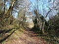
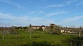
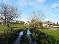
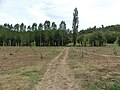
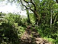
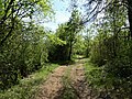
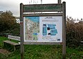
Français : Le sentier de grande randonnée 36 (GR 36) relie la Manche à la mer Méditerranée, sur plus de mille kilomètres de Ouistreham (Calvados) à Bourg-Madame (Pyrénées-Orientales).
English: The GR 36 is a long-distance walking route of the Grande Randonnée network in France. The route connects Ouistreham, on the Normandy coast of the English Channel, with Bourg-Madame, on the Pyrenees border with Spain.
walking trail in France  | |||||
| Upload media | |||||
| Instance of |
| ||||
|---|---|---|---|---|---|
| Location |
| ||||
| Length |
| ||||
| Terminus | |||||
 | |||||
Subcategories
This category has the following 2 subcategories, out of 2 total.
C
- Cours Général Kœnig (8 F)
G
Media in category "GR 36"
The following 54 files are in this category, out of 54 total.
-
 Coll Mitjà vue vers le nord.jpg 4,112 × 3,039; 2.42 MB
-
 Coll Mitjà vue vers le sud.jpg 4,608 × 3,456; 4.4 MB
-
 Fanlac croix du Couderc.JPG 2,448 × 3,264; 2.71 MB
-
 Fanlac GR 36 croix.JPG 3,264 × 2,448; 3.61 MB
-
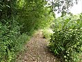
 Fanlac GR 36 est.JPG 3,264 × 2,448; 3.72 MB
-
 Fanlac GR 36 ouest (1).JPG 3,160 × 2,370; 2.13 MB
-
 Fanlac GR 36 ouest (2).JPG 3,212 × 2,411; 2.21 MB
-
 Fanlac GR 36 ouest (3).JPG 3,167 × 2,377; 2.1 MB
-
 Fanlac GR 36 ouest (4).JPG 3,175 × 2,381; 2.49 MB
-
 Fanlac GR 36 ouest (5).JPG 3,197 × 2,396; 2.75 MB
-
 Fanlac GR 36 ouest.JPG 3,264 × 2,448; 3.71 MB
-
 Fanlac panorama.JPG 3,264 × 1,830; 977 KB
-
 Fanlac village GR 36.JPG 3,152 × 2,366; 1.78 MB
-
 GR 36 Blis-et-Born direction Blis-et-Born (1).JPG 3,264 × 2,448; 3.61 MB
-
 GR 36 Blis-et-Born direction Blis-et-Born.JPG 3,264 × 2,448; 3.84 MB
-
 GR 36 Blis-et-Born direction Le Change (1).JPG 3,264 × 2,448; 3.81 MB
-
 GR 36 Blis-et-Born direction Le Change.JPG 3,264 × 2,448; 4.07 MB
-
 GR 36 Saint-Avit-Rivière (1).jpg 3,264 × 2,448; 2.29 MB
-
 GR 36 Saint-Avit-Rivière (2).jpg 3,179 × 2,383; 2.56 MB
-
 GR 36 Thonac Vermondie (1).jpg 3,264 × 2,448; 3.19 MB
-
 GR 36 Thonac Vermondie (2).jpg 3,101 × 2,325; 2.44 MB
-
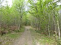
 GR 36-646 forêt Lanmary Antonne (1).jpg 3,264 × 2,448; 3.74 MB
-
 GR 36-646 forêt Lanmary Antonne (2).jpg 3,264 × 2,448; 4.66 MB
-
 GR 36-646 forêt Lanmary Antonne (3).jpg 3,264 × 2,448; 3.75 MB
-
 GR 36-646 forêt Lanmary Antonne (4).jpg 3,264 × 2,448; 3.84 MB
-
 GR 36-646 forêt Lanmary Antonne (5).jpg 3,264 × 2,448; 3.59 MB
-
 GR 36-646 forêt Lanmary Antonne (6).jpg 3,264 × 2,448; 4.45 MB
-
 GR 36-646 forêt Lanmary Antonne (7).jpg 3,264 × 2,448; 4.55 MB
-
 GR 36-646 forêt Lanmary Antonne (8).jpg 3,264 × 2,448; 4.64 MB
-
 GR 36-646 forêt Lanmary Antonne (9).jpg 3,264 × 2,448; 3.86 MB
-
 GR 36-646 forêt Lanmary Antonne-Trélissac (1).jpg 3,264 × 2,448; 3.47 MB
-
 GR 36-646 forêt Lanmary Antonne-Trélissac (2).jpg 3,264 × 2,448; 3.29 MB
-
 GR 36-646 forêt Lanmary Antonne-Trélissac (3).jpg 3,264 × 2,448; 3.47 MB
-
 GR 36-646-654 forêt Lanmary Trélissac (1).jpg 3,264 × 2,448; 2.16 MB
-
 GR 36-646-654 forêt Lanmary Trélissac (2).jpg 3,264 × 2,448; 2.4 MB
-
 GR 36-646-654 forêt Lanmary Trélissac (3).jpg 3,151 × 2,363; 1.33 MB
-
 Gr36.jpg 900 × 627; 275 KB
-
 Licheres charente bac.JPG 1,600 × 1,200; 419 KB
-
 Milhac-d'Auberoche GR 36 sud-est Loubatières (1).JPG 3,264 × 2,448; 3.81 MB
-
 Milhac-d'Auberoche GR 36 sud-est Loubatières (2).JPG 3,264 × 2,448; 4.04 MB
-
 Milhac-d'Auberoche pont SNCF ouest.JPG 3,264 × 2,448; 3.74 MB
-
 Plazac GR36 E Escoffie (1).JPG 2,744 × 2,055; 1.1 MB
-
 Plazac GR36 E Escoffie.JPG 3,264 × 2,448; 2.26 MB
-
 Pont Vell de Carcassona amb senyal del GR-36 - 20230824 121726.jpg 2,448 × 3,264; 3.26 MB
-
 Prats66 orri1.JPG 1,600 × 1,200; 639 KB
-
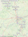 Principales villes du GR36.png 621 × 815; 846 KB
-
 Touvre gr4 36.jpg 1,600 × 1,200; 1.11 MB
-
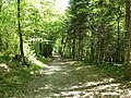
 Vieux-Mareuil GR 36 et coteau nord la Salle (1).jpg 3,264 × 2,448; 3.29 MB
-
 Vieux-Mareuil GR 36 et coteau nord la Salle (2).jpg 2,448 × 3,264; 3.73 MB
-
 Vieux-Mareuil GR 36 et coteau nord la Salle (3).jpg 3,264 × 2,448; 3.51 MB
-
 Vieux-Mareuil GR 36 et coteau nord la Salle (4).jpg 3,264 × 2,448; 3.62 MB
-
 Vieux-Mareuil GR 36 et coteau nord la Salle (5).jpg 3,191 × 2,393; 3.5 MB
-
 Vieux-Mareuil GR 36 et coteau nord la Salle (6).jpg 3,264 × 2,448; 3.61 MB
-
 Voie verte de Caen à Ouistreham.jpg 2,775 × 1,959; 1.19 MB


.JPG)
.JPG)
.JPG)
.JPG)
.JPG)


.JPG)

.JPG)

.jpg)
.jpg)
.jpg)
.jpg)
.jpg)
.jpg)
.jpg)
.jpg)
.jpg)
.jpg)
.jpg)
.jpg)
.jpg)
.jpg)
.jpg)
.jpg)
.jpg)
.jpg)
.jpg)


.JPG)
.JPG)

.JPG)


.jpg)
.jpg)
.jpg)
.jpg)
.jpg)
.jpg)
