Category:GRASS GIS
Jump to navigation
Jump to search
English: GRASS GIS (Geographic Resources Analysis Support System) is a free, open source geographical information system (GIS) capable of handling raster, topological vector, image processing, and graphic data.
free, open source geographical information system  GRASS GIS utilisé avec l'interface QGIS.  | |||||
| Upload media | |||||
| Instance of | |||||
|---|---|---|---|---|---|
| Copyright license |
| ||||
| Has use |
| ||||
| Developer |
| ||||
| Operating system | |||||
| Software version identifier |
| ||||
| Inception |
| ||||
| Different from | |||||
| user manual URL | |||||
| official website | |||||
| |||||
Subcategories
This category has the following 5 subcategories, out of 5 total.
- Created with GRASS GIS (105 F)
C
- Cincinnati Bike Map (9 F)
Media in category "GRASS GIS"
The following 13 files are in this category, out of 13 total.
-
 GRASS 6.1 GUI.png 1,143 × 575; 370 KB
-
 GRASS 6.3 small.jpg 356 × 261; 49 KB
-
 GRASS 6.3.png 1,186 × 871; 708 KB
-
 Grass gis 6 4 2.png 1,366 × 768; 664 KB
-
 Grass GIS.png 256 × 256; 20 KB
-
 Grass GIS.svg 207 × 224; 6 KB
-
 Grass logo animated.gif 110 × 123; 16 KB
-
 Grass6-gism.png 1,024 × 522; 107 KB
-
 Grasslogo vector big.png 889 × 989; 18 KB
-
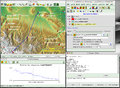
 Tutorial optimization shaded relief map with GRASS 01.jpg 1,280 × 1,024; 169 KB
-
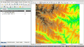
 Tutorial optimization shaded relief map with GRASS 02.jpg 1,280 × 1,024; 157 KB
-
 Tutorial optimization shaded relief map with GRASS 03.jpg 1,280 × 1,024; 117 KB
-
 Wxgui-atm.png 1,325 × 631; 125 KB


