Category:GPS coordinates
Jump to navigation
Jump to search
| NO WIKIDATA ID FOUND! Search for GPS coordinates on Wikidata | |
| Upload media |
English: GPS coordinates is a term used to refer to geographic coordinates given in the form of a set of numerical longitude and latitude references (whether or not obtained via the Global Positioning System).
Subcategories
This category has the following 2 subcategories, out of 2 total.
G
- GPS-Referenzpunkte (38 F)
Q
- Q150 GPS marks (2 F)
Media in category "GPS coordinates"
The following 20 files are in this category, out of 20 total.
-
 01 gpx coordinates.jpg 137 × 20; 23 KB
-
 02 gpx coordinates.jpg 191 × 46; 35 KB
-

-
 Boston MA DaylightChart.png 969 × 685; 46 KB
-
 Eckernförde - Schiffbrücke - Hafenbrücke 01 ies.jpg 3,744 × 5,616; 13.02 MB
-
 Emergency Point Sign (24164844189).jpg 5,760 × 3,840; 10.03 MB
-
 Global-Positioning-System.jpg 768 × 456; 58 KB
-
 GPS Coordinates (15622025729).jpg 3,100 × 2,072; 5.43 MB
-
 GPS data at Raipur Airport.jpg 2,795 × 2,096; 5.74 MB
-
 GPS-Referenzpunkt Stuttgart Schlossplatz.jpg 6,000 × 4,000; 13.76 MB
-
 Klokhøjen Station 12.jpg 2,592 × 1,944; 3.6 MB
-
 Northern lights at the Arctic Circle.jpg 3,456 × 2,304; 4.64 MB
-
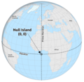 Null Island.png 888 × 876; 414 KB
-
 Phillip-table-04.jpg 500 × 708; 72 KB
-
 Plaque-1130622, Fenit, Co. Kerry, Ireland.jpg 4,896 × 3,672; 8.72 MB
-

-
 Reconstruction and maintenance of Bocaue diamond interchange 16.jpg 4,867 × 3,616; 3.83 MB
-
 Saint Helier latitude longitude Jersey.jpg 1,410 × 548; 535 KB
-
 Saint-Hélier - Saint-Helier Marina coordinates.JPG 5,408 × 3,606; 8.3 MB
-
 Stamp 2012 Dilove (1).jpg 909 × 324; 185 KB


.jpg)

.jpg)


.jpg)