Category:GO Transit maps
Jump to navigation
Jump to search
Media in category "GO Transit maps"
The following 13 files are in this category, out of 13 total.
-
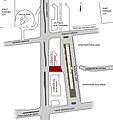
Finchmap.jpg 569 × 603; 97 KB
-
GO System Map.svg 778 × 666; 109 KB
-
GO Train System Map - Chinese.png 1,900 × 1,450; 121 KB
-
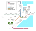
GO Train System Map.png 841 × 723; 69 KB
-
GO Transit RER map.png 841 × 723; 70 KB
-
GO Transit service area.png 432 × 379; 68 KB
-
GOTrain.png 3,925 × 1,597; 72 KB
-
GOTrain.svg 3,925 × 1,597; 517 KB
-
GOTrain2008Map.png 1,962 × 908; 78 KB
-
GoTransitTrainMap-Chinese.png 1,580 × 960; 91 KB
-
GoTransitTrainMap.png 1,580 × 960; 107 KB
-
GoTransitTrainMap.svg 1,580 × 960; 110 KB
-
Union-Pearson track dwg.png 1,703 × 719; 42 KB


