Category:GDP maps of India
Jump to navigation
Jump to search
Media in category "GDP maps of India"
The following 17 files are in this category, out of 17 total.
-
 35 India States and Union Territories GDP per capita on PPP basis in 2011.svg 1,578 × 1,738; 862 KB
-
 GDP of India states.png 3,818 × 4,600; 702 KB
-
 GDP of Indian states 2001.png 3,818 × 4,600; 1,009 KB
-
 GDP of Indian states 2011.png 3,818 × 4,600; 999 KB
-
 GDP of Indian states 2019.png 3,818 × 4,600; 1,005 KB
-
 GDP of Indian states 2020.png 3,818 × 4,600; 1.01 MB
-
 GDP of Indian states and union territories in 2017.png 3,818 × 4,600; 1.01 MB
-
 Gdpcapita.png 3,818 × 4,600; 992 KB
-
 GDPnominal.png 3,818 × 4,600; 1.02 MB
-
 Gdppercapita.png 3,818 × 4,600; 998 KB
-
 India vs World by Nominal GDP per capita in 2020.png 6,460 × 3,480; 1.98 MB
-
 Indian states and union territories by GRDP (nominal) per capita.png 3,818 × 4,600; 1.19 MB
-

-
 Indian states by GDP (nominal) 2013-14.png 1,486 × 1,734; 275 KB
-
 Indian states by GDP per capita.png 1,486 × 1,734; 265 KB
-
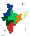 Indian-zones.png 3,818 × 4,600; 956 KB
-
 Per capita gdp India states.png 3,818 × 4,600; 987 KB


_per_capita.png)
_per_capita_according_to_latest_available_data.png)
_2013-14.png)


