Category:Görike
Jump to navigation
Jump to search
| Object location | | View all coordinates using: OpenStreetMap |
|---|
village in Brandenburg state, Germany | |||||
| Upload media | |||||
| Instance of |
| ||||
|---|---|---|---|---|---|
| Location | Gumtow, Prignitz District, Brandenburg, Germany | ||||
| Area |
| ||||
| Elevation above sea level |
| ||||
 | |||||
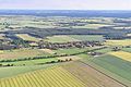
English: The village Görike is part of Gumtow municipality, Prignitz district, Brandenburg state, Germany
Deutsch: Das Dorf Görike gehört zur Gemeinde Gumtow, Landkreis Prignitz, Land Brandenburg, Deutschland.
Français : Le village de Görike fait partie de la commune de Gumtow, arrondissement Prignitz, état fédéral de Brandebourg, Allemagne
Subcategories
This category has the following 3 subcategories, out of 3 total.
Media in category "Görike"
The following 7 files are in this category, out of 7 total.
-
 Aerial view of Görike, Prignitz, by-RaBoe 2013.jpg 2,600 × 1,727; 915 KB
-
 Gefallendenkmal Görike 2011.jpg 3,000 × 4,000; 4.28 MB
-
 Görike Dorfstraße 10 2023-02-11.jpg 3,648 × 1,744; 2.27 MB
-
 Görike Gebäude 1.JPG 4,000 × 3,000; 4.47 MB
-
 GörikeDorfstr12+14.jpg 2,592 × 1,944; 1.74 MB
-
 Lausitz Luftsport- & Techniktage 2013-Hinflug by-RaBoe 0695.jpg 2,600 × 1,726; 857 KB
-
 Lausitz Luftsport- & Techniktage 2013-Hinflug by-RaBoe 0696.jpg 2,600 × 1,726; 904 KB


