Category:Fyfield, Oxfordshire
Jump to navigation
Jump to search
village in Fyfield and Tubney, Oxfordshire, England  | |||||
| Upload media | |||||
| Instance of | |||||
|---|---|---|---|---|---|
| Location | Fyfield and Tubney, Vale of White Horse, Oxfordshire, South East England, England | ||||
| Different from | |||||
 | |||||
English: Fyfield is a village in Oxfordshire, England, about southwest of Oxford. It is situated just off the A420 between Oxford and Faringdon. It forms a civil parish with the village of Tubney. In 1974 it was transferred from Berkshire.
Subcategories
This category has the following 6 subcategories, out of 6 total.
C
- St Nicholas' Church, Fyfield (19 F)
F
- Fyfield Chapel (4 F)
- Fyfield Manor (5 F)
M
- Main Road milestone, Fyfield (2 F)
- Manor Farmhouse, Fyfield (3 F)
Media in category "Fyfield, Oxfordshire"
The following 12 files are in this category, out of 12 total.
-
 Chapel at the end - geograph.org.uk - 1268330.jpg 640 × 426; 54 KB
-
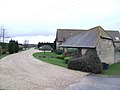
 Crossroads in Fyfield - geograph.org.uk - 1289931.jpg 640 × 426; 57 KB
-
 Crossroads in Fyfield - geograph.org.uk - 1430950.jpg 640 × 427; 63 KB
-
 Derelict barn at Marsh Farm - geograph.org.uk - 442729.jpg 640 × 480; 101 KB
-
 Footpath to the village - geograph.org.uk - 1268324.jpg 640 × 426; 80 KB
-
 Woodhouse Farm - geograph.org.uk - 309148.jpg 640 × 480; 78 KB
-
 Fyfield OldBerks FingerPost.JPG 1,200 × 2,000; 1.14 MB
-
 Fyfield OldBerks OldSchool.JPG 2,900 × 1,740; 754 KB
-
 Fyfield village street - geograph.org.uk - 1430954.jpg 640 × 427; 84 KB
-
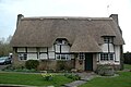 Netherton DrewettsCottage.JPG 2,940 × 1,960; 2.11 MB
-
 Second to first - geograph.org.uk - 1469624.jpg 640 × 427; 70 KB
-
 Redundant filling station - geograph.org.uk - 309139.jpg 640 × 480; 110 KB


