
Category:Fuxing District, Taoyuan
日本語: 復興区。
中文(臺灣):台灣桃園市復興區。
A special municipal mountain indigenous district in Taoyuan City, Taiwan   | |||||
| Upload media | |||||
| Instance of | |||||
|---|---|---|---|---|---|
| Location | Taoyuan, ROC | ||||
| Population |
| ||||
| Elevation above sea level |
| ||||
| official website | |||||
 | |||||
Subcategories
This category has the following 31 subcategories, out of 31 total.
*
- Sanguang Village, Taoyuan (10 F)
C
D
- Dahan Bridge (Taoyuan) (5 F)
F
- Fuhsing Shelter (8 F)
- Fuxing Bridge (Taoyuan) (14 F)
G
- Gaorao Creek (3 F)
- Gudian Coffee Shop (5 F)
J
- Jiaobanshan Resort (88 F)
- JiaoBanShan Shrine (6 F)
- Jiaobanshan XunFeng Building (19 F)
M
R
- Ronghua Dam (3 F)
S
- Suruw Bridge (4 F)
T
- Taman Creek (2 F)
U
X
- XiaYun Bridge (5 F)
- Xikou Suspension Bridge (5 F)
- Xikou Terrace (30 F)
Y
- Yixing Hydropower Plant (5 F)
Media in category "Fuxing District, Taoyuan"
The following 74 files are in this category, out of 74 total.
-
 06.23 桃園市復興區衛生所內一隅 (35442332866).jpg 2,048 × 1,365; 1.82 MB
-

-
 2019 Gate of Xikou Community Fuxing District.jpg 6,000 × 4,000; 2.58 MB
-
 2019 Xikou Catholic Church Fuxing District.jpg 6,000 × 4,000; 12.47 MB
-
 336, Taiwan, 桃園市復興區澤仁里 - panoramio (1).jpg 4,608 × 3,456; 4.73 MB
-
 336, Taiwan, 桃園市復興區高義里 - panoramio (1).jpg 3,264 × 2,448; 3.46 MB
-
 336, Taiwan, 桃園市復興區高義里 - panoramio (2).jpg 3,264 × 2,448; 3.25 MB
-
 336, Taiwan, 桃園市復興區高義里 - panoramio (3).jpg 3,264 × 2,448; 2.62 MB
-
 336, Taiwan, 桃園市復興區高義里 - panoramio (4).jpg 3,264 × 2,448; 2.74 MB
-
 336, Taiwan, 桃園市復興區高義里 - panoramio.jpg 3,264 × 2,448; 2.81 MB
-
 Atayal Culture,TAIWAN.jpg 3,264 × 2,448; 1.04 MB
-
 Bus Shelter 候車亭 - panoramio.jpg 3,234 × 2,425; 2.27 MB
-
 Buzz (106512037).jpeg 2,048 × 1,151; 468 KB
-
 Chatianshan Nature Reserve-Jerry Shen-01.jpg 4,608 × 2,592; 4.17 MB
-
 Chatianshan Nature Reserve-Jerry Shen-02.jpg 5,952 × 3,348; 6.05 MB
-
 Cilan Major Wildlife Habitat.jpg 4,032 × 3,024; 3.89 MB
-
 County highway 118 between Hsinchu and Taoyuan 2.jpg 1,600 × 1,116; 413 KB
-
 County highway 118 between Hsinchu and Taoyuan1.JPG 1,120 × 1,600; 395 KB
-
 Dahan River 大漢溪 - panoramio (1).jpg 3,962 × 2,970; 3.45 MB
-
 Dahan River 大漢溪 - panoramio.jpg 3,648 × 2,736; 4.19 MB
-
 Dahan River-2,TAIWAN.jpg 3,264 × 2,448; 772 KB
-
 Dong-Yan-Shan National Forest Recreational Area.jpg 3,648 × 2,736; 2.14 MB
-
 Fusing Township Administration Building 20080601.jpg 3,264 × 2,297; 785 KB
-
 Fuxing District Library 2020-09-22.jpg 4,160 × 3,120; 5.11 MB
-
 Fuxing district sign.jpg 2,958 × 2,935; 1.28 MB
-
 House123.jpg 480 × 360; 32 KB
-
 Old Toog Tree 老茄苳樹 - panoramio.jpg 3,648 × 2,736; 4.08 MB
-
 Pyasan, Taoyuan 2.jpg 4,032 × 3,024; 3.01 MB
-
 Pyasan, Taoyuan 3.jpg 4,032 × 3,024; 2.97 MB
-
 Pyasan, Taoyuan.jpg 4,032 × 3,024; 1.46 MB
-
 San Guang River, Fusing, Taoyuan, Taiwan - 20080601.jpg 3,264 × 2,448; 790 KB
-
 Taking a Break 小憩 - panoramio.jpg 3,648 × 2,736; 4.19 MB
-
 Taoyuan City Fuxing District Visitor Center.jpg 4,032 × 3,024; 2.53 MB
-
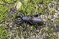
 Trigonotoma lewisii at Fuxing, Taoyuan 2022-06-12.jpg 4,701 × 3,134; 8.88 MB
-
 Typopeltis crucifer at Fuxing, Taoyuan 2022-06-12 (cropped).jpg 4,587 × 3,059; 10.25 MB
-
 Typopeltis crucifer at Fuxing, Taoyuan 2022-06-12.jpg 6,016 × 4,016; 16.13 MB
-
 Upper Gaorao 上高遶 - panoramio.jpg 3,223 × 2,417; 1.97 MB
-
 Xikou Community 溪口部落 - panoramio.jpg 2,736 × 2,736; 1.91 MB
-
 Xikou Tribal Community 溪口部落 - panoramio.jpg 3,648 × 2,736; 2.73 MB
-
 三個沒有經驗的小鬼頭,很好奇黑人叔叔怎麼把小魚兒們放生?! 01.jpg 750 × 500; 225 KB
-
 三個沒有經驗的小鬼頭,很好奇黑人叔叔怎麼把小魚兒們放生?! 02.jpg 750 × 500; 241 KB
-
 三個沒有經驗的小鬼頭,很好奇黑人叔叔怎麼把小魚兒們放生?! 03.jpg 750 × 500; 280 KB
-
 下奎輝 Xia Kuihui - panoramio.jpg 3,648 × 2,736; 4.49 MB
-
 前往龍鳳瀑布的步道 The footpath to the Longfeng Waterfalls in Xiao Wulai Scenic Area.jpg 2,592 × 4,608; 3.01 MB
-
 北插登山口旁 - panoramio.jpg 3,504 × 2,336; 3.42 MB
-
 台灣的柳杉林.jpg 4,000 × 3,000; 5.69 MB
-
 吊橋風光 - panoramio.jpg 2,560 × 1,920; 1.63 MB
-
 大漢溪 Dahan River - panoramio (2).jpg 6,000 × 4,000; 10.5 MB
-
 大漢溪 Dahan River - panoramio.jpg 3,153 × 2,365; 2 MB
-
 復興 角板山風光 - panoramio.jpg 2,816 × 2,112; 907 KB
-
 復興分駐所.jpg 4,000 × 3,000; 6.49 MB
-
 復興郵局.jpg 4,000 × 3,000; 4.86 MB
-
 思親亭 - panoramio.jpg 2,816 × 2,112; 1.08 MB
-
 桃119 鄉道 - panoramio.jpg 1,600 × 1,200; 456 KB
-
 桃園客運復興站 復興區行政大樓 20210829.jpg 4,000 × 3,000; 4.48 MB
-
 桃園復興街景 Fuxing - panoramio.jpg 2,816 × 2,112; 880 KB
-
 比亞外部落.jpg 726 × 1,280; 212 KB
-
 泰雅族三光社貝珠裙.jpg 4,592 × 2,584; 5.93 MB
-
 獵山豬者 Wild Boar Hunter - panoramio.jpg 2,376 × 3,168; 1.85 MB
-
 獵食者 Predator - panoramio.jpg 3,000 × 2,000; 1.14 MB
-
 省道七號 Provincial Route 7 - panoramio.jpg 4,000 × 3,000; 2.24 MB
-
 織布圖 Weaving - panoramio.jpg 4,605 × 3,070; 3.4 MB
-
 義興吊橋.JPG 889 × 603; 114 KB
-
 老茄苳樹 Old Toog Tree - panoramio.jpg 3,648 × 2,736; 4.08 MB
-
 落葉 Dropped Leaves - panoramio.jpg 3,920 × 2,204; 2.91 MB
-
 角板山全景.jpg 1,122 × 662; 210 KB
-
 角板山全景舊貌.jpg 2,439 × 1,577; 1.5 MB
-
 角板山戰備隧道 Jiaobanshan Readiness Tunnel - panoramio.jpg 3,732 × 2,096; 2.61 MB
-
 角板山樟腦收納所 (日式建築) - panoramio.jpg 2,816 × 2,112; 773 KB
-
 部落集會所 Tribal Chi Hui Suo - panoramio (1).jpg 3,648 × 2,736; 3.17 MB
-
 部落集會所 Tribal Chi Hui Suo - panoramio.jpg 3,648 × 2,736; 3.33 MB
-
 雪霧鬧部落景色.jpg 4,032 × 3,024; 613 KB
-
 青年活動中心廣場.jpg 4,000 × 3,000; 4.84 MB
-
 鹽酥菇創始達人.jpg 4,000 × 3,000; 5.18 MB
.jpg)


.jpg)
.jpg)
.jpg)
.jpg)
.jpg)


.jpeg)


.jpg)


.jpg)


.jpg)


_-_panoramio.jpg)
.jpg)


