Category:Fundenhall
Jump to navigation
Jump to search
village and former civil parish in Norfolk, England, UK | |||||
| Upload media | |||||
| Instance of |
| ||||
|---|---|---|---|---|---|
| Location | Ashwellthorpe and Fundenhall, South Norfolk, Norfolk, East of England, England | ||||
 | |||||
Subcategories
This category has only the following subcategory.
N
Media in category "Fundenhall"
The following 20 files are in this category, out of 20 total.
-
 B1113, Smithy Corner, Fundenhall - geograph.org.uk - 6184063.jpg 3,456 × 2,592; 2.45 MB
-

-
 Church Lane in Fundenhall - geograph.org.uk - 1577022.jpg 640 × 455; 157 KB
-

-
 Fundenhall village sign (detail) - geograph.org.uk - 4541399.jpg 768 × 1,024; 627 KB
-
 Fundenhall Village Sign - geograph.org.uk - 345524.jpg 640 × 480; 119 KB
-
 Old Milestone - geograph.org.uk - 1513327.jpg 480 × 640; 144 KB
-
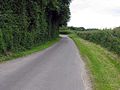
 Public footpath to Ashwellthorpe - geograph.org.uk - 1577015.jpg 640 × 448; 116 KB
-
 Rattee's Corner, Fundenhall - geograph.org.uk - 345512.jpg 640 × 480; 78 KB
-

-

-
-
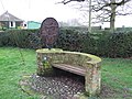 Seat and Village Sign, Fundenhall - geograph.org.uk - 345505.jpg 640 × 480; 127 KB
-

-
 Sign for the King's Head, Fundenhall - geograph.org.uk - 4590512.jpg 545 × 640; 73 KB
-

-
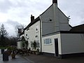 The King's Head, Fundenhall - geograph.org.uk - 346105.jpg 640 × 480; 62 KB
-
 The King's Head, Fundenhall - geograph.org.uk - 4590511.jpg 640 × 480; 56 KB
-
 To New Buckenham 6 - geograph.org.uk - 1513323.jpg 640 × 480; 115 KB
-


_-_geograph.org.uk_-_4541399.jpg)


