Category:Full Sutton
Jump to navigation
Jump to search
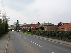
English: Full Sutton is a village and civil parish in the East Riding of Yorkshire, England. It is situated approximately 2 miles (3.2 km) east of the village of Stamford Bridge.
village and civil parish in East Riding of Yorkshire, UK | |||||
| Upload media | |||||
| Instance of | |||||
|---|---|---|---|---|---|
| Location | East Riding of Yorkshire, Yorkshire and the Humber, England | ||||
| Population |
| ||||
 | |||||
Media in category "Full Sutton"
The following 46 files are in this category, out of 46 total.
-
Approaching Full Sutton - geograph.org.uk - 262290.jpg 640 × 480; 106 KB
-
Bridleway to Youlthorpe - geograph.org.uk - 399709.jpg 640 × 478; 121 KB
-
Course of the railway - geograph.org.uk - 3763538.jpg 640 × 427; 92 KB
-
Cows near Full Sutton - geograph.org.uk - 3678795.jpg 640 × 427; 67 KB
-
East of Full Sutton - geograph.org.uk - 125998.jpg 640 × 480; 127 KB
-
Entering Full Sutton - geograph.org.uk - 259587.jpg 640 × 480; 106 KB
-
Entrance to HMP Full Sutton. - geograph.org.uk - 2498014.jpg 3,264 × 2,448; 2 MB
-
Entranceway to the Church Full Sutton.jpg 640 × 364; 91 KB
-
Farm Entrance at Moor Lane Corner - geograph.org.uk - 2498041.jpg 3,264 × 2,448; 1.74 MB
-
Farmland near Full Sutton - geograph.org.uk - 1846305.jpg 640 × 480; 59 KB
-
Field Edge toward the A166 - geograph.org.uk - 2497996.jpg 3,264 × 2,448; 2.57 MB
-
Fly-in at Full Sutton Aerodrome (geograph 4606817).jpg 640 × 427; 54 KB
-
Fly-in at Full Sutton Aerodrome (geograph 4606826).jpg 640 × 427; 44 KB
-
Fly-in at Full Sutton Aerodrome (geograph 4606830).jpg 640 × 427; 47 KB
-
Footpath near Full Sutton - geograph.org.uk - 6002573.jpg 1,024 × 768; 254 KB
-
Free range pigs near Full Sutton - geograph.org.uk - 2503765.jpg 800 × 600; 266 KB
-
Full Sutton UK parish locator map.svg 1,425 × 1,107; 1.68 MB
-
Full Sutton View 1.jpg 640 × 337; 65 KB
-
Full Sutton.jpg 640 × 478; 114 KB
-
Grazing land, Full Sutton - geograph.org.uk - 1846309.jpg 640 × 480; 115 KB
-
Handley Page Halifax CH14526.jpg 800 × 616; 59 KB
-
Hatkill Lane towards Full Sutton - geograph.org.uk - 1846307.jpg 640 × 480; 54 KB
-
Hatkill Lane, Full Sutton - geograph.org.uk - 1846312.jpg 640 × 480; 90 KB
-
Into Full Sutton Village - geograph.org.uk - 2498001.jpg 3,264 × 2,448; 2.48 MB
-
Minor road beside Black Plantation - geograph.org.uk - 2371484.jpg 1,600 × 1,200; 583 KB
-
Moor Lane - geograph.org.uk - 2503772.jpg 800 × 600; 323 KB
-
Moor Lane towards Full Sutton - geograph.org.uk - 2371457.jpg 1,600 × 1,200; 513 KB
-
Moor Lane, Full Sutton - geograph.org.uk - 4607041.jpg 640 × 427; 68 KB
-
Moor Lane, Full Sutton - geograph.org.uk - 4607073.jpg 640 × 427; 75 KB
-
Road through Black Plantation - geograph.org.uk - 6447896.jpg 1,024 × 683; 601 KB
-
Seeded land - geograph.org.uk - 399250.jpg 640 × 478; 108 KB
-
Sheds And Polytunnels - geograph.org.uk - 262300.jpg 640 × 480; 99 KB
-
Spoilt for Choice - geograph.org.uk - 2497992.jpg 640 × 480; 84 KB
-
St Marys Church Full Sutton.jpg 640 × 360; 111 KB
-
The entrance to HM Prison, Full Sutton (geograph 2503791).jpg 800 × 600; 262 KB
-
The Minster Way - geograph.org.uk - 262294.jpg 640 × 480; 103 KB
-
The Road Across Hunland Field - geograph.org.uk - 262299.jpg 640 × 480; 105 KB
-
This is Flat - geograph.org.uk - 2498046.jpg 640 × 480; 52 KB
-
Two Cottages Full Sutton.jpg 640 × 352; 62 KB
-
Village Green Full Sutton.jpg 640 × 361; 91 KB


