Category:Fryton
Jump to navigation
Jump to search
village in the United Kingdom  | |||||
| Upload media | |||||
| Instance of | |||||
|---|---|---|---|---|---|
| Location | Ryedale, North Yorkshire, Yorkshire and the Humber, England | ||||
| Population |
| ||||
 | |||||
Media in category "Fryton"
The following 52 files are in this category, out of 52 total.
-
 Arable Farmland near Fryton - geograph.org.uk - 5476260.jpg 3,123 × 1,401; 1.38 MB
-
 B1257 to Slingsby - geograph.org.uk - 3722171.jpg 800 × 479; 292 KB
-
 B1257, Fryton - geograph.org.uk - 6711798.jpg 1,024 × 768; 139 KB
-
 Bales on Fryton Moor - geograph.org.uk - 4386509.jpg 640 × 428; 109 KB
-
 Bales on Fryton Moor - geograph.org.uk - 4386510.jpg 640 × 428; 102 KB
-
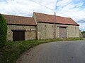 Barns, North Farm, Fryton.jpg 1,024 × 768; 191 KB
-
 Brickyard Farm - geograph.org.uk - 2453574.jpg 1,600 × 1,200; 324 KB
-
 Bridleway approaching Hollin Hill Bogs - geograph.org.uk - 4322892.jpg 4,320 × 3,240; 3.56 MB
-
 Bridleway near High Baxtonhowe - geograph.org.uk - 4322883.jpg 4,320 × 2,160; 2.13 MB
-
 Bridleway to Hollin Hill - geograph.org.uk - 4386506.jpg 640 × 428; 88 KB
-
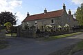
 Cherrygarth Farmhouse, Fryton.jpg 1,024 × 682; 783 KB
-
 Cottage on Fryton Lane, Fryton - geograph.org.uk - 6757716.jpg 1,600 × 1,200; 547 KB
-
 Elizabeth II postbox on Fryton Lane, Fryton - geograph.org.uk - 6757715.jpg 830 × 1,600; 330 KB
-
 Farm track at edge of Fryton Wood - geograph.org.uk - 4322873.jpg 3,240 × 4,320; 4 MB
-
 Farmland from the woodland edge - geograph.org.uk - 4322867.jpg 4,320 × 3,240; 2.94 MB
-
 Farmland near Aryholme - geograph.org.uk - 4386504.jpg 640 × 428; 81 KB
-
 Farmland west of Fryton Lane - geograph.org.uk - 6295078.jpg 4,608 × 3,456; 4.39 MB
-
 Field entrance off the B1257 - geograph.org.uk - 6711794.jpg 1,024 × 768; 221 KB
-
 Footpath to South Holme Farm - geograph.org.uk - 3445563.jpg 4,000 × 3,000; 2.33 MB
-
 Forester hauling Thinned Trees - geograph.org.uk - 2760210.jpg 3,264 × 2,448; 3.05 MB
-
 Fryton cross roads - geograph.org.uk - 5888812.jpg 4,320 × 2,372; 1.45 MB
-
 Fryton East Wood - geograph.org.uk - 6777065.jpg 2,448 × 3,264; 5.66 MB
-
 Fryton Lane - geograph.org.uk - 3581096.jpg 427 × 640; 267 KB
-
 Fryton Lane after logging operations - geograph.org.uk - 1140742.jpg 640 × 480; 78 KB
-
 Fryton Lane leading to the Old Gatehouse - geograph.org.uk - 6295076.jpg 4,608 × 3,456; 4.46 MB
-
 Fryton Lane running north from the village - geograph.org.uk - 6295080.jpg 4,608 × 3,456; 4.39 MB
-
 Fryton Lane, Fryton - geograph.org.uk - 6711805.jpg 640 × 480; 79 KB
-
 Fryton road end - geograph.org.uk - 5497197.jpg 1,500 × 844; 207 KB
-
 Fryton, North Yorkshire.jpg 640 × 480; 66 KB
-
 Harvested field with straw bales waiting collection - geograph.org.uk - 6295142.jpg 4,608 × 3,456; 4.2 MB
-
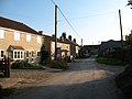
 Houses on Fryton Lane, Fryton - geograph.org.uk - 6711802.jpg 1,024 × 695; 167 KB
-
 Job done for this year - geograph.org.uk - 6295148.jpg 3,844 × 2,880; 5.62 MB
-
 Log Pile, Fryton Wood - geograph.org.uk - 3581093.jpg 640 × 427; 310 KB
-

-
 Near Fryton Grange - geograph.org.uk - 4671823.jpg 1,600 × 1,200; 791 KB
-
 Near Tuft House Farm - geograph.org.uk - 4664667.jpg 1,600 × 1,200; 678 KB
-
 Old oak by the track - geograph.org.uk - 4322900.jpg 4,320 × 3,240; 3.73 MB
-
 Path through Fryton West Wood - geograph.org.uk - 6480365.jpg 3,887 × 4,569; 5.12 MB
-
 Piggy paradise, pedestrian problem - geograph.org.uk - 6480362.jpg 5,158 × 3,567; 3.09 MB
-
 Pond at Hollin Hill Bogs - geograph.org.uk - 4322908.jpg 4,320 × 3,240; 5.13 MB
-
 Road east of Wath - geograph.org.uk - 6853482.jpg 1,024 × 683; 468 KB
-
 Road towards Wath - geograph.org.uk - 6853485.jpg 1,024 × 683; 485 KB
-
 The old Kilns at Brickyard Farm - geograph.org.uk - 3445553.jpg 4,000 × 3,000; 2.86 MB
-
 The road to East Ness - geograph.org.uk - 2262754.jpg 800 × 600; 233 KB
-
 The road to Slinsgby and (ultimately) Malton - geograph.org.uk - 3721772.jpg 1,024 × 768; 167 KB
-
 The top of Fryton Lane - geograph.org.uk - 5662840.jpg 2,048 × 1,536; 923 KB
-
 Thinning Trees in Fryton East Wood - geograph.org.uk - 2760195.jpg 3,264 × 2,448; 2.44 MB
-
 Towards Fryton East Wood - geograph.org.uk - 4386508.jpg 640 × 428; 89 KB
-
 Towards Fryton West Wood - geograph.org.uk - 4386502.jpg 640 × 428; 108 KB
-
 Towards Hollin Hill - geograph.org.uk - 4386503.jpg 640 × 428; 89 KB
-
 Track through Fryton East Wood - geograph.org.uk - 3894271.jpg 4,000 × 3,000; 4.47 MB
-
 West Farmhouse, Fryton.jpg 1,024 × 683; 609 KB


_Malton_-_geograph.org.uk_-_3721772.jpg)


