Category:Friston, Suffolk
Jump to navigation
Jump to search
village and civil parish in Suffolk, United Kingdom | |||||
| Upload media | |||||
| Instance of | |||||
|---|---|---|---|---|---|
| Location |
| ||||
| Different from | |||||
| official website | |||||
 | |||||
Subcategories
This category has the following 11 subcategories, out of 11 total.
E
- Environs of Friston, Suffolk (1 F)
F
- Friston Baptist Church (3 F)
- Friston Village Hall (4 F)
- Friston Windmill (11 F)
H
- Hazlewood Hall Farm, Suffolk (2 F)
M
O
- Old Chequers, Friston (8 F)
S
V
- Friston Village Sign (4 F)
Media in category "Friston, Suffolk"
The following 200 files are in this category, out of 393 total.
(previous page) (next page)-
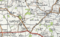 20th Century map of Friston.png 609 × 379; 572 KB
-
 A small house in Black Heath Wood. - geograph.org.uk - 905251.jpg 640 × 480; 131 KB
-
 A1094 Aldeburgh Road - geograph.org.uk - 2520558.jpg 3,072 × 2,304; 1.39 MB
-
 A1094 Aldeburgh Road - geograph.org.uk - 2520561.jpg 3,072 × 2,304; 1.35 MB
-
 A1094 Aldeburgh Road - geograph.org.uk - 2520579.jpg 3,072 × 2,304; 1.32 MB
-
 A1094 Aldeburgh Road - geograph.org.uk - 2520610.jpg 3,072 × 2,304; 1.25 MB
-
 A1094 Aldeburgh Road - geograph.org.uk - 2520611.jpg 3,072 × 2,304; 1.32 MB
-
 A1094 Aldeburgh Road - geograph.org.uk - 2520632.jpg 3,072 × 2,304; 1.21 MB
-
 A1094 Aldeburgh Road - geograph.org.uk - 2520654.jpg 3,072 × 2,304; 1.35 MB
-
 A1094 Aldeburgh Road - geograph.org.uk - 2520656.jpg 3,072 × 2,304; 1.18 MB
-
 A1094 Aldeburgh Road - geograph.org.uk - 2522068.jpg 3,072 × 2,304; 1.4 MB
-
 A1094 Aldeburgh Road - geograph.org.uk - 2522089.jpg 3,072 × 2,304; 1.25 MB
-
 A1094 Aldeburgh Road - geograph.org.uk - 2522275.jpg 3,072 × 2,304; 1.16 MB
-
 A1094 Aldeburgh Road - geograph.org.uk - 2522847.jpg 3,072 × 2,304; 1.34 MB
-
 A1094 Aldeburgh Road ^ entrance to Hazlewood Hall Farm - geograph.org.uk - 2520619.jpg 3,072 × 2,304; 1.31 MB
-
 A1094 Aldeburgh Road ^ Rushmere Lodge Farm - geograph.org.uk - 2522065.jpg 3,072 × 2,304; 1.34 MB
-
 A1094 Aldeburgh Road ^ The entrance to Park Farm - geograph.org.uk - 2522072.jpg 3,072 × 2,304; 1.32 MB
-
 A1094 Approaching Snape - geograph.org.uk - 3864806.jpg 640 × 480; 320 KB
-
 A1094 at Hazlewood Hall Farm - geograph.org.uk - 5615891.jpg 1,600 × 1,064; 352 KB
-
 A1094 junction with B1121 - geograph.org.uk - 3560731.jpg 3,344 × 2,365; 1.03 MB
-
 A1094 near Friston - geograph.org.uk - 3864801.jpg 640 × 480; 297 KB
-
 A1094 passes Hazlewood Hall Farm - geograph.org.uk - 3560754.jpg 3,540 × 2,497; 1.05 MB
-
 A1094 south of Rushmere Lodge Farm - geograph.org.uk - 3560745.jpg 3,263 × 2,502; 1.73 MB
-
 A1094 to the south of Friston - geograph.org.uk - 3864804.jpg 640 × 480; 283 KB
-
-
 A1094, South of Friston - geograph.org.uk - 3864803.jpg 640 × 480; 257 KB
-
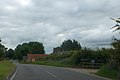
 Aldeburgh Road (A1094) - geograph.org.uk - 3864800.jpg 640 × 480; 365 KB
-

-
 Aldeburgh Road sign - geograph.org.uk - 2522741.jpg 3,072 × 2,304; 1.52 MB
-
 Another double dose of pylons - geograph.org.uk - 2079796.jpg 640 × 480; 54 KB
-
 Approaching the A1094 at Knodishall Whin - geograph.org.uk - 5594912.jpg 1,600 × 1,064; 247 KB
-
 B1069 Snape Road - geograph.org.uk - 2522084.jpg 3,072 × 2,304; 1.52 MB
-
 B1069 Snape Road - geograph.org.uk - 3414255.jpg 640 × 480; 37 KB
-
 B1069 Snape Road - geograph.org.uk - 3414267.jpg 640 × 480; 52 KB
-
 B1069 Snape Road ^ the footpath to the B1121 Aldeburgh Road - geograph.org.uk - 2520524.jpg 3,072 × 2,304; 1.19 MB
-
 B1069 Snape Road, Knodishall - geograph.org.uk - 2519482.jpg 3,072 × 2,304; 1.33 MB
-
 B1069 Snape Road, Knodishall - geograph.org.uk - 2519513.jpg 3,072 × 2,304; 1.3 MB
-
 B1121 Aldeburgh Road - geograph.org.uk - 2533693.jpg 3,072 × 2,304; 1.28 MB
-
 B1121 Aldeburgh Road - geograph.org.uk - 2533694.jpg 3,072 × 2,304; 1.3 MB
-
 B1121 Aldeburgh Road ^ the footpath to Low Road - geograph.org.uk - 2533684.jpg 3,072 × 2,304; 1.28 MB
-

-
 B1121 Aldeburgh Road, Friston - geograph.org.uk - 2517359.jpg 3,072 × 2,304; 1.32 MB
-
 B1121 Aldeburgh Road, Friston - geograph.org.uk - 2517400.jpg 3,072 × 2,304; 1.29 MB
-
 B1121 Aldeburgh Road, Friston - geograph.org.uk - 4335361.jpg 3,072 × 2,232; 1.8 MB
-
 B1121 at Theberton - geograph.org.uk - 4361887.jpg 1,024 × 768; 325 KB
-
 B1121 enters Friston - geograph.org.uk - 3600255.jpg 3,500 × 2,549; 964 KB
-
 B1121 junction with Kiln Lane - geograph.org.uk - 3601205.jpg 3,388 × 2,638; 1.78 MB
-
 B1121 west of Friston House Wood - geograph.org.uk - 3600260.jpg 3,537 × 2,664; 1.39 MB
-
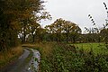
 B1169 southwest of Drane's Lane Cottages - geograph.org.uk - 3576184.jpg 3,532 × 2,645; 1.01 MB
-
 Barns of Rushmere Lodge Farm by A1094 - geograph.org.uk - 4070017.jpg 1,536 × 1,023; 806 KB
-
 Bend In Fence Line - geograph.org.uk - 4492266.jpg 1,024 × 768; 286 KB
-
 Black Heath Wood - geograph.org.uk - 6202920.jpg 3,456 × 2,592; 3.84 MB
-
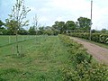
 Bridleway alongside to Five Acre Pickle - geograph.org.uk - 4280128.jpg 640 × 480; 196 KB
-
 Bridleway sign to Grove Road - geograph.org.uk - 2519498.jpg 2,304 × 3,072; 1.32 MB
-
 Bridleway to Grove Road - geograph.org.uk - 2519494.jpg 3,072 × 2,304; 1.37 MB
-
 Bridleway to Grove Road - geograph.org.uk - 2519510.jpg 3,072 × 2,304; 1.39 MB
-
 Bull's Hall - geograph.org.uk - 173469.jpg 640 × 480; 109 KB
-
 Byway past Foxburrow Covert - geograph.org.uk - 4280131.jpg 640 × 480; 201 KB
-
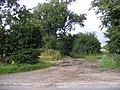
 Byway to Billeaford Hall - geograph.org.uk - 4280133.jpg 640 × 480; 138 KB
-
 Chase's Lane sign - geograph.org.uk - 2522675.jpg 3,072 × 2,304; 1.48 MB
-
 Chase's Lane, Friston - geograph.org.uk - 2522672.jpg 3,072 × 2,304; 1.43 MB
-
 Chase's Lane, Friston - geograph.org.uk - 2532590.jpg 2,304 × 3,072; 1.31 MB
-
 Chase's Lane, Friston - geograph.org.uk - 2532635.jpg 2,304 × 3,072; 1.35 MB
-
 Chase's Lane, Friston - geograph.org.uk - 2532639.jpg 2,304 × 3,072; 1.21 MB
-
 Children's playground - geograph.org.uk - 2080108.jpg 640 × 480; 44 KB
-
 Church Lane, Friston - geograph.org.uk - 2519008.jpg 3,072 × 2,304; 1.31 MB
-
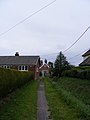
 Church Path footpath to Church Road - geograph.org.uk - 2517450.jpg 2,304 × 3,072; 1.29 MB
-
 Church Path footpath to Grove Road - geograph.org.uk - 2533646.jpg 3,072 × 2,304; 1.3 MB
-
 Church Path footpath to Grove Road - geograph.org.uk - 2533649.jpg 2,304 × 3,072; 1.26 MB
-
 Church Path footpath to Grove Road - geograph.org.uk - 2533652.jpg 2,304 × 3,072; 1.22 MB
-
 Church Path footpath to Grove Road - geograph.org.uk - 2533656.jpg 2,304 × 3,072; 1.32 MB
-
 Church Path footpath to Grove Road - geograph.org.uk - 2533661.jpg 3,072 × 2,304; 1.45 MB
-
 Church Path footpath to Grove Road - geograph.org.uk - 2533665.jpg 2,304 × 3,072; 1.28 MB
-
 Church Path footpath to Grove Road - geograph.org.uk - 2533666.jpg 2,304 × 3,072; 1.29 MB
-
 Church Path footpath to Grove Road - geograph.org.uk - 2533679.jpg 2,304 × 3,072; 1.32 MB
-
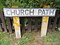 Church Path sign - geograph.org.uk - 2517448.jpg 3,072 × 2,304; 1.55 MB
-
 Church Path, Friston - geograph.org.uk - 2517439.jpg 3,072 × 2,304; 1.41 MB
-
 Church Road ^ the footpath to Friston Moor - geograph.org.uk - 2533613.jpg 3,072 × 2,304; 1.36 MB
-
 Church Road ^ the footpath to Grove Road - geograph.org.uk - 2533576.jpg 3,072 × 2,304; 1.41 MB
-
 Church Road, Friston - geograph.org.uk - 2533574.jpg 3,072 × 2,304; 1.3 MB
-
 Church Road, Friston - geograph.org.uk - 2533578.jpg 2,304 × 3,072; 1.29 MB
-
 Church Road, Friston - geograph.org.uk - 2533676.jpg 2,304 × 3,072; 1.35 MB
-
 Church Road, Friston - geograph.org.uk - 2533682.jpg 3,072 × 2,304; 1.26 MB
-
 Crops under cloches, at the Park Farm turnoff - geograph.org.uk - 5615878.jpg 1,600 × 1,064; 537 KB
-
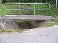
 Culvert under Grove Road - geograph.org.uk - 2517457.jpg 3,072 × 2,304; 1.66 MB
-
 Culvert under the footpath to the A1094 Aldeburgh Road - geograph.org.uk - 2532458.jpg 2,304 × 3,072; 1.65 MB
-
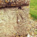 Cut Mark Friston St Marys Church - geograph.org.uk - 5729579.jpg 2,231 × 2,231; 3.69 MB
-
 Dead trees at the edge of Hazlewood Marshes - geograph.org.uk - 6289295.jpg 1,600 × 1,064; 548 KB
-
 Dead trees at the edge of Hazlewood Marshes - geograph.org.uk - 6289369.jpg 1,600 × 1,064; 497 KB
-
 Dead trees at the edge of Hazlewood Marshes - geograph.org.uk - 6289373.jpg 1,064 × 1,600; 511 KB
-
 Destroying Angel. Amanita virosa - Flickr - gailhampshire.jpg 2,088 × 3,089; 748 KB
-
 Donkey Lane sign - geograph.org.uk - 2532667.jpg 3,072 × 2,304; 1.38 MB
-
 Donkey Lane, Friston ^ footpath to Mill ^ Low Roads - geograph.org.uk - 2532663.jpg 3,072 × 2,304; 1.48 MB
-
 Donkey Lane, Friston ^ footpath to Mill ^ Low Roads - geograph.org.uk - 2532672.jpg 2,304 × 3,072; 1.4 MB
-
 Donkey Lane, Friston ^ footpath to Mill ^ Low Roads - geograph.org.uk - 2532683.jpg 2,304 × 3,072; 1.41 MB
-
 Donkey Lane, Friston ^ footpath to Mill ^ Low Roads - geograph.org.uk - 2532941.jpg 2,304 × 3,072; 1.39 MB
-
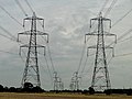 Double dose of Pylons - geograph.org.uk - 2079794.jpg 640 × 480; 52 KB
-
 Drain off the Sailors' Path - geograph.org.uk - 5792409.jpg 1,064 × 1,600; 623 KB
-
 Driveway to Grange Farm, Hazlewood - geograph.org.uk - 4361970.jpg 1,024 × 768; 287 KB
-
 East end of Kiln Lane - geograph.org.uk - 5594985.jpg 1,600 × 1,064; 488 KB
-
 Ebb and Flow, Sailor's Path Sculptures - geograph.org.uk - 2012199.jpg 427 × 640; 189 KB
-
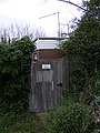 Electricity Sub Station near to footpath 30 - geograph.org.uk - 2532471.jpg 2,304 × 3,072; 1.38 MB
-
 Entering Friston on the B1121 Aldeburgh Road - geograph.org.uk - 4335282.jpg 3,072 × 2,304; 1.92 MB
-
 Entrance to Bull's Hall, Knoddishall - geograph.org.uk - 2079735.jpg 640 × 480; 50 KB
-
 Entrance to Park Farm for cars but not tractors - geograph.org.uk - 4361886.jpg 1,024 × 768; 488 KB
-
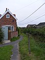
 Entrance to Pond House, Friston - geograph.org.uk - 2080114.jpg 640 × 480; 53 KB
-

-
 Field entrance off the A1094 Aldeburgh Road - geograph.org.uk - 2522287.jpg 3,072 × 2,304; 1.36 MB
-
 Field entrance opposite Rushmere Lodge Farm - geograph.org.uk - 2522069.jpg 3,072 × 2,304; 1.6 MB
-
 Field next to the entrance to Park Farm ^ Park House - geograph.org.uk - 2520547.jpg 3,072 × 2,304; 1.37 MB
-
 Fields north of Snape Road, Knodishall - geograph.org.uk - 5974206.jpg 1,600 × 1,064; 395 KB
-
 Fields off the B1121 Aldeburgh Road - geograph.org.uk - 4335273.jpg 3,072 × 2,182; 1.84 MB
-
 Fire Hydrant in Grove Road, Friston - geograph.org.uk - 2517485.jpg 2,304 × 3,072; 1.47 MB
-
 Footbridge near Church Path in Church Road - geograph.org.uk - 2533651.jpg 3,072 × 2,304; 1.61 MB
-
 Footbridge, Blackheath - geograph.org.uk - 2619567.jpg 4,048 × 3,040; 2.48 MB
-
 Footpath amendment notice on Church Path - geograph.org.uk - 2533663.jpg 3,072 × 2,304; 1.4 MB
-
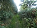 Footpath in Black Heath Forest near Snape - geograph.org.uk - 229422.jpg 640 × 480; 119 KB
-

-
 Footpath junction on Friston footpath no.28 - geograph.org.uk - 2533244.jpg 2,304 × 3,072; 1.52 MB
-

-
 Footpath near Friston - geograph.org.uk - 4560500.jpg 3,772 × 2,664; 2.56 MB
-
 Footpath north from the roadway in Black Heath Wood - geograph.org.uk - 6202910.jpg 3,456 × 2,592; 3.93 MB
-

-

-

-
 Footpath sign ^ amendment notice - geograph.org.uk - 2533658.jpg 2,304 × 3,072; 1.44 MB
-
 Footpath south from the roadway in Black Heath Wood - geograph.org.uk - 6202914.jpg 3,224 × 2,418; 7.33 MB
-
 Footpath through crop, near Friston - geograph.org.uk - 4145254.jpg 3,240 × 4,320; 5.28 MB
-
 Footpath to Church Farm - geograph.org.uk - 2517379.jpg 2,304 × 3,072; 1.44 MB
-
 Footpath to Church Farm - geograph.org.uk - 2517384.jpg 2,304 × 3,072; 1.31 MB
-
 Footpath to Church Farm - geograph.org.uk - 2517387.jpg 2,304 × 3,072; 1.15 MB
-
 Footpath to Church Road - geograph.org.uk - 2517478.jpg 2,304 × 3,072; 1.66 MB
-
 Footpath to Church Road - geograph.org.uk - 2533844.jpg 2,304 × 3,072; 1.66 MB
-
 Footpath to Church Road - geograph.org.uk - 2533850.jpg 2,304 × 3,072; 1.51 MB
-
 Footpath to Church Road - geograph.org.uk - 2533852.jpg 2,304 × 3,072; 1.38 MB
-
 Footpath to Church Road ^ St Mary Magdalene Church - geograph.org.uk - 2517481.jpg 3,072 × 2,304; 1.38 MB
-
 Footpath to Friston - geograph.org.uk - 1211265.jpg 640 × 429; 123 KB
-
 Footpath to Friston Moor - geograph.org.uk - 2519103.jpg 3,072 × 2,304; 1.33 MB
-
 Footpath to Friston Moor ^ Church Road - geograph.org.uk - 2519116.jpg 2,304 × 3,072; 1.36 MB
-
 Footpath to Friston Moor ^ Church Road - geograph.org.uk - 2519117.jpg 2,304 × 3,072; 1.52 MB
-
 Footpath to Friston Moor ^ Church Road - geograph.org.uk - 2519120.jpg 3,072 × 2,304; 1.39 MB
-

-
 Footpath to Grove Road - geograph.org.uk - 2533583.jpg 3,072 × 2,304; 1.45 MB
-
 Footpath to Grove Road - geograph.org.uk - 2533585.jpg 2,304 × 3,072; 1.26 MB
-
 Footpath to Grove Road - geograph.org.uk - 2533588.jpg 3,072 × 2,304; 1.35 MB
-
 Footpath to Grove Road - geograph.org.uk - 2533597.jpg 2,304 × 3,072; 1.33 MB
-
 Footpath to Grove Road - geograph.org.uk - 2533600.jpg 3,072 × 2,304; 1.38 MB
-
 Footpath to Grove Road - geograph.org.uk - 2533607.jpg 2,304 × 3,072; 1.45 MB
-
 Footpath to Grove Road - geograph.org.uk - 4327034.jpg 2,304 × 3,072; 2.76 MB
-
 Footpath to Grove Road - geograph.org.uk - 4327035.jpg 3,072 × 2,304; 3.01 MB
-
 Footpath to Low Road - geograph.org.uk - 2532901.jpg 2,304 × 3,072; 1.64 MB
-
 Footpath to Low Road - geograph.org.uk - 2532903.jpg 2,304 × 3,072; 1.25 MB
-
 Footpath to Low Road - geograph.org.uk - 2533688.jpg 3,072 × 2,304; 1.27 MB
-
 Footpath to Low Road - geograph.org.uk - 2533689.jpg 3,072 × 2,304; 1.28 MB
-
 Footpath to Low Road - geograph.org.uk - 2533690.jpg 3,072 × 2,304; 1.29 MB
-
 Footpath to Low Road ^ Chase's Lane - geograph.org.uk - 2522598.jpg 2,304 × 3,072; 1.26 MB
-
 Footpath to Low Road ^ Chase's Lane - geograph.org.uk - 2532625.jpg 2,304 × 3,072; 1.37 MB
-
 Footpath to Low Road ^ Chase's Lane - geograph.org.uk - 2532626.jpg 2,304 × 3,072; 1.37 MB
-
 Footpath to Low Road ^ Chase's Lane - geograph.org.uk - 2532895.jpg 2,304 × 3,072; 1.65 MB
-
 Footpath to Low Road ^ Chase's Lane - geograph.org.uk - 2532899.jpg 2,304 × 3,072; 1.62 MB
-
 Footpath to Low Road, Friston - geograph.org.uk - 2533705.jpg 3,072 × 2,304; 1.28 MB
-
 Footpath to Low Road, Friston - geograph.org.uk - 2533709.jpg 3,072 × 2,304; 1.31 MB
-
 Footpath to Low Road, Friston - geograph.org.uk - 2533710.jpg 2,304 × 3,072; 1.24 MB
-
 Footpath to Low Road, Friston - geograph.org.uk - 2533712.jpg 3,072 × 2,304; 1.33 MB
-
 Footpath to Low Road, Friston - geograph.org.uk - 2533715.jpg 3,072 × 2,304; 1.28 MB
-
 Footpath to Mill Road - geograph.org.uk - 2522271.jpg 2,304 × 3,072; 1.46 MB
-
 Footpath to Mill Road - geograph.org.uk - 2522272.jpg 2,304 × 3,072; 1.51 MB
-
 Footpath to Mill Road - geograph.org.uk - 2522273.jpg 2,304 × 3,072; 1.67 MB
-
 Footpath to Mill Road - geograph.org.uk - 2522274.jpg 2,304 × 3,072; 1.45 MB
-
 Footpath to Mill Road - geograph.org.uk - 2532467.jpg 2,304 × 3,072; 1.43 MB
-
 Footpath to Mill Road - geograph.org.uk - 2532473.jpg 2,304 × 3,072; 1.27 MB
-
 Footpath to Mill Road - geograph.org.uk - 2533241.jpg 2,304 × 3,072; 1.5 MB
-
 Footpath to Mill Road ^ Chase's Lane - geograph.org.uk - 2532908.jpg 2,304 × 3,072; 1.37 MB
-
 Footpath to Mill Road ^ Chase's Lane - geograph.org.uk - 2533232.jpg 2,304 × 3,072; 1.59 MB
-
 Footpath to Mill Road ^ Chase's Lane - geograph.org.uk - 2533236.jpg 2,304 × 3,072; 1.51 MB
-
 Footpath to Mill Road ^ Chase's Lane - geograph.org.uk - 2533240.jpg 2,304 × 3,072; 1.53 MB
-
 Footpath to Mill Road ^ Chase's Lane - geograph.org.uk - 2533253.jpg 3,072 × 2,304; 1.47 MB
-
 Footpath to Mill ^ Low Roads - geograph.org.uk - 2532943.jpg 2,304 × 3,072; 1.51 MB
-
 Footpath to the A1094 Aldeburgh Road - geograph.org.uk - 2522572.jpg 3,072 × 2,304; 1.37 MB
-
 Footpath to the A1094 Aldeburgh Road - geograph.org.uk - 2522578.jpg 3,072 × 2,304; 1.29 MB
-
 Footpath to the A1094 Aldeburgh Road - geograph.org.uk - 2522717.jpg 3,072 × 2,304; 1.51 MB
-
 Footpath to the A1094 Aldeburgh Road - geograph.org.uk - 2532121.jpg 3,072 × 2,304; 1.47 MB
-
 Footpath to the A1094 Aldeburgh Road - geograph.org.uk - 2532124.jpg 2,304 × 3,072; 1.4 MB
-
 Footpath to the A1094 Aldeburgh Road - geograph.org.uk - 2532437.jpg 2,304 × 3,072; 1.43 MB
-
 Footpath to the A1094 Aldeburgh Road - geograph.org.uk - 2532459.jpg 3,072 × 2,304; 1.64 MB
-
 Footpath to the A1094 Aldeburgh Road - geograph.org.uk - 2532461.jpg 2,304 × 3,072; 1.34 MB
-
 Footpath to the A1094 Aldeburgh Road - geograph.org.uk - 2532464.jpg 2,304 × 3,072; 1.34 MB
-
 Footpath to the A1094 Aldeburgh Road - geograph.org.uk - 2532477.jpg 2,304 × 3,072; 1.43 MB
-
 Footpath to the B1069 Church Road - geograph.org.uk - 2522585.jpg 3,072 × 2,304; 1.54 MB
-
 Footpath to the B1069 Church Road - geograph.org.uk - 2522586.jpg 2,304 × 3,072; 1.46 MB
-
 Footpath to the B1069 Church Road - geograph.org.uk - 2522587.jpg 3,072 × 2,304; 1.39 MB
-
 Footpath to the B1069 Snape Road - geograph.org.uk - 2517388.jpg 2,304 × 3,072; 1.44 MB
-
 Footpath to the B1069 Snape Road - geograph.org.uk - 2517389.jpg 3,072 × 2,304; 1.27 MB
-
 Footpath to the B1121 Aldeburgh Road - geograph.org.uk - 2520528.jpg 3,072 × 2,304; 1.38 MB
-
 Footpath to the B1121 Aldeburgh Road - geograph.org.uk - 2520532.jpg 2,304 × 3,072; 1.34 MB
-
 Footpath to the B1121 Aldeburgh Road - geograph.org.uk - 2520534.jpg 3,072 × 2,304; 1.38 MB
-
 Footpath to the B1121 Aldeburgh Road - geograph.org.uk - 2522265.jpg 3,072 × 2,304; 1.39 MB
-
 Footpath to the B1121 Aldeburgh Road - geograph.org.uk - 2522266.jpg 3,072 × 2,304; 1.17 MB
-
 Footpath to the B1121 Aldeburgh Road - geograph.org.uk - 2522746.jpg 3,072 × 2,304; 1.6 MB
-
 Footpath to the B1121 Aldeburgh Road - geograph.org.uk - 2532403.jpg 3,072 × 2,304; 1.62 MB


_-_geograph.org.uk_-_3864800.jpg)


