Category:Friedrich-Ebert-Straße (Gotha)
Jump to navigation
Jump to search
| Object location | | View all coordinates using: OpenStreetMap |
|---|
street in Gotha, Thuringia, Germany | |||||
| Upload media | |||||
| Instance of | |||||
|---|---|---|---|---|---|
| Named after | |||||
| Location | Gotha, Thuringia, Germany | ||||
 | |||||
Media in category "Friedrich-Ebert-Straße (Gotha)"
The following 6 files are in this category, out of 6 total.
-
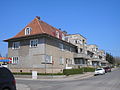 Am Schmalen Rain Gotha5.JPG 2,560 × 1,920; 917 KB
-
 Gartenstadt “Am Schmalen Rain” (Gotha) 02.jpg 3,072 × 2,304; 3.33 MB
-
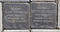 Gotha-Stolperstein-Friedrich-Ebert-Straße 27-CTH.jpg 1,449 × 770; 756 KB
-
 Gotha-Stolperstein-Friedrich-Ebert-Straße 27a-CTH.JPG 683 × 686; 344 KB
-
 Gotha-Stolperstein-Friedrich-Ebert-Straße 27b-CTH.jpg 676 × 700; 353 KB
-
 Hinterhausgarten Gartenstadt hinter der Beethovenstraße.jpg 3,072 × 2,304; 4.09 MB

_02.jpg)


