Category:Friedhof Böhmerwold
Jump to navigation
Jump to search
| Object location | | View all coordinates using: OpenStreetMap |
|---|
Media in category "Friedhof Böhmerwold"
The following 22 files are in this category, out of 22 total.
-
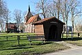
 Jemgum Böhmerwold - Böhmerwold + Bentumer Sieltief + Friedhof + Kirche 01 ies.jpg 4,851 × 3,234; 20.77 MB
-
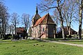
 Jemgum Böhmerwold - Böhmerwold + Friedhof + Kirche 01 ies.jpg 5,616 × 3,744; 29.55 MB
-
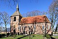
 Jemgum Böhmerwold - Böhmerwold + Friedhof + Kirche 02 ies.jpg 5,400 × 3,600; 25.46 MB
-
 Jemgum Böhmerwold - Böhmerwold - Friedhof + Kirche 01 ies.jpg 5,017 × 3,345; 17.9 MB
-
 Jemgum Böhmerwold - Böhmerwold - Friedhof + Kirche 02 ies.jpg 5,068 × 3,380; 18.21 MB
-
 Jemgum Böhmerwold - Böhmerwold - Friedhof + Kirche 03 ies.jpg 3,443 × 5,164; 18.14 MB
-
 Jemgum Böhmerwold - Böhmerwold - Friedhof + Kirche 04 ies.jpg 5,293 × 3,529; 21.08 MB
-
 Jemgum Böhmerwold - Böhmerwold - Friedhof + Kirche 05 ies.jpg 5,455 × 3,637; 26.32 MB
-
 Jemgum Böhmerwold - Böhmerwold - Friedhof + Kirche 06 ies.jpg 5,366 × 3,578; 23.57 MB
-
 Jemgum Böhmerwold - Böhmerwold - Friedhof + Kirche 07 ies.jpg 5,037 × 3,358; 20.13 MB
-
 Jemgum Böhmerwold - Böhmerwold - Friedhof + Kirche 08 ies.jpg 3,278 × 4,917; 17.09 MB
-
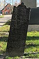 Jemgum Böhmerwold - Böhmerwold - Friedhof 01 ies.jpg 3,596 × 5,393; 19.44 MB
-
 Jemgum Böhmerwold - Böhmerwold - Friedhof 02 ies.jpg 3,744 × 5,616; 24.02 MB
-
 Jemgum Böhmerwold - Böhmerwold - Friedhof 03 ies.jpg 3,744 × 5,616; 27.72 MB
-
 Jemgum Böhmerwold - Böhmerwold - Friedhof 04 ies.jpg 3,341 × 5,011; 21.83 MB
-
 Jemgum Böhmerwold - Böhmerwold - Friedhof 05 ies.jpg 3,381 × 5,071; 18.09 MB
-
 Jemgum Böhmerwold - Böhmerwold - Friedhof 06 ies.jpg 2,709 × 4,063; 12.16 MB
-
 Jemgum Böhmerwold - Böhmerwold - Friedhof 07 ies.jpg 3,744 × 5,616; 22.53 MB
-
 Jemgum Böhmerwold - Böhmerwold - Friedhof 08 ies.jpg 3,436 × 5,154; 18.43 MB
-
 Jemgum Böhmerwold - Böhmerwold - Friedhof 09 ies.jpg 5,396 × 3,597; 20.64 MB
-
 Jemgum Böhmerwold - Böhmerwold - Friedhof 10 ies.jpg 3,476 × 5,214; 23.61 MB
-
 Jemgum Böhmerwold - Böhmerwold - Friedhof 11 ies.jpg 5,616 × 3,744; 28.3 MB


