Category:Freudenburg
Jump to navigation
Jump to search
municipality of Germany    | |||||
| Upload media | |||||
| Instance of |
| ||||
|---|---|---|---|---|---|
| Location | Trier-Saarburg, Rhineland-Palatinate, Germany | ||||
| Population |
| ||||
| Area |
| ||||
| Elevation above sea level |
| ||||
| Different from | |||||
| official website | |||||
 | |||||
Subcategories
This category has the following 7 subcategories, out of 7 total.
Media in category "Freudenburg"
The following 47 files are in this category, out of 47 total.
-
 DEU Freudenburg COA.svg 478 × 562; 56 KB
-
 Wappen-freudenburg.JPG 1,713 × 2,040; 921 KB
-
 Ducsaal - Freudenburg.jpg 3,072 × 2,304; 2.46 MB
-
 Ducsaal Frendenburg 03-09-10.jpg 3,072 × 2,304; 1.76 MB
-
 Freudenburg in TR.svg 667 × 590; 292 KB
-
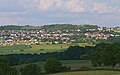
 Freudenburg, Blick auf Kirf.jpg 2,551 × 1,701; 857 KB
-
 Freudenburg, Blick nach Faha.jpg 2,551 × 1,701; 1.06 MB
-
 Freudenburg, Blick zum Mühlental und nach Kollesleuken.jpg 2,551 × 1,701; 1.58 MB
-
 Freudenburg, Blick zum Mühlental.jpg 2,551 × 1,701; 1.19 MB
-
 Freudenburg, Blick zur Burgruine und zur Kirche.jpg 2,517 × 1,635; 1,008 KB
-
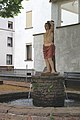 Freudenburg, Brunnen mit Figur Hl. Sebastian.jpg 1,701 × 2,551; 1,006 KB
-
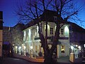
 Freudenburg, der Ducsaal.jpg 2,551 × 1,623; 1.41 MB
-
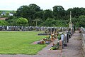 Freudenburg, der Friedhof.jpg 2,551 × 1,701; 1.38 MB
-
 Freudenburg, die Balduinstraße.jpg 2,551 × 1,701; 962 KB
-
 Freudenburg, die Burgstraße.jpg 2,424 × 1,537; 817 KB
-
 Freudenburg5.jpg 4,014 × 2,509; 4.7 MB
-
 Hundred Seventy Split Ducsaal Freudenburg 2 mars 2012.jpg 3,072 × 2,304; 2.32 MB
-
 Jesus Volt - Frendenburg - 01-04-2010.jpg 3,072 × 2,304; 2.94 MB
-
 Jesus Volt - Freudenburg - 01-04-10 - Basse.jpg 2,304 × 3,072; 718 KB
-
 Jesus Volt - Freudenburg - 01-04-10 - Battarie.jpg 2,304 × 3,072; 714 KB
-
 Jesus Volt - Freudenburg - 01-04-10 - Chant.jpg 2,304 × 3,072; 740 KB
-
 Jesus Volt - Freudenburg - 01-04-10 - Guitare.jpg 2,304 × 3,072; 680 KB
-
 Kollesleuker schweiz.jpg 2,288 × 1,712; 813 KB
-
 Maria-Croon-Weg (Kollesleuker Schweiz).jpg 4,247 × 3,185; 5.19 MB
-
 Randy Hansen - Freudenburg - 20-11-2010 - 1.jpg 3,072 × 2,304; 772 KB
-
 Randy Hansen - Freudenburg - 20-11-2010 - 2.jpg 3,072 × 2,304; 3.68 MB
-
 Randy Hansen - Freudenburg - 20-11-2010 - 3.jpg 2,920 × 2,100; 4.3 MB
-
 Randy Hansen - Freudenburg - 20-11-2010 - 4.jpg 3,072 × 2,304; 3.93 MB
-
 Randy Hansen - Freudenburg - 20-11-2010 - 5.jpg 1,898 × 2,643; 2.78 MB
-
 Randy Hansen - Freudenburg - 20-11-2010 - 6.jpg 2,560 × 1,920; 3.66 MB
-
 Randy Hansen - Freudenburg - 20-11-2010 - 7.jpg 2,560 × 1,920; 3.66 MB
-
 Randy Hansen - Freudenburg - 20-11-2010 - 8.jpg 2,560 × 1,920; 1,024 KB
-
 Robin Trower Ducsaal Freudenburg 24 mars 2012.jpg 3,072 × 1,728; 1.59 MB
-
 Thomas Blug - Freudenburg 10-09-2010 - 1.jpg 2,304 × 3,072; 4.5 MB
-
 Thomas Blug - Freudenburg 10-09-2010 - 2.jpg 1,920 × 2,560; 3.77 MB
-
 Thomas Blug - Freudenburg 10-09-2010 - 3.jpg 2,304 × 3,072; 3.32 MB
-
 Thomas Blug - Freudenburg 10-09-2010 - David Readman.jpg 2,304 × 3,072; 3.48 MB
-
 Thomas Blug - Freudenburg 10-09-2010 - Fin.jpg 2,560 × 1,920; 3.62 MB
-
 Thomas Blug - Freudenburg 10-09-2010 - Matériel.jpg 1,920 × 2,560; 2.86 MB
-
 Thomas Blug - Freudenburg 10-09-2010 - Mikky Meyer.jpg 3,072 × 2,304; 3.67 MB
-
 Thomas Blug - Freudenburg 10-09-2010 - Piet Eifel.jpg 2,304 × 3,072; 3.34 MB
-
 Thomas Blug - Freudenburg 10-09-2010 - Reggie Worthy.jpg 2,560 × 1,920; 4.08 MB
-
 Thomas Blug - Freudenburg 10-09-2010 - Wolf Simon.jpg 2,304 × 3,072; 3.72 MB
-
 Thomas Blug Band - Freudenburg 10-09-2010.jpg 3,072 × 2,304; 3.54 MB
-
 Topographic Map of Freudenburg with Defense Overprint - NARA - 100384875.jpg 8,440 × 6,624; 5.97 MB
-
 Winter im Leukbachtal.jpg 4,000 × 6,000; 27.54 MB
-
 Ö buecherschrank 1.png 3,628 × 2,036; 14.99 MB


.jpg)


