Category:Freiwillige Feuerwehr Heede (Emsland)
Jump to navigation
Jump to search
| Object location | | View all coordinates using: OpenStreetMap |
|---|
Media in category "Freiwillige Feuerwehr Heede (Emsland)"
The following 3 files are in this category, out of 3 total.
-
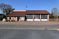 Heede - Vinkestraße + Freiwillige Feuerwehr 01 ies.jpg 5,616 × 3,744; 18.45 MB
-
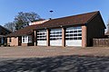 Heede - Vinkestraße - Freiwillige Feuerwehr 01 ies.jpg 5,616 × 3,744; 18.03 MB
-
 Heede - Vinkestraße - Freiwillige Feuerwehr 02 ies.jpg 5,616 × 3,745; 16.21 MB


