Category:Frederik den Femtes Atlas
Jump to navigation
Jump to search
Frederik den Femtes Atlas was a collection of maps and drawings, belonging to the Danish King Frederik V (1723-1766). The collection was iniated at the birth of Frederik, thanks to a gift by the minister Jacob Tilli, containing approximately 400 maps. During his lifetime, Frederik enlarged the collection, and it eventually contained 3,535 numbered plates. After his death, the plates were organized in 55 bound voulumes, now found in the Danish Royal Library. Source: http://wayback-01.kb.dk/wayback/20101030123536/http://www2.kb.dk//kb/dept/nbo/kob/Fr5Atlas/en.omfr5.htm
Media in category "Frederik den Femtes Atlas"
The following 5 files are in this category, out of 5 total.
-
 Dreidecker-Schiffbau.jpg 4,729 × 4,176; 16.52 MB
-
 Not-Signaler.jpg 3,954 × 2,561; 8.44 MB
-
 Nysted 1754.jpg 1,011 × 702; 70 KB
-
 Signalflaggenposition.jpg 3,438 × 2,620; 5.92 MB
-
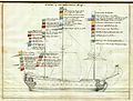
 Soeridderen.jpg 4,728 × 3,448; 10.71 MB


