Category:Fransham
Jump to navigation
Jump to search
Main Wikipedia article: Fransham.
civil parish in Norfolk, United Kingdom  | |||||
| Upload media | |||||
| Instance of | |||||
|---|---|---|---|---|---|
| Location | Breckland, Norfolk, East of England, England | ||||
| Population |
| ||||
| Area |
| ||||
 | |||||
Subcategories
This category has the following 5 subcategories, out of 5 total.
Media in category "Fransham"
The following 56 files are in this category, out of 56 total.
-

-
 A47 at Little Fransham - geograph.org.uk - 4724400.jpg 640 × 427; 353 KB
-
 A47 Eastbound at Little Fransham - geograph.org.uk - 4721705.jpg 640 × 480; 363 KB
-
 A47, West of Wendling - geograph.org.uk - 4724578.jpg 640 × 427; 298 KB
-
 Bus Stop on the A47 at Little Fransham - geograph.org.uk - 4724399.jpg 640 × 427; 348 KB
-
 Dereham Lane - geograph.org.uk - 1263994.jpg 543 × 620; 81 KB
-
 Dereham Lane past agricultural sheds - geograph.org.uk - 1263998.jpg 610 × 517; 87 KB
-

-
 Ditch beside the A47 road - geograph.org.uk - 4021689.jpg 640 × 434; 178 KB
-
 Eastbound A47 leaving Little Fransham - geograph.org.uk - 4724406.jpg 640 × 427; 316 KB
-
 Eastbound A47 near Hyde Hall - geograph.org.uk - 4724458.jpg 640 × 427; 349 KB
-
 Eastbound A47, Layby at Little Fransham - geograph.org.uk - 4724403.jpg 640 × 480; 384 KB
-
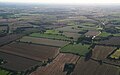 ESE of Little Fransham, aerial 2015 - geograph.org.uk - 4667275.jpg 640 × 398; 56 KB
-
 Ferns on a field entrance, Great Fransham - geograph.org.uk - 4694499.jpg 4,320 × 3,240; 5.99 MB
-
 Field margin - geograph.org.uk - 3943336.jpg 640 × 428; 121 KB
-
 Fields beside Beeston Road - geograph.org.uk - 3943328.jpg 640 × 480; 109 KB
-
 Fields by Crane's Corner - geograph.org.uk - 3943042.jpg 640 × 480; 165 KB
-

-
 Great Fransham All Saints' church - geograph.org.uk - 2278618.jpg 760 × 570; 166 KB
-
 Great Fransham railway bridge - geograph.org.uk - 6526327.jpg 1,024 × 683; 245 KB
-

-
 Layby and ditch beside the A47 road - geograph.org.uk - 4021690.jpg 640 × 480; 173 KB
-
 Layby beside the A47 road - geograph.org.uk - 4021688.jpg 640 × 434; 179 KB
-
 Layby on Westbound A47 - geograph.org.uk - 4724571.jpg 640 × 427; 347 KB
-

-
 Little Fransham St Mary's church - geograph.org.uk - 2230500.jpg 640 × 480; 225 KB
-
 Lorry in layby beside the A47 road - geograph.org.uk - 4021687.jpg 640 × 480; 170 KB
-
 Lower Farm Cottages, 1966 - geograph.org.uk - 3431392.jpg 640 × 480; 102 KB
-

-
 Open land - geograph.org.uk - 846238.jpg 480 × 640; 71 KB
-
 Past The Old Chapel - geograph.org.uk - 1263777.jpg 640 × 520; 104 KB
-

-
 Postbox by the Beeston Road-A47 junction - geograph.org.uk - 4021683.jpg 640 × 480; 178 KB
-
 Postbox in Beeston Road - geograph.org.uk - 4021686.jpg 480 × 640; 258 KB
-
 Private road to Hyde Hall - geograph.org.uk - 4021692.jpg 640 × 442; 187 KB
-
 Railway bridge no 2277 - geograph.org.uk - 1263985.jpg 640 × 480; 125 KB
-
 Railway bridge no 2277 - geograph.org.uk - 3943047.jpg 640 × 442; 204 KB
-
 Railway bridge over Beeston Road - geograph.org.uk - 1264013.jpg 640 × 480; 116 KB
-
 Sheds by Home Farm - geograph.org.uk - 3943054.jpg 640 × 422; 99 KB
-

-
 The A47 and bus stop in Little Fransham - geograph.org.uk - 4460241.jpg 1,024 × 768; 437 KB
-

-
 The Canary ^ Linnet, Little Fransham - geograph.org.uk - 2212833.jpg 3,504 × 2,336; 1.94 MB
-

-

-
 The War Memorial in Little Fransham churchyard - geograph.org.uk - 4460253.jpg 768 × 1,024; 585 KB
-
 The WW1 Memorial plaque at Great Fransham - geograph.org.uk - 4460273.jpg 1,024 × 768; 269 KB
-
 The WW2 Memorial plaque at Great Fransham - geograph.org.uk - 4460279.jpg 1,024 × 768; 214 KB
-
 Towards Dunham Lodge - geograph.org.uk - 845566.jpg 640 × 480; 93 KB
-
 Track into fields beside Beeston Road - geograph.org.uk - 3943325.jpg 640 × 480; 176 KB
-
 Village sign - geograph.org.uk - 1391963.jpg 428 × 639; 80 KB
-
 Westbound A47 at Little Fransham - geograph.org.uk - 4724408.jpg 640 × 480; 404 KB
-
 Wheat crop by Hyde Hall - geograph.org.uk - 3943043.jpg 640 × 480; 150 KB
-
 Wheat field ready for harvest - geograph.org.uk - 520738.jpg 640 × 480; 225 KB
-
 Woodland south of Beeston, Norfolk - geograph.org.uk - 5155606.jpg 4,320 × 3,240; 5.6 MB
-
 Woodland track south of Beeston, Norfolk - geograph.org.uk - 5155592.jpg 4,320 × 3,240; 5.68 MB
_-_geograph.org.uk_-_4829740.jpg)


,_aerial_2015_-_geograph.org.uk_-_4666464.jpg)


