Category:Foveran
Jump to navigation
Jump to search
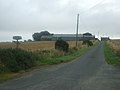
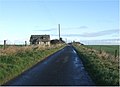
English: Foveran is the name of both a parish and village in Aberdeenshire, Scotland. The village is located 11 miles north of Aberdeen and 4 miles south-east of Ellon; the main group of houses and the village school are located adjacent to the main A90 trunk road. The hereditary baronetcy of Foveran is held by the Turing family (see Turing Baronets). The cryptographer and computing pioneer Alan Turing (1912-1954) was uncle to the present Baronet, Sir John Dermot Turing.
village in Aberdeenshire, Scotland, UK  | |||||
| Upload media | |||||
| Instance of | |||||
|---|---|---|---|---|---|
| Location |
| ||||
 | |||||
Media in category "Foveran"
The following 30 files are in this category, out of 30 total.
-
 Ancient raised beach on Foveran links - geograph.org.uk - 718176.jpg 640 × 480; 144 KB
-
 B9000 near Auchnacant - geograph.org.uk - 509628.jpg 640 × 426; 59 KB
-
 Farm road to Hill of Minnes - geograph.org.uk - 532553.jpg 640 × 480; 56 KB
-
 Farm road to Overhill - geograph.org.uk - 532547.jpg 640 × 480; 50 KB
-
 Field at Kirkhill - geograph.org.uk - 332704.jpg 640 × 425; 303 KB
-
 Fountainbleau - geograph.org.uk - 504417.jpg 640 × 480; 63 KB
-
 Foveran Cemetery.jpg 640 × 480; 79 KB
-
 Pond at Dambrae - geograph.org.uk - 332675.jpg 640 × 425; 312 KB
-
 Rashierieve - geograph.org.uk - 332709.jpg 640 × 425; 268 KB
-
 Sheep at Aikenshill Farm - geograph.org.uk - 332664.jpg 640 × 425; 290 KB
-
 Turquoise bales at Hillhead Farm - geograph.org.uk - 332634.jpg 640 × 425; 285 KB
-
 World War 2 beach defences - geograph.org.uk - 175018.jpg 640 × 480; 93 KB
-
 Blairythan Terrace, Foveran - geograph.org.uk - 532538.jpg 640 × 480; 51 KB
-
 Cothill - geograph.org.uk - 612748.jpg 640 × 420; 59 KB
-
 Delfrigs - geograph.org.uk - 613159.jpg 640 × 480; 77 KB
-
 Drums Farmhouse - geograph.org.uk - 506843.jpg 640 × 480; 87 KB
-
 Dust to dust^ - geograph.org.uk - 409253.jpg 640 × 480; 588 KB
-
 East Cothill - geograph.org.uk - 612756.jpg 640 × 465; 52 KB
-
 Farm road to Little Haddo - geograph.org.uk - 509624.jpg 640 × 426; 60 KB
-
 Foveran Burn - geograph.org.uk - 532533.jpg 640 × 480; 97 KB
-
 Foveran Parish Church - geograph.org.uk - 172995.jpg 640 × 414; 130 KB
-
 Oldmill - geograph.org.uk - 332713.jpg 640 × 425; 266 KB
-
 Ploughed field at Kincraig - geograph.org.uk - 332694.jpg 640 × 425; 302 KB
-
 Private road to Fornety - geograph.org.uk - 509634.jpg 640 × 426; 68 KB
-
 Road to Hatterseat - geograph.org.uk - 612767.jpg 640 × 480; 64 KB
-
 Snowy track to Mill of Fiddes - geograph.org.uk - 332516.jpg 640 × 425; 287 KB
-
 South Farden Croft - geograph.org.uk - 509627.jpg 640 × 428; 96 KB
-
 Straw bales at Mid Savock - geograph.org.uk - 532557.jpg 640 × 480; 70 KB
-
 Track to Leyton - geograph.org.uk - 612772.jpg 640 × 480; 93 KB
-
 Young trees - geograph.org.uk - 332630.jpg 640 × 425; 329 KB


